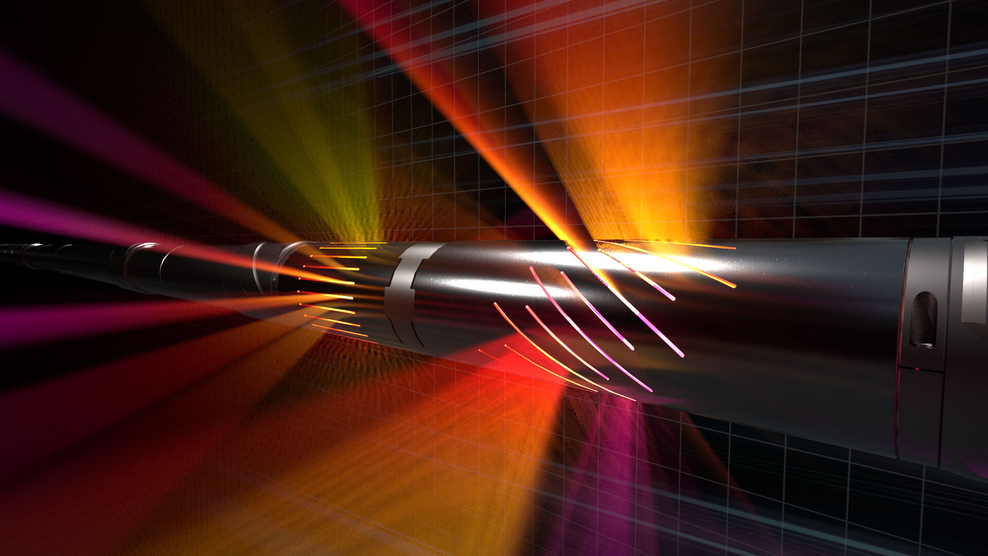
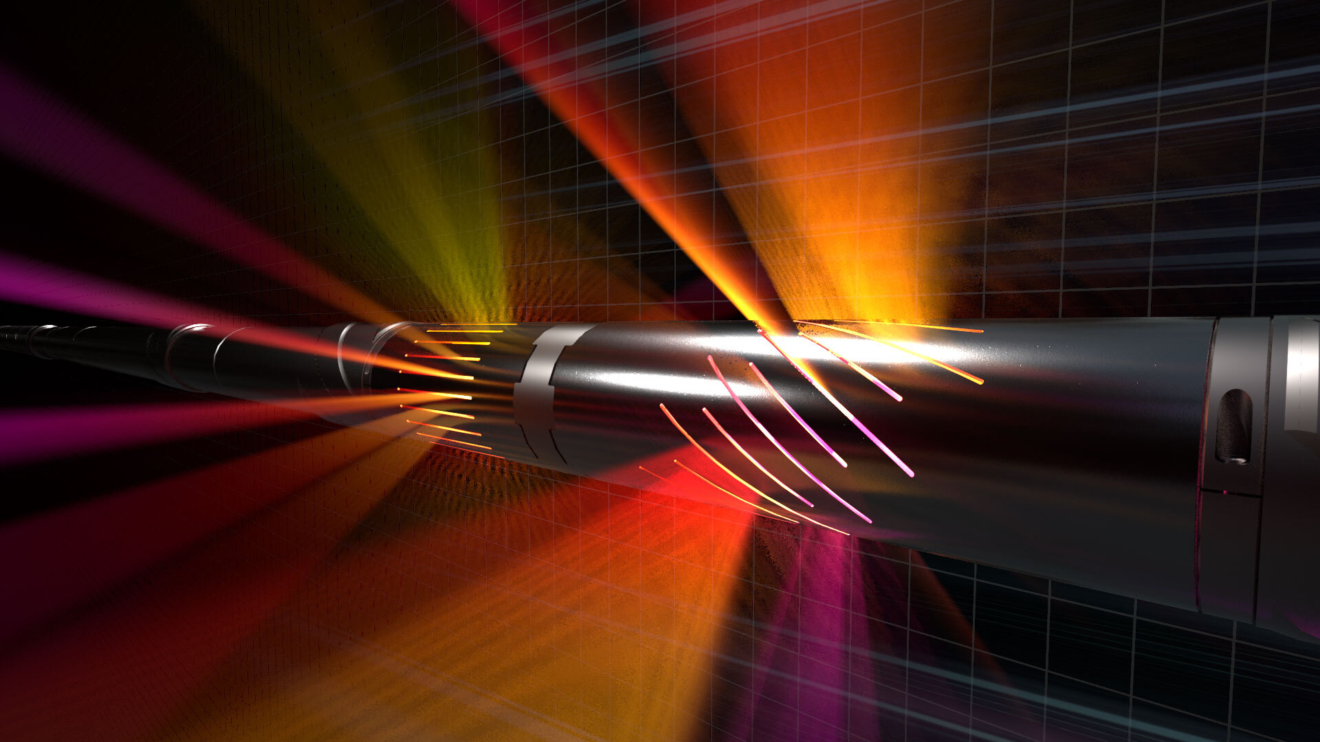
Innovative LWD technology delivers highest depth of detection
Knowing the location, size, and shape of your reservoir can help you place wells accurately the first time, every time. At Halliburton, we can help you enhance reservoir understanding, make better-informed geosteering decisions, and efficiently plan for future field development.
Halliburton Sperry Drilling offers the EarthStar® ultra-deep resistivity service, an industry-leading, logging-while-drilling (LWD) technology that is proven to map reservoir and fluid boundaries up to 225 feet (68 meters) from the wellbore – over twice the depth of investigation of the previous industry standard.
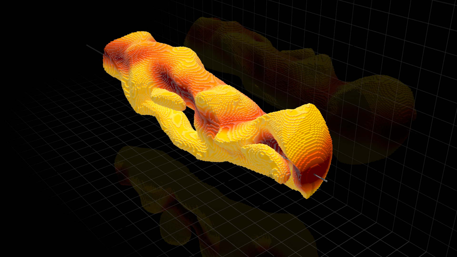
Our latest LWD innovation, advanced 3D inversion capability, provides you with an unmatched visualization of the true structure of your reservoir, helping you gain greater insight.
Maximize asset value through geostopping, geosteering and geomapping
With our EarthStar service, we can help you illuminate your reservoir:
Geostopping – Reduce well time and cost-per-BOE by detecting target zones early and landing the production lateral in a single-run, eliminating costly pilot holes and sidetracks.
Geosteering – Drill to produce by placing the well in the sweet spot, avoiding unwanted reservoir exits and non-productive zones, making geosteering decisions early while drilling.
Geomapping – Enhance reservoir understanding by mapping while drilling formation boundaries and hydrocarbons in place and identifying bypassed pay and fluid movements, increasing production potential and maximizing field reserves.
Let's work together to maximize the value of your assets every step of the way.
[{"contenttype":"Case Studies","datasource":[{"title":"Operator Significantly Enhances Reservoir Insight from 3D Inversion","description":"EarthStar™ ultra-deep resistivity service combined with unique, industry-leading 3D inversion sheds new light on mature reservoir.","path":"/content/dam/ps/public/ss/contents/Case_Histories/web/EarthStar-3D-1.pdf","docCreatedDate":"2019-06-19T13:11:00.000-05:00","modifiedDate":"2019-06-19T14:13:34.057-04:00","docdate":"2019-06-19T13:11:00.000-05:00","docrefNum":"H013295","languageSet":["English"],"accessType":"P","dataSearch":"brandgroups:Sperry_Drilling_Services,|locations:Europe:Northern_Europe:Norway_Northern_Europe,|prodgroups:LWD:Resistivity_Logging-LWD,Geosteering,"},{"title":"North Sea: Operator Avoids Drilling Hazards and Maximizes Reservoir Exposure","description":"EarthStar™ ultra-deep resistivity service delivers additional producible reserves.","path":"/content/dam/ps/public/ss/contents/Case_Histories/web/EarthStar-Geomapping-NorthSea.pdf","docCreatedDate":"2019-07-26T15:43:00.000-05:00","modifiedDate":"2019-07-26T16:44:29.497-04:00","docdate":"2019-07-26T15:43:00.000-05:00","languageSet":["English"],"accessType":"P","dataSearch":"brandgroups:Sperry_Drilling_Services,|locations:Oceans_Gulfs_International_Waters:North_Sea,|prodgroups:Drilling,LWD:Resistivity_Logging-LWD,"},{"title":"Operator Identifies Bypassed Pay and Increases Pay Zone by 50% in Water-flooded Reservoir","description":"Earthstar™ Ultra-Deep Resistivity Service Maximizes Asset Value in Mature Carbonate Field","path":"/content/dam/ps/public/ss/contents/Case_Histories/web/earthStar-geosteering.pdf","docCreatedDate":"2018-12-05T13:01:00.000-06:00","modifiedDate":"2018-12-05T13:02:51.050-06:00","docdate":"2018-12-05T13:01:00.000-06:00","docrefNum":"H012961","languageSet":["English"],"accessType":"P","dataSearch":"locations:Oceans_Gulfs_International_Waters:North_Sea,|prodgroups:LWD:Resistivity_Logging-LWD,Formation_Evaluation:Resistivity_Logging,Geosteering,"},{"title":"Oman: Operator Drills 4,245 Feet in Shoe-to-Shoe Run, Hitting Sweet Spot a Week Ahead of Plan","description":"Unique engineered drilling solution involving 4-3/4 in. EarthStar® service and iCruise® intelligent RSS maximizes asset value.","path":"/content/dam/ps/public/ss/contents/Case_Histories/web/iCruise-RSS-EarthStar-Service-Oman.pdf","docCreatedDate":"2020-07-24T16:48:00.000-05:00","modifiedDate":"2020-07-24T21:50:29.030Z","docdate":"2020-07-24T16:48:00.000-05:00","languageSet":["English"],"accessType":"P","dataSearch":"custchallenges:Production_Challenges:Unconventional_Resources,|brandgroups:Sperry_Drilling_Services,|locations:Middle_East:Oman_Middle_East,|prodgroups:Directional_Drilling:Rotary_Steerables,Formation_Evaluation:Resistivity_Logging,LWD,"},{"title":"Southeast Asia: Operator Achieves 99.5 Percent Run Efficiency in Complex Carbonate Reservoir","description":"EarthStar® servcie geomaps multiple oil saturation layers and fluid contacts, and helps execute directional plan within pay zone.","path":"/content/dam/ps/public/ss/contents/Case_Histories/web/EarthStar-Southeast-Asia.pdf","docCreatedDate":"2020-01-13T20:12:00.000-06:00","modifiedDate":"2020-01-14T02:15:12.647Z","docdate":"2020-01-13T20:12:00.000-06:00","docrefNum":"H013458","languageSet":["English"],"accessType":"P","dataSearch":"custchallenges:Reservoir_Challenges:Mature_Fields,|brandgroups:Sperry_Drilling_Services,|locations:Asia:Southeastern_Asia:Malaysia_Southeastern_Asia,|prodgroups:LWD:Resistivity_Logging-LWD,Geosteering,"}]},{"contenttype":"Data Sheets","datasource":[{"title":"EarthStar™ Ultra-Deep Resistivity Service - (Russian)","description":"The EarthStar™ ultra-deep resistivity service illuminates and maps reservoir and fluid boundaries more than 200 feet (61 meters) from the wellbore. In deepwater and mature fields, this technology helps operators to maximize asset values and plans for future field developments by mapping pockets of hydrocarbons, allowing for real-time steering decisions, and eliminating costly pilot holes and sidetracks.","path":"/content/dam/ps/public/ss/contents/Data_Sheets/web/H012879-EarthStar-Russian.pdf","docCreatedDate":"2018-10-16T09:17:53.439-05:00","modifiedDate":"2018-10-16T09:17:53.439-05:00","docdate":"2018-10-16T09:17:53.439-05:00","docrefNum":"H012879","languageSet":["Russian"],"accessType":"P","dataSearch":"locations:Global,|prodgroups:LWD:Resistivity_Logging-LWD,Formation_Evaluation:Resistivity_Logging,Drilling,LWD,"},{"title":"EarthStar™ Ultra-Deep Resistivity Service","description":"The EarthStar™ ultra-deep resistivity service is proven to illuminate and map reservoir and fluid boundaries up to 225 feet (68m) from the wellbore. It also offers the industry\u2019s only 3D inversion capability, providing unparalleled visualization of the true reservoir structure.","path":"/content/dam/ps/public/ss/contents/Data_Sheets/web/EarthStar-Datasheet.pdf","docCreatedDate":"2019-06-14T11:34:00.000-05:00","modifiedDate":"2019-07-29T14:28:48.080-04:00","docdate":"2019-06-14T11:34:00.000-05:00","docrefNum":"H013109","languageSet":["English"],"accessType":"P","dataSearch":"brandgroups:Sperry_Drilling_Services,|locations:Global,|prodgroups:LWD:Resistivity_Logging-LWD,Geosteering,"}]},{"contenttype":"External News Articles","datasource":[{"title":"Offshore Magazine: New Ultra-Deep Resistivity Service Identifies Bypassed Oil in Mature North Sea Field","description":"This article descrribes how the EarthStar™ service helped an operator increase the overall productive length of the well by approximately 50%.","path":"/content/dam/ps/public/ss/contents/Papers_and_Articles/web/Offshore-Magazine-EarthStar0519.pdf","docCreatedDate":"2019-06-13T09:10:00.000-05:00","modifiedDate":"2019-06-13T10:12:11.914-04:00","docdate":"2019-06-13T09:10:00.000-05:00","languageSet":["English"],"accessType":"P","dataSearch":"brandgroups:Sperry_Drilling_Services,|locations:Global,|prodgroups:LWD:Resistivity_Logging-LWD,Geosteering,"},{"title":"World Oil: Applying Ultra-deep LWD Resistivity Technology Successfully in a SAGD Operations","description":"This article discusses how a SAGD operator used the EarthStar™ service to successfully place the well accurately, and map the top and base of the reservoir.","path":"/content/dam/ps/public/ss/contents/Papers_and_Articles/web/World-Oil-EarthStar-SAGD-Operation.pdf","docCreatedDate":"2019-06-27T15:52:00.000-05:00","modifiedDate":"2019-06-27T16:52:59.409-04:00","docdate":"2019-06-27T15:52:00.000-05:00","languageSet":["English"],"accessType":"P","dataSearch":"brandgroups:Sperry_Drilling_Services,|locations:Global,|prodgroups:LWD:Resistivity_Logging-LWD,"},{"title":"Harts E&P: Clearer Downhole Picture Emerges","description":"This article descrives how the EarthStar ultra-deep resistivity service provides operators with reservoir insight by illuminating and mapping ultra-deep reservoir and fluid boundaries in the wellbore.","path":"/content/dam/ps/public/ss/contents/Papers_and_Articles/web/HartsEP-EarthStar-Sept2018.pdf","docCreatedDate":"2019-06-13T13:30:00.000-05:00","modifiedDate":"2019-06-13T14:31:53.946-04:00","docdate":"2019-06-13T13:30:00.000-05:00","languageSet":["English"],"accessType":"P","dataSearch":"brandgroups:Sperry_Drilling_Services,|locations:Global,|prodgroups:LWD:Resistivity_Logging-LWD,Geosteering,"}]},{"contenttype":"Multimedia","datasource":[{"title":"EarthStar™ Ultra-Deep Resistivity Service 3D Inversion Demonstration","description":"With 3D inversions from the EarthStar™ ultra-deep resistivity service, know the location, size, and shape of your reservoir in three dimensions to help you place wells accurately the first time, every time.","path":"/content/dam/ps/public/ss/contents/Multimedia/web/earthstar-3D-inversions-demonstration.mp4","docCreatedDate":"2019-07-31T09:05:42.470-04:00","modifiedDate":"2019-07-31T09:05:42.470-04:00","docdate":"2019-07-31T09:05:42.470-04:00","languageSet":["English"],"accessType":"P","dataSearch":"brandgroups:Sperry_Drilling_Services,|locations:Global,|prodgroups:Drilling,LWD:Resistivity_Logging-LWD,Geosteering,"},{"title":"EarthStar™ Ultra-Deep Resistivity Service Video","description":"This video highlights the benefits of the EarthStar™ Ultra-Deep Resistivity Service.","path":"/content/dam/ps/public/ss/contents/Multimedia/web/EarthStarFINAL1080.mp4","docCreatedDate":"2019-06-17T10:18:00.000-05:00","modifiedDate":"2019-06-17T11:20:43.914-04:00","docdate":"2019-06-17T10:18:00.000-05:00","languageSet":["English"],"accessType":"P","dataSearch":"brandgroups:Sperry_Drilling_Services,|locations:Global,|prodgroups:LWD:Resistivity_Logging-LWD,Geosteering,"},{"title":"RoxC™ Geosteering Software Demonstration","description":"Demonstration of RoxC™ geosteering software for real-time reservoir insight.","path":"/content/dam/ps/public/ss/contents/Multimedia/web/roxc-geosteering-software-demonstration.html","docCreatedDate":"2018-11-09T11:12:00.000-06:00","modifiedDate":"2018-11-09T11:13:11.769-06:00","docdate":"2018-11-09T11:12:00.000-06:00","languageSet":["English"],"accessType":"P","dataSearch":"locations:Global,|prodgroups:Geosteering,"},{"title":"EarthStar™ Ultra-Deep Resistivity Service","description":"Michael Bittar, senior director of technology, discusses how EarthStar was developed and its advantages for operators.","path":"/content/dam/ps/public/ss/contents/Multimedia/web/earthstar-product-announcement.html","docCreatedDate":"2018-05-30T23:30:00.000-05:00","modifiedDate":"2018-05-30T23:30:00.000-05:00","docdate":"2018-05-30T23:30:00.000-05:00","languageSet":["English"],"accessType":"P","dataSearch":"brandgroups:Sperry_Drilling_Services,|locations:Global,|prodgroups:Formation_Evaluation:Resistivity_Logging,"}]},{"contenttype":"News Announcements","datasource":[{"title":"Halliburton Releases Oil & Gas Industry\u2019s First 3D Logging-While Drilling Technology ","description":"HOUSTON \u2013 July 17, 2019 \u2013 Halliburton Company (NYSE: HAL) today introduced 3D reservoir mapping, a new logging-while-drilling (LWD) capability that provides a detailed representation of subsurface structures to improve well placement in complex reservoirs.","path":"/content/halliburton/en-US/news/announcements/2019/halliburton-releases-oil-gas-industrys-frist-3d-lwd-technology.html","docCreatedDate":"2019-07-17T00:00:00.000-05:00","modifiedDate":"2019-07-17T09:58:47.439-04:00","docdate":"2019-07-17T00:00:00.000-05:00","languageSet":["English"],"accessType":"P","dataSearch":"brandgroups:Sperry_Drilling_Services,|locations:Global,|prodgroups:LWD:Resistivity_Logging-LWD,"}]},{"contenttype":"Webinars","datasource":[{"title":"EarthStar® 3D Inversion Capability Webinar","description":"Learn how this technology can provide you an unmatched and unique visualization of the true structure of your reservoir, helping you gain greater insight.","path":"/content/dam/ps/public/ss/contents/webinars/earthstar-3d-inversion-webinar.mp4","docCreatedDate":"2020-09-23T11:56:00.000-05:00","modifiedDate":"2020-09-23T16:58:49.455Z","docdate":"2020-09-23T11:56:00.000-05:00","languageSet":["English"],"accessType":"P","dataSearch":"brandgroups:Sperry_Drilling_Services,|locations:Global,|prodgroups:LWD:Resistivity_Logging-LWD,LWD,"}]},{"contenttype":"centerColList","datasource":[{"title":"Operator Significantly Enhances Reservoir Insight from 3D Inversion","description":"EarthStar™ ultra-deep resistivity service combined with unique, industry-leading 3D inversion sheds new light on mature reservoir.","path":"/content/dam/ps/public/ss/contents/Case_Histories/web/EarthStar-3D-1.pdf","docCreatedDate":"2019-06-19T13:11:00.000-05:00","modifiedDate":"2019-06-19T14:13:34.057-04:00","docdate":"2019-06-19T13:11:00.000-05:00","docrefNum":"H013295","languageSet":["English"],"accessType":"P","dataSearch":"brandgroups:Sperry_Drilling_Services,|locations:Europe:Northern_Europe:Norway_Northern_Europe,|prodgroups:LWD:Resistivity_Logging-LWD,Geosteering,"},{"title":"North Sea: Operator Avoids Drilling Hazards and Maximizes Reservoir Exposure","description":"EarthStar™ ultra-deep resistivity service delivers additional producible reserves.","path":"/content/dam/ps/public/ss/contents/Case_Histories/web/EarthStar-Geomapping-NorthSea.pdf","docCreatedDate":"2019-07-26T15:43:00.000-05:00","modifiedDate":"2019-07-26T16:44:29.497-04:00","docdate":"2019-07-26T15:43:00.000-05:00","languageSet":["English"],"accessType":"P","dataSearch":"brandgroups:Sperry_Drilling_Services,|locations:Oceans_Gulfs_International_Waters:North_Sea,|prodgroups:Drilling,LWD:Resistivity_Logging-LWD,"},{"title":"Operator Identifies Bypassed Pay and Increases Pay Zone by 50% in Water-flooded Reservoir","description":"Earthstar™ Ultra-Deep Resistivity Service Maximizes Asset Value in Mature Carbonate Field","path":"/content/dam/ps/public/ss/contents/Case_Histories/web/earthStar-geosteering.pdf","docCreatedDate":"2018-12-05T13:01:00.000-06:00","modifiedDate":"2018-12-05T13:02:51.050-06:00","docdate":"2018-12-05T13:01:00.000-06:00","docrefNum":"H012961","languageSet":["English"],"accessType":"P","dataSearch":"locations:Oceans_Gulfs_International_Waters:North_Sea,|prodgroups:LWD:Resistivity_Logging-LWD,Formation_Evaluation:Resistivity_Logging,Geosteering,"},{"title":"Oman: Operator Drills 4,245 Feet in Shoe-to-Shoe Run, Hitting Sweet Spot a Week Ahead of Plan","description":"Unique engineered drilling solution involving 4-3/4 in. EarthStar® service and iCruise® intelligent RSS maximizes asset value.","path":"/content/dam/ps/public/ss/contents/Case_Histories/web/iCruise-RSS-EarthStar-Service-Oman.pdf","docCreatedDate":"2020-07-24T16:48:00.000-05:00","modifiedDate":"2020-07-24T21:50:29.030Z","docdate":"2020-07-24T16:48:00.000-05:00","languageSet":["English"],"accessType":"P","dataSearch":"custchallenges:Production_Challenges:Unconventional_Resources,|brandgroups:Sperry_Drilling_Services,|locations:Middle_East:Oman_Middle_East,|prodgroups:Directional_Drilling:Rotary_Steerables,Formation_Evaluation:Resistivity_Logging,LWD,"},{"title":"Southeast Asia: Operator Achieves 99.5 Percent Run Efficiency in Complex Carbonate Reservoir","description":"EarthStar® servcie geomaps multiple oil saturation layers and fluid contacts, and helps execute directional plan within pay zone.","path":"/content/dam/ps/public/ss/contents/Case_Histories/web/EarthStar-Southeast-Asia.pdf","docCreatedDate":"2020-01-13T20:12:00.000-06:00","modifiedDate":"2020-01-14T02:15:12.647Z","docdate":"2020-01-13T20:12:00.000-06:00","docrefNum":"H013458","languageSet":["English"],"accessType":"P","dataSearch":"custchallenges:Reservoir_Challenges:Mature_Fields,|brandgroups:Sperry_Drilling_Services,|locations:Asia:Southeastern_Asia:Malaysia_Southeastern_Asia,|prodgroups:LWD:Resistivity_Logging-LWD,Geosteering,"}]}]