Search

Maximize the energy you produce 

To achieve this goal, you need to locate and stay in the productive zone of the reservoir. From a petrophysics and geoscience perspective, you must understand your reservoir and detect, diagnose, and resolve any abnormalities, if they arise, to stay in zone.
 
Halliburton collaborates with operators to provide enahnced subsurface insights through measurement quality and accuracy with digitalization and automation.

Measurement quality & accuracy

In high risk, high-cost exploration settings, you need to make quick, smart decisions. High-quality and accurate measurements create the foundation to interpret, calculate, and act on the data using digital and automation

Still of animated StrataStar deep azimuthal resistivity service model in use

Benefits

  • Enhance petrophysical measurements
  • Increase positional certainty
  • Improve and correlate reserve estimates

Features 

  • Continuous positional measurements 
  • Highly accurate, wireline quality formation evaluation measurement
  • High resolution acoustic amplitude images in oil-and water-based mud
  • 16-bin azimuthal gamma
  • 4 axial ultrasonic imaging caliper
  • High accuracy azimuthal litho-density
  • Thermal neutrol porosity

Digital and automation

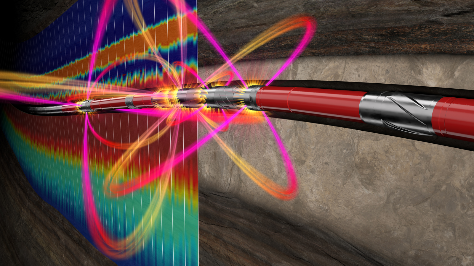
Visualize the reservoir and boundaries to quickly detect and diagnose potential risks and hazards. With a digital connection, you can use your downhole equipment to act fast.

Benefits

  • Improve subsurface interpretation 
  • Make data driven decisions with real-time 3D reservoir and boundaries visualization
  • Faster and more accurate decision making with measurements close to the bit
  • Monitor and control drilling and logging from anywhere

Features

  • Digital integration with subsurface model
  • Advanced 3D visualization of reservoir and boundaries
  • Autonomous sensor diagnostics and data quality checks
  • Architecture supports automation, machine learning, and artificial intelligence
Illuminated reservoir and fluid boundaries model produced by EarthStar resistivity service

Solutions that make it possible

iStar® Intelligent Drilling and Logging Platform

iStar® Intelligent Drilling and Logging Platform

Fully digital and web-enabled to monitor and control drilling and logging operations from anywhere.

Explore
EarthStar® Service

EarthStar® Service

Ultra-deep resistivity service mapping reservoir and fluid boundaries up to 225 feet from the wellbore.

Explore
icon

Ready to take the next step?

Talk to a Halliburton subsurface insights expert

Get in touch