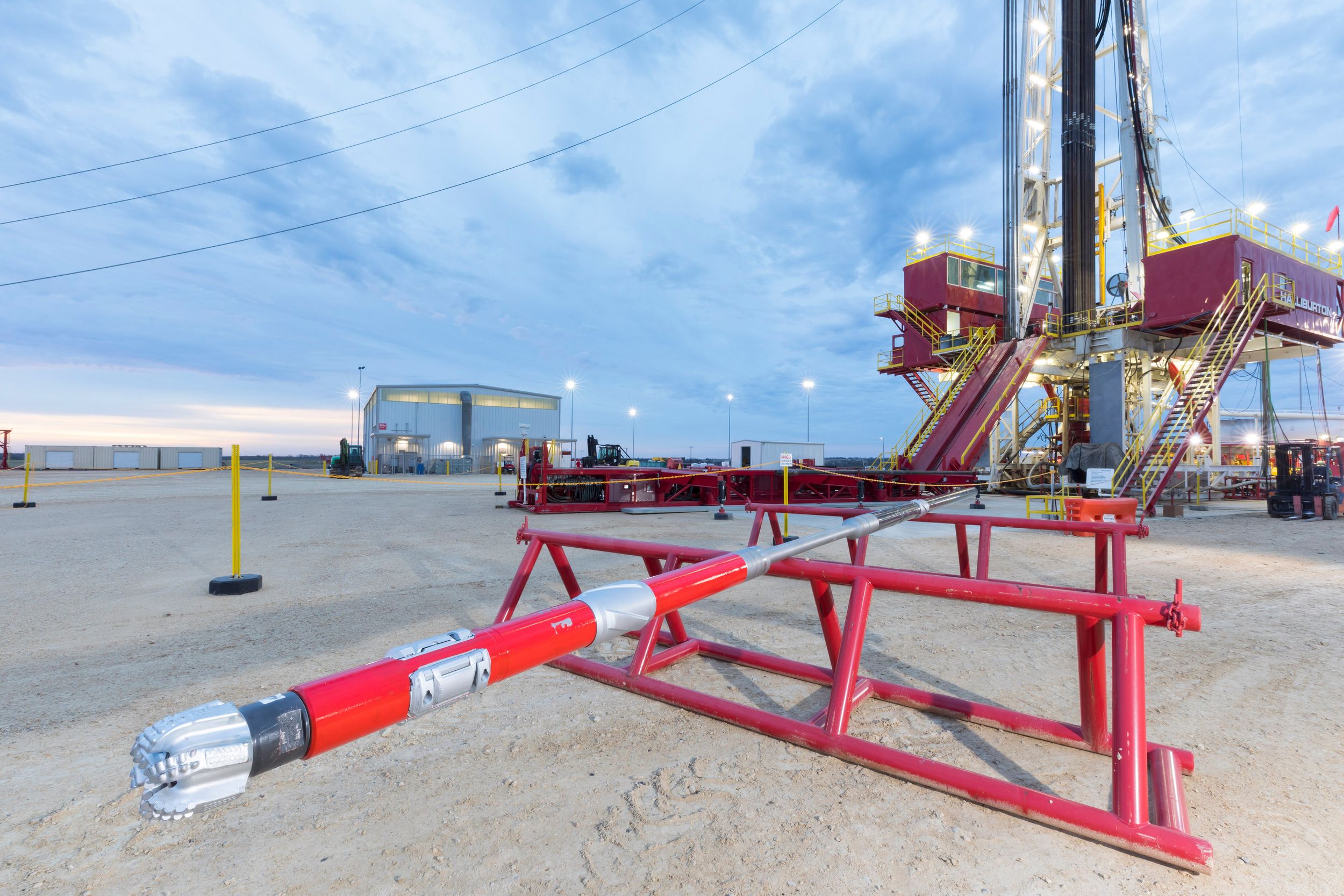
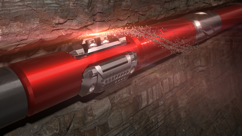
Additional information that can aid in formation evaluation is actual samples of the reservoir fluids and pressures in the formation.
Pore pressure measurements for example can aid in determining permeability of the formation and viscosity of the fluids, identify fluid contact points, and are helpful in managing formation pressures and the drilling mud program.
By being able to capture samples from the formation, a number of fluid and formation properties can be monitored, including: resistivity/capacitance; viscosity; density; bubble point; compressibility; horizontal permeability; vertical permeability; and anisotropy.
[{"contenttype":"Case Studies","datasource":[{"title":"Malaysia / GOM / Norway: GeoTap®/Geo-Pilot® Malaysia/GOM/Norway Solution Profile","description":"Three case histories: 1. GeoTap Formation Tester Allows TorqueReduction While Dramatically Improving ROP2. GeoTap® Slimhole LWD Formation Tester and Geo-Pilot® Rotary SteerableSystem Get Pressure Answers In High-Risk Sidetrack3. GeoTap® Tester Increases Reservoir Section and Adds $13 Million of New Oil Production","path":"/content/dam/ps/public/ss/contents/Case_Histories/web/H05813_Malaysia_GOM_Norway_GT_GP.pdf","docCreatedDate":"2007-10-01T03:00:00.000-05:00","modifiedDate":"2012-07-19T23:30:00.000-05:00","docdate":"2007-10-01T03:00:00.000-05:00","docrefNum":"H05813","languageSet":["English"],"accessType":"P","dataSearch":"custchallenges:Formation_Challenges:Formation_Pore_Pressure,|brandgroups:Sperry_Drilling_Services,|locations:Oceans_Gulfs_International_Waters,Asia,Oceans_Gulfs_International_Waters:Gulf_of_Mexico,Europe:Northern_Europe:Norway_Northern_Europe,Asia:Southeastern_Asia,Europe,Europe:Northern_Europe,Asia:Southeastern_Asia:Malaysia_Southeastern_Asia,|prodgroups:Optimization_Services:Drilling_Optimization:Matched_System,Directional_Drilling,LWD:Borehole_Imaging-LWD,LWD,Directional_Drilling:Rotary_Steerables,LWD:Density_Logging-LWD,LWD:Testing_and_Sampling-LWD,Drilling,"},{"title":"Operator Obtains Reliable Reservoir Measurements and Reduces Well Time, Saving USD 1 Million","description":"GeoTap® sensor 10K PSI drawdown capability acquires accurate and precise formation pressure data in real time.","path":"/content/dam/ps/public/ss/contents/Case_Histories/web/GeoTap-Azerbaijan.pdf","docCreatedDate":"2019-10-10T14:58:00.000-05:00","modifiedDate":"2019-10-10T16:00:29.769-04:00","docdate":"2019-10-10T14:58:00.000-05:00","languageSet":["English"],"accessType":"P","dataSearch":"custchallenges:Drilling_Challenges:Deepwater_Drilling,|brandgroups:Sperry_Drilling_Services,|locations:Asia:Southwestern_Asia:Azerbaijan_Southwestern_Asia,|prodgroups:LWD:Testing_and_Sampling-LWD,"},{"title":"U.K. Offshore: Operator Saves Significant Rig Time by Gathering Complete Formation Evaluation Data in Real Time","description":"In an offshore U.K. well, an operator needed to obtain a complete formation evaluation (FE) data set to measure reservoir and overburden characteristics in a deviated well.","path":"/content/dam/ps/public/ss/contents/Case_Histories/web/MLWD-Penta-Combo-UKOffshore-RT-FE-Data.pdf","docCreatedDate":"2016-11-15T02:00:00.000-06:00","modifiedDate":"2016-11-15T22:30:00.000-06:00","docdate":"2016-11-15T02:00:00.000-06:00","docrefNum":"H012370","languageSet":["English"],"accessType":"P","dataSearch":"custchallenges:Reducing_Costs,Deepwater:Reduce_Uncertainty,Reduce_Nonproductive_Time,|brandgroups:Sperry_Drilling_Services,|locations:Europe,Europe:Western_Europe:United_Kingdom_Western_Europe,Europe:Western_Europe,|prodgroups:LWD:Rock_Mechanics-LWD,Directional_Drilling,MWD,LWD,Directional_Drilling:Rotary_Steerables,LWD:Resistivity_Logging-LWD,LWD:Neutron_Logging-LWD,MWD:Wellbore_Pressure_Monitoring-MWD,LWD:Density_Logging-LWD,LWD:Testing_and_Sampling-LWD,Drilling,LWD:Gamma_Logging-LWD,"},{"title":"North Sea, Norway: Operator Successfully Runs 5 ¾-inch Slim-Hole Drilling Operation with Geo-Pilot® RSS System","description":"In a mature field on the Norwegian Continental Shelf of the North Sea, an operator had attempted twice to drill a new extended-reach drilling (ERD) wellbore with a 2.05 measured depth (MD) to true vertical depth (TVD) ratio that resulted in the bottomhole assembly (BHA) becoming lost in hole above the reservoir.","path":"/content/dam/ps/public/ss/contents/Case_Histories/web/GeoPilot-Norway-First575Run.pdf","docCreatedDate":"2017-03-22T03:00:00.000-05:00","modifiedDate":"2017-06-02T23:30:00.000-05:00","docdate":"2017-03-22T03:00:00.000-05:00","docrefNum":"H012515","languageSet":["English"],"accessType":"P","dataSearch":"custchallenges:Reservoir_Challenges:Mature_Fields,Drilling_Challenges:Extended_Reach_Drilling_(ERD),|brandgroups:Sperry_Drilling_Services,|locations:Oceans_Gulfs_International_Waters,Oceans_Gulfs_International_Waters:North_Sea,Europe,Europe:Northern_Europe,Europe:Northern_Europe:Norway_Northern_Europe,|prodgroups:Directional_Drilling:Rotary_Steerables,LWD:Neutron_Logging-LWD,LWD:Gamma_Logging-LWD,Geosteering,Directional_Drilling,MWD,LWD,LWD:Resistivity_Logging-LWD,MWD:Wellbore_Pressure_Monitoring-MWD,LWD:Density_Logging-LWD,LWD:Testing_and_Sampling-LWD,Drilling,Drilling:Drilling_Engineering_Solutions,"},{"title":"Mexico: Operator Saves Time USD 7.5 Million in Deepwater Rig Time by Acquiring Crucial Formation Evaluation Data in Real Time","description":"An operator on a deepwater well had recently issued an internal mandate seeking opportunities to reduce the authorizations for expenditure (AFEs) associated with drilling its oil and gas exploration and development projects.","path":"/content/dam/ps/public/ss/contents/Case_Histories/web/GeoTap-IDS-MRIL-WD-Mexico-FullFE.pdf","docCreatedDate":"2016-11-01T03:00:00.000-05:00","modifiedDate":"2016-11-01T23:30:00.000-05:00","docdate":"2016-11-01T03:00:00.000-05:00","docrefNum":"H012369","languageSet":["English"],"accessType":"P","dataSearch":"custchallenges:Deepwater:Reduce_Uncertainty,Reducing_Costs,Reserve-Resource_Calculation_and_Formation_Evaluation,Drilling_Challenges:Deepwater_Drilling,Deepwater,Reduce_Nonproductive_Time,|brandgroups:Sperry_Drilling_Services,|locations:North_America,North_America:Mexico,|prodgroups:LWD:Rock_Mechanics-LWD,LWD,LWD:Nuclear_Magnetic_Resonance-LWD,LWD:Resistivity_Logging-LWD,LWD:Neutron_Logging-LWD,LWD:Density_Logging-LWD,LWD:Testing_and_Sampling-LWD,Drilling,LWD:Gamma_Logging-LWD,"}]},{"contenttype":"Data Sheets","datasource":[{"title":"GeoTap® IDS Fluid Identification and Sampling Sensor","description":"The GeoTap® IDS fluid identification and sampling sensor from Halliburton Sperry Drilling enables reservoir fluid samples to be recovered with logging-while-drilling (LWD) technology.","path":"/content/dam/ps/public/ss/contents/Data_Sheets/web/GeoTap-Identification-and-Sampling-Sensor-Datasheet.pdf","docCreatedDate":"2019-05-30T14:38:00.000-05:00","modifiedDate":"2019-05-30T15:41:39.309-04:00","docdate":"2019-05-30T14:38:00.000-05:00","docrefNum":"H013251","languageSet":["English"],"accessType":"P","dataSearch":"brandgroups:Sperry_Drilling_Services,|locations:Global,|prodgroups:LWD:Testing_and_Sampling-LWD,"},{"title":"GeoTap® Formation Pressure Tester Service","description":"The GeoTap® formation pressure tester service from Halliburton Sperry Drilling provides real-time formation pressure measurements.","path":"/content/dam/ps/public/ss/contents/Data_Sheets/web/Geo-Tap-Formation-Datasheet.pdf","docCreatedDate":"2019-07-12T15:47:00.000-05:00","modifiedDate":"2019-07-12T16:49:59.514-04:00","docdate":"2019-07-12T15:47:00.000-05:00","docrefNum":"H013325","languageSet":["English"],"accessType":"P","dataSearch":"brandgroups:Sperry_Drilling_Services,|locations:Global,|prodgroups:LWD:Testing_and_Sampling-LWD,"}]},{"contenttype":"Multimedia","datasource":[{"title":"Geo-Span Downlinking System Animation","description":"Animation","path":"/content/dam/ps/public/ss/contents/Multimedia/web/07-GeoSpan.wmv","docCreatedDate":"2012-03-23T23:30:00.000-05:00","modifiedDate":"2012-03-23T23:30:00.000-05:00","docdate":"2012-03-23T23:30:00.000-05:00","languageSet":["English"],"accessType":"P","dataSearch":"brandgroups:Sperry_Drilling_Services,|locations:Global,|prodgroups:LWD:Testing_and_Sampling-LWD,Drilling,Directional_Drilling,LWD,Drilling:Telemetry,"}]},{"contenttype":"centerColList","datasource":[{"title":"Operator Obtains Reliable Reservoir Measurements and Reduces Well Time, Saving USD 1 Million","description":"GeoTap® sensor 10K PSI drawdown capability acquires accurate and precise formation pressure data in real time.","path":"/content/dam/ps/public/ss/contents/Case_Histories/web/GeoTap-Azerbaijan.pdf","docCreatedDate":"2019-10-10T14:58:00.000-05:00","modifiedDate":"2019-10-10T16:00:29.769-04:00","docdate":"2019-10-10T14:58:00.000-05:00","languageSet":["English"],"accessType":"P","dataSearch":"custchallenges:Drilling_Challenges:Deepwater_Drilling,|brandgroups:Sperry_Drilling_Services,|locations:Asia:Southwestern_Asia:Azerbaijan_Southwestern_Asia,|prodgroups:LWD:Testing_and_Sampling-LWD,"},{"title":"U.K. Offshore: Operator Saves Significant Rig Time by Gathering Complete Formation Evaluation Data in Real Time","description":"In an offshore U.K. well, an operator needed to obtain a complete formation evaluation (FE) data set to measure reservoir and overburden characteristics in a deviated well.","path":"/content/dam/ps/public/ss/contents/Case_Histories/web/MLWD-Penta-Combo-UKOffshore-RT-FE-Data.pdf","docCreatedDate":"2016-11-15T02:00:00.000-06:00","modifiedDate":"2016-11-15T22:30:00.000-06:00","docdate":"2016-11-15T02:00:00.000-06:00","docrefNum":"H012370","languageSet":["English"],"accessType":"P","dataSearch":"custchallenges:Reducing_Costs,Deepwater:Reduce_Uncertainty,Reduce_Nonproductive_Time,|brandgroups:Sperry_Drilling_Services,|locations:Europe,Europe:Western_Europe:United_Kingdom_Western_Europe,Europe:Western_Europe,|prodgroups:LWD:Rock_Mechanics-LWD,Directional_Drilling,MWD,LWD,Directional_Drilling:Rotary_Steerables,LWD:Resistivity_Logging-LWD,LWD:Neutron_Logging-LWD,MWD:Wellbore_Pressure_Monitoring-MWD,LWD:Density_Logging-LWD,LWD:Testing_and_Sampling-LWD,Drilling,LWD:Gamma_Logging-LWD,"},{"title":"North Sea, Norway: Operator Successfully Runs 5 ¾-inch Slim-Hole Drilling Operation with Geo-Pilot® RSS System","description":"In a mature field on the Norwegian Continental Shelf of the North Sea, an operator had attempted twice to drill a new extended-reach drilling (ERD) wellbore with a 2.05 measured depth (MD) to true vertical depth (TVD) ratio that resulted in the bottomhole assembly (BHA) becoming lost in hole above the reservoir.","path":"/content/dam/ps/public/ss/contents/Case_Histories/web/GeoPilot-Norway-First575Run.pdf","docCreatedDate":"2017-03-22T03:00:00.000-05:00","modifiedDate":"2017-06-02T23:30:00.000-05:00","docdate":"2017-03-22T03:00:00.000-05:00","docrefNum":"H012515","languageSet":["English"],"accessType":"P","dataSearch":"custchallenges:Reservoir_Challenges:Mature_Fields,Drilling_Challenges:Extended_Reach_Drilling_(ERD),|brandgroups:Sperry_Drilling_Services,|locations:Oceans_Gulfs_International_Waters,Oceans_Gulfs_International_Waters:North_Sea,Europe,Europe:Northern_Europe,Europe:Northern_Europe:Norway_Northern_Europe,|prodgroups:Directional_Drilling:Rotary_Steerables,LWD:Neutron_Logging-LWD,LWD:Gamma_Logging-LWD,Geosteering,Directional_Drilling,MWD,LWD,LWD:Resistivity_Logging-LWD,MWD:Wellbore_Pressure_Monitoring-MWD,LWD:Density_Logging-LWD,LWD:Testing_and_Sampling-LWD,Drilling,Drilling:Drilling_Engineering_Solutions,"},{"title":"Mexico: Operator Saves Time USD 7.5 Million in Deepwater Rig Time by Acquiring Crucial Formation Evaluation Data in Real Time","description":"An operator on a deepwater well had recently issued an internal mandate seeking opportunities to reduce the authorizations for expenditure (AFEs) associated with drilling its oil and gas exploration and development projects.","path":"/content/dam/ps/public/ss/contents/Case_Histories/web/GeoTap-IDS-MRIL-WD-Mexico-FullFE.pdf","docCreatedDate":"2016-11-01T03:00:00.000-05:00","modifiedDate":"2016-11-01T23:30:00.000-05:00","docdate":"2016-11-01T03:00:00.000-05:00","docrefNum":"H012369","languageSet":["English"],"accessType":"P","dataSearch":"custchallenges:Deepwater:Reduce_Uncertainty,Reducing_Costs,Reserve-Resource_Calculation_and_Formation_Evaluation,Drilling_Challenges:Deepwater_Drilling,Deepwater,Reduce_Nonproductive_Time,|brandgroups:Sperry_Drilling_Services,|locations:North_America,North_America:Mexico,|prodgroups:LWD:Rock_Mechanics-LWD,LWD,LWD:Nuclear_Magnetic_Resonance-LWD,LWD:Resistivity_Logging-LWD,LWD:Neutron_Logging-LWD,LWD:Density_Logging-LWD,LWD:Testing_and_Sampling-LWD,Drilling,LWD:Gamma_Logging-LWD,"},{"title":"Malaysia / GOM / Norway: GeoTap®/Geo-Pilot® Malaysia/GOM/Norway Solution Profile","description":"Three case histories: 1. GeoTap Formation Tester Allows TorqueReduction While Dramatically Improving ROP2. GeoTap® Slimhole LWD Formation Tester and Geo-Pilot® Rotary SteerableSystem Get Pressure Answers In High-Risk Sidetrack3. GeoTap® Tester Increases Reservoir Section and Adds $13 Million of New Oil Production","path":"/content/dam/ps/public/ss/contents/Case_Histories/web/H05813_Malaysia_GOM_Norway_GT_GP.pdf","docCreatedDate":"2007-10-01T03:00:00.000-05:00","modifiedDate":"2012-07-19T23:30:00.000-05:00","docdate":"2007-10-01T03:00:00.000-05:00","docrefNum":"H05813","languageSet":["English"],"accessType":"P","dataSearch":"custchallenges:Formation_Challenges:Formation_Pore_Pressure,|brandgroups:Sperry_Drilling_Services,|locations:Oceans_Gulfs_International_Waters,Asia,Oceans_Gulfs_International_Waters:Gulf_of_Mexico,Europe:Northern_Europe:Norway_Northern_Europe,Asia:Southeastern_Asia,Europe,Europe:Northern_Europe,Asia:Southeastern_Asia:Malaysia_Southeastern_Asia,|prodgroups:Optimization_Services:Drilling_Optimization:Matched_System,Directional_Drilling,LWD:Borehole_Imaging-LWD,LWD,Directional_Drilling:Rotary_Steerables,LWD:Density_Logging-LWD,LWD:Testing_and_Sampling-LWD,Drilling,"}]}]