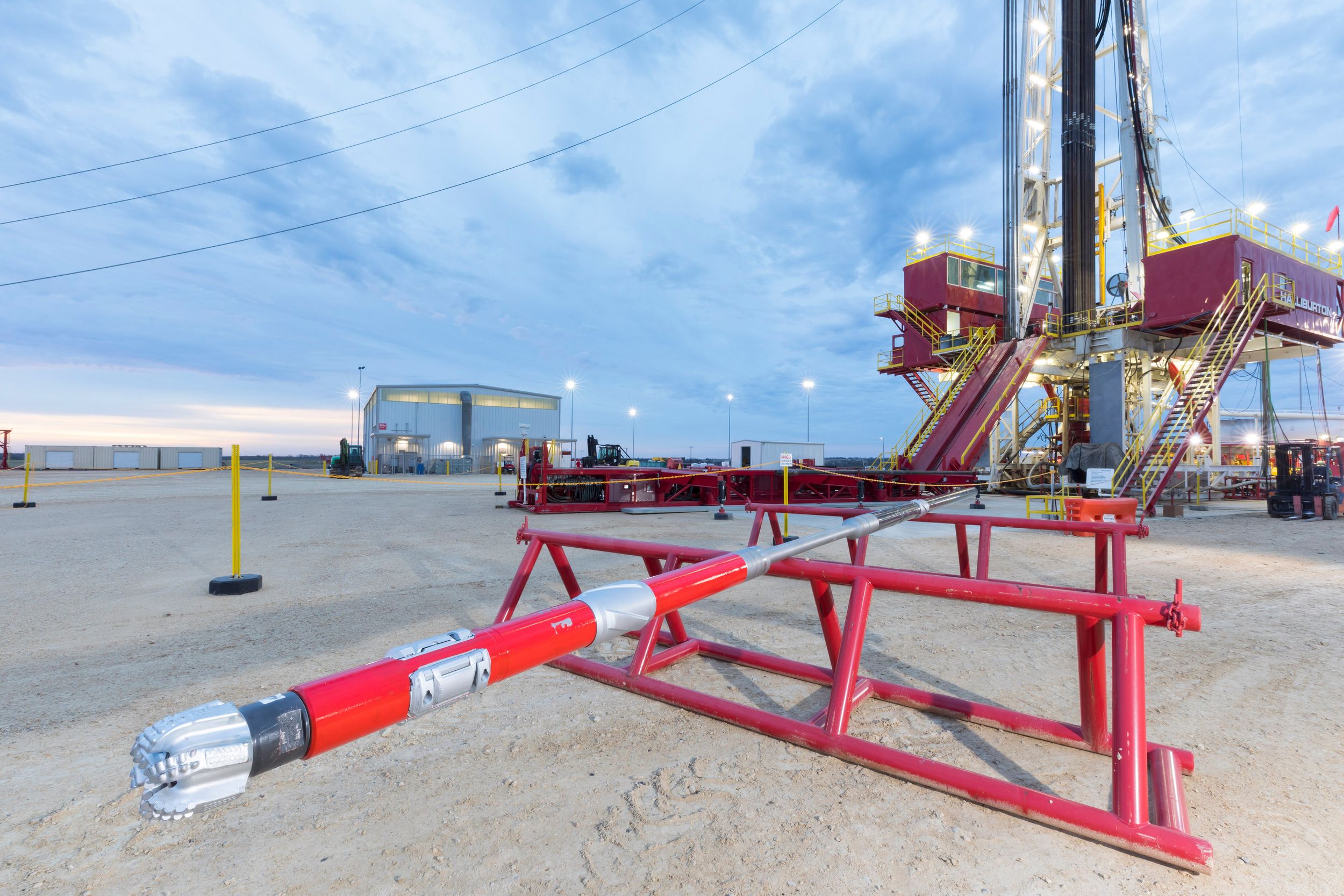
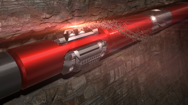
High resolution images of the borehole can be used to identify a variety of geological attributes such as structural dip, faults and fractures. These images can also provide insight into the condition of the borehole, stress and rock mechanics around the borehole and assist in porosity determination.
Halliburton provides a suite of solutions for operation in water-based or oil-based muds.
The Radian® azimuthal gamma ray and inclination service provides high-quality borehole images for geosteering, and precise gamma-ray measurements for reservoir evaluation.
[{"contenttype":"Case Studies","datasource":[{"title":"Oman: Operator Proves Cost Savings With LWD High-Resolution Imaging Service","description":"Borehole imaging is one of the most rapidly advancing technologies in wireline logging and logging while drilling (LWD). In an onshore horizontal well in Oman, an operator needed more details of the geology in the reservoir in order to gain a better understanding of the distribution of faults, natural fractures, borehole breakouts, and drilling-induced fractures along the well path.","path":"/content/dam/ps/public/ss/contents/Case_Histories/web/AFR-Oman-RealTimeImaging.pdf","docCreatedDate":"2017-03-21T03:00:00.000-05:00","modifiedDate":"2017-03-21T23:30:00.000-05:00","docdate":"2017-03-21T03:00:00.000-05:00","docrefNum":"H012502","languageSet":["English"],"accessType":"P","dataSearch":"custchallenges:Reservoir_Challenges:Mature_Fields,Deepwater:Reduce_Uncertainty,Reducing_Costs,Formation_Challenges:Low_Permeability_Formations,|locations:Middle_East,Middle_East:Oman_Middle_East,|prodgroups:LWD:Rock_Mechanics-LWD,LWD:Borehole_Imaging-LWD,LWD,LWD:Resistivity_Logging-LWD,LWD:Neutron_Logging-LWD,LWD:Density_Logging-LWD,LWD:Gamma_Logging-LWD,Drilling,"},{"title":"Texas: High-Resolution Images Identify Formation Bedding Features and Fractures in Oil-Based Mud ","description":"PixStar™ high-resolution ultrasonic imaging service enhances reservoir understanding","path":"/content/dam/ps/public/ss/contents/Case_Histories/web/pixstar-accurate-fracture-placement.pdf","docCreatedDate":"2019-11-08T10:25:00.000-06:00","modifiedDate":"2019-11-13T17:36:06.845Z","docdate":"2019-11-08T10:25:00.000-06:00","languageSet":["English"],"accessType":"P","dataSearch":"brandgroups:Sperry_Drilling_Services,|locations:North_America:United_States:Texas,|prodgroups:LWD:Rock_Mechanics-LWD,Drilling,LWD:Borehole_Imaging-LWD,"},{"title":"Malaysia / GOM / Norway: GeoTap®/Geo-Pilot® Malaysia/GOM/Norway Solution Profile","description":"Three case histories: 1. GeoTap Formation Tester Allows TorqueReduction While Dramatically Improving ROP2. GeoTap® Slimhole LWD Formation Tester and Geo-Pilot® Rotary SteerableSystem Get Pressure Answers In High-Risk Sidetrack3. GeoTap® Tester Increases Reservoir Section and Adds $13 Million of New Oil Production","path":"/content/dam/ps/public/ss/contents/Case_Histories/web/H05813_Malaysia_GOM_Norway_GT_GP.pdf","docCreatedDate":"2007-10-01T03:00:00.000-05:00","modifiedDate":"2012-07-19T23:30:00.000-05:00","docdate":"2007-10-01T03:00:00.000-05:00","docrefNum":"H05813","languageSet":["English"],"accessType":"P","dataSearch":"custchallenges:Formation_Challenges:Formation_Pore_Pressure,|brandgroups:Sperry_Drilling_Services,|locations:Oceans_Gulfs_International_Waters,Asia,Oceans_Gulfs_International_Waters:Gulf_of_Mexico,Europe:Northern_Europe:Norway_Northern_Europe,Asia:Southeastern_Asia,Europe,Europe:Northern_Europe,Asia:Southeastern_Asia:Malaysia_Southeastern_Asia,|prodgroups:Optimization_Services:Drilling_Optimization:Matched_System,Directional_Drilling,LWD:Borehole_Imaging-LWD,LWD,Directional_Drilling:Rotary_Steerables,LWD:Density_Logging-LWD,LWD:Testing_and_Sampling-LWD,Drilling,"},{"title":"Middle East: Middle Eastern Oil Company Saves $450,000 Field Testing the InSite AFR™ Sensor","description":"By eliminating unnecessary runs, use of the InSite AFR sensor in threehorizontal wells saved about nine days of rig time worth approximately$450,000. Also the sensor clearly revealed numerous geologic features.","path":"/content/dam/ps/public/ss/contents/Case_Histories/web/H06067.pdf","docCreatedDate":"2008-04-29T03:00:00.000-05:00","modifiedDate":"2008-09-24T23:30:00.000-05:00","docdate":"2008-04-29T03:00:00.000-05:00","docrefNum":"H06067","languageSet":["English"],"accessType":"P","dataSearch":"custchallenges:Drilling_Challenges:Precise_Well_Placement,|brandgroups:Sperry_Drilling_Services,|locations:Middle_East,|prodgroups:LWD:Resistivity_Logging-LWD,Drilling,LWD,LWD:Borehole_Imaging-LWD,"},{"title":"Middle East: Operator Identifies Fractures and Optimizes Completion Design ","description":"PixStar™ high-resolution ultrasonic imaging service enhances reservoir understanding in oil-based mud","path":"/content/dam/ps/public/ss/contents/Case_Histories/web/PixStar-Optimize-Completion-Design-Middle-East.pdf","docCreatedDate":"2019-11-08T10:19:00.000-06:00","modifiedDate":"2019-11-13T17:36:06.805Z","docdate":"2019-11-08T10:19:00.000-06:00","docrefNum":"H013412","languageSet":["English"],"accessType":"P","dataSearch":"custchallenges:Reservoir_Challenges:Mature_Fields,|brandgroups:Sperry_Drilling_Services,|locations:Middle_East,|prodgroups:LWD:Rock_Mechanics-LWD,Drilling,LWD:Borehole_Imaging-LWD,"}]},{"contenttype":"Data Sheets","datasource":[{"title":"PixStar™ High-Resolution Ultrasonic Imaging Service ","description":"Provides greater wellbore coverage to enhance reservoir understanding","path":"/content/dam/ps/public/ss/contents/Data_Sheets/web/pixstar-high-resolution-ultrasonic-imaging-service.pdf","docCreatedDate":"2019-11-08T09:58:00.000-06:00","modifiedDate":"2019-11-13T17:36:06.887Z","docdate":"2019-11-08T09:58:00.000-06:00","docrefNum":"H013411","languageSet":["English"],"accessType":"P","dataSearch":"locations:Global,|prodgroups:LWD:Rock_Mechanics-LWD,LWD:Borehole_Imaging-LWD,"}]},{"contenttype":"Technical Papers","datasource":[{"title":"Oilfield Technology: M/LWD Q&A","description":"2017 Oilfield Technology M/LWD Q&A article discusses the applications and benefits of the Radian™ Service and 9 1/2-inch ALD™ Service","path":"/content/dam/ps/public/ss/contents/Papers_and_Articles/web/Oilfield-Technlogy-2017MLWD-QA.pdf","docCreatedDate":"2017-06-01T03:00:00.000-05:00","modifiedDate":"2017-07-18T23:30:00.000-05:00","docdate":"2017-06-01T03:00:00.000-05:00","languageSet":["English"],"accessType":"P","dataSearch":"custchallenges:Salt_Challenges,Deepwater:Reduce_Uncertainty,Drilling_Challenges:Precise_Well_Placement,Formation_Challenges:Shale,|brandgroups:Sperry_Drilling_Services,|locations:Global,|prodgroups:Geosteering,MWD,LWD:Borehole_Imaging-LWD,LWD,MWD:Wellbore_Surveying-MWD,LWD:Density_Logging-LWD,LWD:Gamma_Logging-LWD,Drilling,"}]},{"contenttype":"centerColList","datasource":[{"title":"Oman: Operator Proves Cost Savings With LWD High-Resolution Imaging Service","description":"Borehole imaging is one of the most rapidly advancing technologies in wireline logging and logging while drilling (LWD). In an onshore horizontal well in Oman, an operator needed more details of the geology in the reservoir in order to gain a better understanding of the distribution of faults, natural fractures, borehole breakouts, and drilling-induced fractures along the well path.","path":"/content/dam/ps/public/ss/contents/Case_Histories/web/AFR-Oman-RealTimeImaging.pdf","docCreatedDate":"2017-03-21T03:00:00.000-05:00","modifiedDate":"2017-03-21T23:30:00.000-05:00","docdate":"2017-03-21T03:00:00.000-05:00","docrefNum":"H012502","languageSet":["English"],"accessType":"P","dataSearch":"custchallenges:Reservoir_Challenges:Mature_Fields,Deepwater:Reduce_Uncertainty,Reducing_Costs,Formation_Challenges:Low_Permeability_Formations,|locations:Middle_East,Middle_East:Oman_Middle_East,|prodgroups:LWD:Rock_Mechanics-LWD,LWD:Borehole_Imaging-LWD,LWD,LWD:Resistivity_Logging-LWD,LWD:Neutron_Logging-LWD,LWD:Density_Logging-LWD,LWD:Gamma_Logging-LWD,Drilling,"},{"title":"Texas: High-Resolution Images Identify Formation Bedding Features and Fractures in Oil-Based Mud ","description":"PixStar™ high-resolution ultrasonic imaging service enhances reservoir understanding","path":"/content/dam/ps/public/ss/contents/Case_Histories/web/pixstar-accurate-fracture-placement.pdf","docCreatedDate":"2019-11-08T10:25:00.000-06:00","modifiedDate":"2019-11-13T17:36:06.845Z","docdate":"2019-11-08T10:25:00.000-06:00","languageSet":["English"],"accessType":"P","dataSearch":"brandgroups:Sperry_Drilling_Services,|locations:North_America:United_States:Texas,|prodgroups:LWD:Rock_Mechanics-LWD,Drilling,LWD:Borehole_Imaging-LWD,"},{"title":"Malaysia / GOM / Norway: GeoTap®/Geo-Pilot® Malaysia/GOM/Norway Solution Profile","description":"Three case histories: 1. GeoTap Formation Tester Allows TorqueReduction While Dramatically Improving ROP2. GeoTap® Slimhole LWD Formation Tester and Geo-Pilot® Rotary SteerableSystem Get Pressure Answers In High-Risk Sidetrack3. GeoTap® Tester Increases Reservoir Section and Adds $13 Million of New Oil Production","path":"/content/dam/ps/public/ss/contents/Case_Histories/web/H05813_Malaysia_GOM_Norway_GT_GP.pdf","docCreatedDate":"2007-10-01T03:00:00.000-05:00","modifiedDate":"2012-07-19T23:30:00.000-05:00","docdate":"2007-10-01T03:00:00.000-05:00","docrefNum":"H05813","languageSet":["English"],"accessType":"P","dataSearch":"custchallenges:Formation_Challenges:Formation_Pore_Pressure,|brandgroups:Sperry_Drilling_Services,|locations:Oceans_Gulfs_International_Waters,Asia,Oceans_Gulfs_International_Waters:Gulf_of_Mexico,Europe:Northern_Europe:Norway_Northern_Europe,Asia:Southeastern_Asia,Europe,Europe:Northern_Europe,Asia:Southeastern_Asia:Malaysia_Southeastern_Asia,|prodgroups:Optimization_Services:Drilling_Optimization:Matched_System,Directional_Drilling,LWD:Borehole_Imaging-LWD,LWD,Directional_Drilling:Rotary_Steerables,LWD:Density_Logging-LWD,LWD:Testing_and_Sampling-LWD,Drilling,"},{"title":"Middle East: Middle Eastern Oil Company Saves $450,000 Field Testing the InSite AFR™ Sensor","description":"By eliminating unnecessary runs, use of the InSite AFR sensor in threehorizontal wells saved about nine days of rig time worth approximately$450,000. Also the sensor clearly revealed numerous geologic features.","path":"/content/dam/ps/public/ss/contents/Case_Histories/web/H06067.pdf","docCreatedDate":"2008-04-29T03:00:00.000-05:00","modifiedDate":"2008-09-24T23:30:00.000-05:00","docdate":"2008-04-29T03:00:00.000-05:00","docrefNum":"H06067","languageSet":["English"],"accessType":"P","dataSearch":"custchallenges:Drilling_Challenges:Precise_Well_Placement,|brandgroups:Sperry_Drilling_Services,|locations:Middle_East,|prodgroups:LWD:Resistivity_Logging-LWD,Drilling,LWD,LWD:Borehole_Imaging-LWD,"},{"title":"Middle East: Operator Identifies Fractures and Optimizes Completion Design ","description":"PixStar™ high-resolution ultrasonic imaging service enhances reservoir understanding in oil-based mud","path":"/content/dam/ps/public/ss/contents/Case_Histories/web/PixStar-Optimize-Completion-Design-Middle-East.pdf","docCreatedDate":"2019-11-08T10:19:00.000-06:00","modifiedDate":"2019-11-13T17:36:06.805Z","docdate":"2019-11-08T10:19:00.000-06:00","docrefNum":"H013412","languageSet":["English"],"accessType":"P","dataSearch":"custchallenges:Reservoir_Challenges:Mature_Fields,|brandgroups:Sperry_Drilling_Services,|locations:Middle_East,|prodgroups:LWD:Rock_Mechanics-LWD,Drilling,LWD:Borehole_Imaging-LWD,"}]}]