Place Your Wells Accurately, Maximize Reservoir Contact
Seeing what’s below the surface can allow you to geosteer through complex geology, minimize seismic uncertainty, and make informed geosteeering decisions to place your wells in the sweet spot.
Halliburton Sperry Drilling geosteering experts provide you with real-time reservoir insight to help you enhance reservoir understanding and get the most out your well at the lowest cost-per-BOE.
Real-Time Reservoir Insight, Timely Decisions
Our proprietary RoxC® real-time geosteering software features fast calculation speeds and a real-time visualization of the reservoir structure. Our latest LWD innovation delivers industry-leading, high-resolution 3D inversions of your reservoir structure in real time.
With this unmatched capability, geosteering experts can help you optimize well placement, reduce wellbore tortuosity, and maximize reservoir contact in all types of environments.
Plus, you can continue to refine your geological model to help you design the right completions and plan for future field development.
Let’s work together to truly understand what’s in your reservoir, place your wells accurately, and help you maximize the value of your assets in deep water, unconventionals, and mature fields.
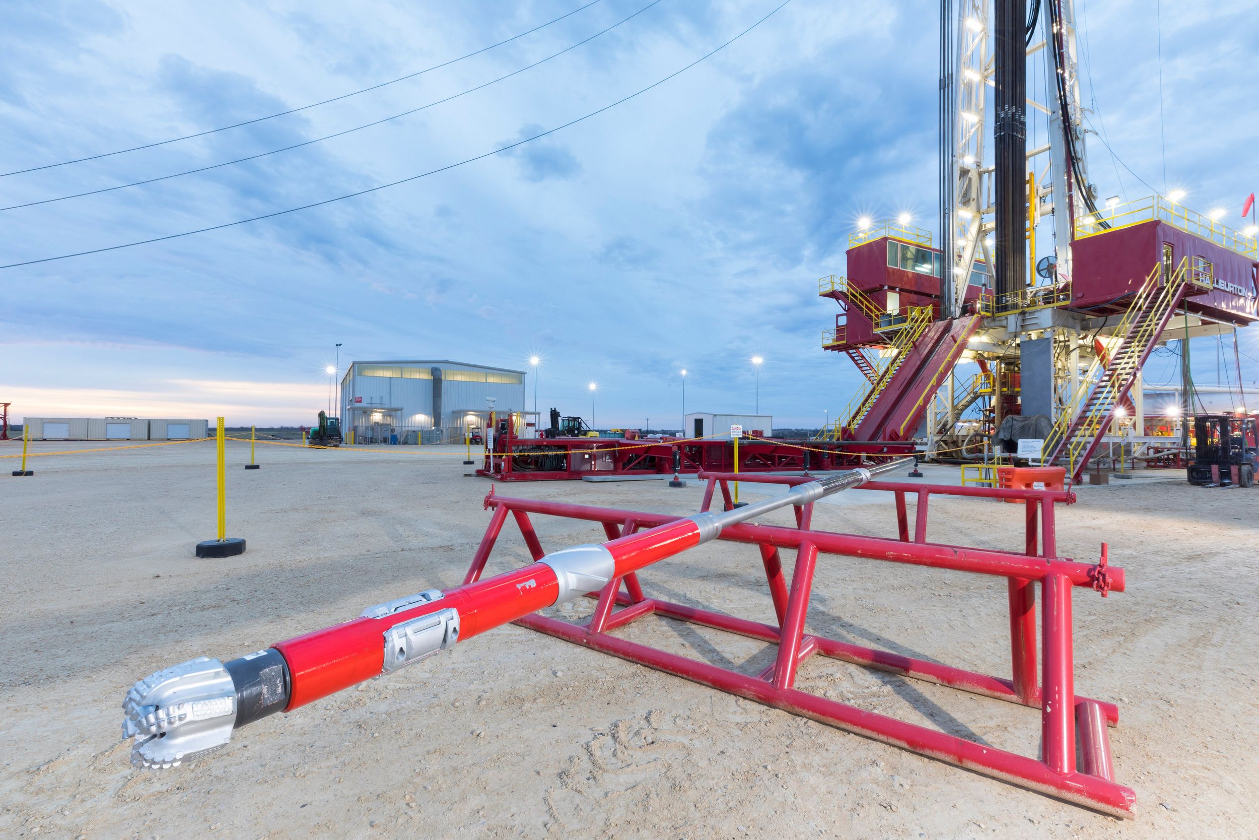
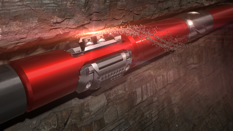
Industry-leading, logging-while-drilling (LWD) service that is proven to map reservoir and fluid boundaries up to 225 feet (68 meters) from the wellbore – over twice the depth of investigation of the previous industry standard.
Consistent 'gas-in-mud' measurements you can rely on for formation fluid characterization: Provides true constant-volume, constant-temperature gas-in-mud extraction with consistent, repeatable results.
Industry-leading, logging-while-drilling (LWD) service that is proven to map reservoir and fluid boundaries up to 225 feet (68 meters) from the wellbore – over twice the depth of investigation of the previous industry standard.
The Radian® azimuthal gamma ray and inclination service provides high-quality borehole images for geosteering, and precise gamma-ray measurements for reservoir evaluation.
[{"contenttype":"Case Studies","datasource":[{"title":"Operator Significantly Enhances Reservoir Insight from 3D Inversion","description":"EarthStar™ ultra-deep resistivity service combined with unique, industry-leading 3D inversion sheds new light on mature reservoir.","path":"/content/dam/ps/public/ss/contents/Case_Histories/web/EarthStar-3D-1.pdf","docCreatedDate":"2019-06-19T13:11:00.000-05:00","modifiedDate":"2019-06-19T14:13:34.057-04:00","docdate":"2019-06-19T13:11:00.000-05:00","docrefNum":"H013295","languageSet":["English"],"accessType":"P","dataSearch":"brandgroups:Sperry_Drilling_Services,|locations:Europe:Northern_Europe:Norway_Northern_Europe,|prodgroups:LWD:Resistivity_Logging-LWD,Geosteering,"},{"title":"Operator Identifies Bypassed Pay and Increases Pay Zone by 50% in Water-flooded Reservoir","description":"Earthstar™ Ultra-Deep Resistivity Service Maximizes Asset Value in Mature Carbonate Field","path":"/content/dam/ps/public/ss/contents/Case_Histories/web/earthStar-geosteering.pdf","docCreatedDate":"2018-12-05T13:01:00.000-06:00","modifiedDate":"2018-12-05T13:02:51.050-06:00","docdate":"2018-12-05T13:01:00.000-06:00","docrefNum":"H012961","languageSet":["English"],"accessType":"P","dataSearch":"locations:Oceans_Gulfs_International_Waters:North_Sea,|prodgroups:LWD:Resistivity_Logging-LWD,Formation_Evaluation:Resistivity_Logging,Geosteering,"},{"title":"North Sea, Norway: Operator Successfully Runs 5 ¾-inch Slim-Hole Drilling Operation with Geo-Pilot® RSS System","description":"In a mature field on the Norwegian Continental Shelf of the North Sea, an operator had attempted twice to drill a new extended-reach drilling (ERD) wellbore with a 2.05 measured depth (MD) to true vertical depth (TVD) ratio that resulted in the bottomhole assembly (BHA) becoming lost in hole above the reservoir.","path":"/content/dam/ps/public/ss/contents/Case_Histories/web/GeoPilot-Norway-First575Run.pdf","docCreatedDate":"2017-03-22T03:00:00.000-05:00","modifiedDate":"2017-06-02T23:30:00.000-05:00","docdate":"2017-03-22T03:00:00.000-05:00","docrefNum":"H012515","languageSet":["English"],"accessType":"P","dataSearch":"custchallenges:Reservoir_Challenges:Mature_Fields,Drilling_Challenges:Extended_Reach_Drilling_(ERD),|brandgroups:Sperry_Drilling_Services,|locations:Oceans_Gulfs_International_Waters,Oceans_Gulfs_International_Waters:North_Sea,Europe,Europe:Northern_Europe,Europe:Northern_Europe:Norway_Northern_Europe,|prodgroups:Directional_Drilling:Rotary_Steerables,LWD:Neutron_Logging-LWD,LWD:Gamma_Logging-LWD,Geosteering,Directional_Drilling,MWD,LWD,LWD:Resistivity_Logging-LWD,MWD:Wellbore_Pressure_Monitoring-MWD,LWD:Density_Logging-LWD,LWD:Testing_and_Sampling-LWD,Drilling,Drilling:Drilling_Engineering_Solutions,"},{"title":"Gulf of Mexico: New LWD Density Service Saves Operator USD 1 Million","description":"During a subsalt deepwater project (water depth of over 5,200 ft (1,585 m)) in the Gulf of Mexico, an operator faced significant uncertainties in the geological model below a salt section. In this area, it is often difficult to acquire good-quality seismic images due to attenuation of seismic signals by the overlying salt formations.","path":"/content/dam/ps/public/ss/contents/Case_Histories/web/ALD-GOM-LargeHoleSaltImages.pdf","docCreatedDate":"2017-01-09T02:00:00.000-06:00","modifiedDate":"2017-01-09T22:30:00.000-06:00","docdate":"2017-01-09T02:00:00.000-06:00","docrefNum":"H012341","languageSet":["English"],"accessType":"P","dataSearch":"custchallenges:Deepwater:Reduce_Uncertainty,Deepwater:Reduce_Uncertainty:Reservoir_Characterization,Salt_Challenges,Exploration_&_Seismic_Challenges,|brandgroups:Sperry_Drilling_Services,|locations:Oceans_Gulfs_International_Waters,Oceans_Gulfs_International_Waters:Gulf_of_Mexico,|prodgroups:Geosteering,LWD:Density_Logging-LWD,Drilling,LWD,"},{"title":"USA, North Dakota Bakken: Operator Achieves More Accurate Wellbore Placement Using a New Azimuthal Gamma Ray Service","description":"An operator in North Dakota\u2019s Middle Bakken shale formation sought a solution that would enable effective drilling and geosteering in a formation with little gamma ray variation, while minimizing drilling costs.","path":"/content/dam/ps/public/ss/contents/Case_Histories/web/Radian-NDBakken-StratigraphyInsight.pdf","docCreatedDate":"2017-01-26T02:00:00.000-06:00","modifiedDate":"2018-06-05T23:30:00.000-05:00","docdate":"2017-01-26T02:00:00.000-06:00","docrefNum":"H012434","languageSet":["English"],"accessType":"P","dataSearch":"custchallenges:Production_Challenges:Unconventional_Resources,Deepwater:Reduce_Uncertainty,Drilling_Challenges:Precise_Well_Placement,|brandgroups:Sperry_Drilling_Services,|locations:North_America:United_States:North_Dakota,North_America,North_America:United_States,|prodgroups:Geosteering,MWD:Wellbore_Surveying-MWD,MWD,Drilling,LWD:Gamma_Logging-LWD,LWD,"},{"title":"Southeast Asia: Operator Achieves 99.5 Percent Run Efficiency in Complex Carbonate Reservoir","description":"EarthStar® servcie geomaps multiple oil saturation layers and fluid contacts, and helps execute directional plan within pay zone.","path":"/content/dam/ps/public/ss/contents/Case_Histories/web/EarthStar-Southeast-Asia.pdf","docCreatedDate":"2020-01-13T20:12:00.000-06:00","modifiedDate":"2020-01-14T02:15:12.712Z","docdate":"2020-01-13T20:12:00.000-06:00","docrefNum":"H013458","languageSet":["English"],"accessType":"P","dataSearch":"custchallenges:Reservoir_Challenges:Mature_Fields,|brandgroups:Sperry_Drilling_Services,|locations:Asia:Southeastern_Asia:Malaysia_Southeastern_Asia,|prodgroups:LWD:Resistivity_Logging-LWD,Geosteering,"},{"title":"Canada: Operator Optimizes Oil Recovery, Drills to Produce in Cyclic Steam Application","description":"Accurate geosteering helps to precisely position wellbore.","path":"/content/dam/ps/public/ss/contents/Case_Histories/web/Survey-Management-Geosteering-Canada.pdf","docCreatedDate":"2020-05-29T12:18:00.000-05:00","modifiedDate":"2020-06-03T17:20:44.692Z","docdate":"2020-05-29T12:18:00.000-05:00","languageSet":["English"],"accessType":"P","dataSearch":"custchallenges:Fluids_Challenges:Heavy_Oil,|brandgroups:Sperry_Drilling_Services,|locations:North_America:Canada,|prodgroups:Geosteering,LWD,Optimization_Services:Drilling_Optimization:Directional_Survey_Management,"}]},{"contenttype":"Data Sheets","datasource":[{"title":"ABG™ At-Bit Gamma Sensor","description":"The ABG™ at-bit gamma sensor is an option on the Geo-Pilot® rotary steerable system (RSS). The combined gamma and inclination package is located close to the bit, providing an early indication of formation changes during drilling.","path":"/content/dam/ps/public/ss/contents/Data_Sheets/web/At-Bit-Gamma-Sensor-DataSheet.pdf","docCreatedDate":"2019-05-30T10:30:00.000-05:00","modifiedDate":"2019-05-30T11:36:16.651-04:00","docdate":"2019-05-30T10:30:00.000-05:00","docrefNum":"H013087","languageSet":["English"],"accessType":"P","dataSearch":"brandgroups:Sperry_Drilling_Services,|locations:Global,|prodgroups:LWD:Gamma_Logging-LWD,LWD,Geosteering,"},{"title":"EarthStar™ Ultra-Deep Resistivity Service","description":"The EarthStar™ ultra-deep resistivity service is proven to illuminate and map reservoir and fluid boundaries up to 225 feet (68m) from the wellbore. It also offers the industry\u2019s only 3D inversion capability, providing unparalleled visualization of the true reservoir structure.","path":"/content/dam/ps/public/ss/contents/Data_Sheets/web/EarthStar-Datasheet.pdf","docCreatedDate":"2019-06-14T11:34:00.000-05:00","modifiedDate":"2019-07-29T14:28:48.080-04:00","docdate":"2019-06-14T11:34:00.000-05:00","docrefNum":"H013109","languageSet":["English"],"accessType":"P","dataSearch":"brandgroups:Sperry_Drilling_Services,|locations:Global,|prodgroups:LWD:Resistivity_Logging-LWD,Geosteering,"},{"title":"GABI™ Gamma-At-Bit and Inclination Sensor","description":"The GABI™ motor is equipped with at-bit azimuthal gamma ray and inclination sensors for improved geosteering and accurate wellbore placement.","path":"/content/dam/ps/public/ss/contents/Data_Sheets/web/Gamma-At-Bit-and-Inclination-Sensor-Datasheet.pdf","docCreatedDate":"2019-05-30T14:28:00.000-05:00","modifiedDate":"2019-05-30T15:32:34.446-04:00","docdate":"2019-05-30T14:28:00.000-05:00","docrefNum":"H013103","languageSet":["English"],"accessType":"P","dataSearch":"brandgroups:Sperry_Drilling_Services,|locations:Global,|prodgroups:Directional_Drilling,Geosteering,Directional_Drilling:Downhole_Drilling_Motors,"},{"title":"Radian® Azimuthal Gamma-Ray and Inclination Service","description":"The Radian service utilizes four highly sensitive gamma-ray detectors arranged evenly around the circumference of the tool, allowing it to generate real-time azimuthal images, whether rotating or not, and providing more details of the reservoir structure. ","path":"/content/dam/ps/public/ss/contents/Data_Sheets/web/Radian-Gamma-Ray-Datasheet.pdf","docCreatedDate":"2019-06-21T16:17:00.000-05:00","modifiedDate":"2019-06-21T17:21:13.822-04:00","docdate":"2019-06-21T16:17:00.000-05:00","docrefNum":"H013216","languageSet":["English"],"accessType":"P","dataSearch":"brandgroups:Sperry_Drilling_Services,|locations:Global,|prodgroups:LWD:Gamma_Logging-LWD,Geosteering,"},{"title":" AFR™ Azimuthal Focused Resistivity Sensor","description":"The AFR™ Azimuthal Focused Resistivity Sensor from Halliburton Sperry Drilling delivers high-resolution logging-while-drilling (LWD) borehole images for improved reserves estimates and enhanced understanding of the reservoir structure.","path":"/content/dam/ps/public/ss/contents/Data_Sheets/web/Azimuthal-Focused-Resistivity-Sensor-Datasheet.pdf","docCreatedDate":"2019-05-30T11:01:00.000-05:00","modifiedDate":"2019-05-30T12:06:52.034-04:00","docdate":"2019-05-30T11:01:00.000-05:00","docrefNum":"H013193","languageSet":["English"],"accessType":"P","dataSearch":"brandgroups:Sperry_Drilling_Services,|locations:Global,|prodgroups:LWD:Resistivity_Logging-LWD,Geosteering,"},{"title":"ADR™ Azimuthal Deep Resistivity Service","description":"The ADR™ azimuthal deep resistivity service from Halliburton Sperry Drilling provides a solution for optimized wellbore placement, while maximizing production and extending field life. ","path":"/content/dam/ps/public/ss/contents/Data_Sheets/web/Azimuthal-Deep-Resistivity-Datasheet.pdf","docCreatedDate":"2019-06-26T15:36:00.000-05:00","modifiedDate":"2019-06-26T16:44:53.800-04:00","docdate":"2019-06-26T15:36:00.000-05:00","docrefNum":"H0131192","languageSet":["English"],"accessType":"P","dataSearch":"brandgroups:Sperry_Drilling_Services,|locations:Global,|prodgroups:LWD:Resistivity_Logging-LWD,Geosteering,"}]},{"contenttype":"External News Articles","datasource":[{"title":"Offshore Magazine: New Ultra-Deep Resistivity Service Identifies Bypassed Oil in Mature North Sea Field","description":"This article descrribes how the EarthStar™ service helped an operator increase the overall productive length of the well by approximately 50%.","path":"/content/dam/ps/public/ss/contents/Papers_and_Articles/web/Offshore-Magazine-EarthStar0519.pdf","docCreatedDate":"2019-06-13T09:10:00.000-05:00","modifiedDate":"2019-06-13T10:12:11.914-04:00","docdate":"2019-06-13T09:10:00.000-05:00","languageSet":["English"],"accessType":"P","dataSearch":"brandgroups:Sperry_Drilling_Services,|locations:Global,|prodgroups:LWD:Resistivity_Logging-LWD,Geosteering,"},{"title":"Harts E&P: Clearer Downhole Picture Emerges","description":"This article descrives how the EarthStar ultra-deep resistivity service provides operators with reservoir insight by illuminating and mapping ultra-deep reservoir and fluid boundaries in the wellbore.","path":"/content/dam/ps/public/ss/contents/Papers_and_Articles/web/HartsEP-EarthStar-Sept2018.pdf","docCreatedDate":"2019-06-13T13:30:00.000-05:00","modifiedDate":"2019-06-13T14:31:53.946-04:00","docdate":"2019-06-13T13:30:00.000-05:00","languageSet":["English"],"accessType":"P","dataSearch":"brandgroups:Sperry_Drilling_Services,|locations:Global,|prodgroups:LWD:Resistivity_Logging-LWD,Geosteering,"}]},{"contenttype":"Multimedia","datasource":[{"title":"EarthStar™ Ultra-Deep Resistivity Service 3D Inversion Demonstration","description":"With 3D inversions from the EarthStar™ ultra-deep resistivity service, know the location, size, and shape of your reservoir in three dimensions to help you place wells accurately the first time, every time.","path":"/content/dam/ps/public/ss/contents/Multimedia/web/earthstar-3D-inversions-demonstration.mp4","docCreatedDate":"2019-07-31T09:05:42.470-04:00","modifiedDate":"2019-07-31T09:05:42.470-04:00","docdate":"2019-07-31T09:05:42.470-04:00","languageSet":["English"],"accessType":"P","dataSearch":"brandgroups:Sperry_Drilling_Services,|locations:Global,|prodgroups:Drilling,LWD:Resistivity_Logging-LWD,Geosteering,"},{"title":"EarthStar™ Ultra-Deep Resistivity Service Video","description":"This video highlights the benefits of the EarthStar™ Ultra-Deep Resistivity Service.","path":"/content/dam/ps/public/ss/contents/Multimedia/web/EarthStarFINAL1080.mp4","docCreatedDate":"2019-06-17T10:18:00.000-05:00","modifiedDate":"2019-06-17T11:20:43.914-04:00","docdate":"2019-06-17T10:18:00.000-05:00","languageSet":["English"],"accessType":"P","dataSearch":"brandgroups:Sperry_Drilling_Services,|locations:Global,|prodgroups:LWD:Resistivity_Logging-LWD,Geosteering,"},{"title":"RoxC™ Geosteering Software Demonstration","description":"Demonstration of RoxC™ geosteering software for real-time reservoir insight.","path":"/content/dam/ps/public/ss/contents/Multimedia/web/roxc-geosteering-software-demonstration.html","docCreatedDate":"2018-11-09T11:12:00.000-06:00","modifiedDate":"2018-11-09T11:13:11.769-06:00","docdate":"2018-11-09T11:12:00.000-06:00","languageSet":["English"],"accessType":"P","dataSearch":"locations:Global,|prodgroups:Geosteering,"}]},{"contenttype":"Technical Papers","datasource":[{"title":"Oilfield Technology: M/LWD Q&A","description":"2017 Oilfield Technology M/LWD Q&A article discusses the applications and benefits of the Radian™ Service and 9 1/2-inch ALD™ Service","path":"/content/dam/ps/public/ss/contents/Papers_and_Articles/web/Oilfield-Technlogy-2017MLWD-QA.pdf","docCreatedDate":"2017-06-01T03:00:00.000-05:00","modifiedDate":"2017-07-18T23:30:00.000-05:00","docdate":"2017-06-01T03:00:00.000-05:00","languageSet":["English"],"accessType":"P","dataSearch":"custchallenges:Salt_Challenges,Deepwater:Reduce_Uncertainty,Drilling_Challenges:Precise_Well_Placement,Formation_Challenges:Shale,|brandgroups:Sperry_Drilling_Services,|locations:Global,|prodgroups:Geosteering,MWD,LWD:Borehole_Imaging-LWD,LWD,MWD:Wellbore_Surveying-MWD,LWD:Density_Logging-LWD,LWD:Gamma_Logging-LWD,Drilling,"}]},{"contenttype":"centerColList","datasource":[{"title":"Operator Significantly Enhances Reservoir Insight from 3D Inversion","description":"EarthStar™ ultra-deep resistivity service combined with unique, industry-leading 3D inversion sheds new light on mature reservoir.","path":"/content/dam/ps/public/ss/contents/Case_Histories/web/EarthStar-3D-1.pdf","docCreatedDate":"2019-06-19T13:11:00.000-05:00","modifiedDate":"2019-06-19T14:13:34.057-04:00","docdate":"2019-06-19T13:11:00.000-05:00","docrefNum":"H013295","languageSet":["English"],"accessType":"P","dataSearch":"brandgroups:Sperry_Drilling_Services,|locations:Europe:Northern_Europe:Norway_Northern_Europe,|prodgroups:LWD:Resistivity_Logging-LWD,Geosteering,"},{"title":"Operator Identifies Bypassed Pay and Increases Pay Zone by 50% in Water-flooded Reservoir","description":"Earthstar™ Ultra-Deep Resistivity Service Maximizes Asset Value in Mature Carbonate Field","path":"/content/dam/ps/public/ss/contents/Case_Histories/web/earthStar-geosteering.pdf","docCreatedDate":"2018-12-05T13:01:00.000-06:00","modifiedDate":"2018-12-05T13:02:51.050-06:00","docdate":"2018-12-05T13:01:00.000-06:00","docrefNum":"H012961","languageSet":["English"],"accessType":"P","dataSearch":"locations:Oceans_Gulfs_International_Waters:North_Sea,|prodgroups:LWD:Resistivity_Logging-LWD,Formation_Evaluation:Resistivity_Logging,Geosteering,"},{"title":"North Sea, Norway: Operator Successfully Runs 5 ¾-inch Slim-Hole Drilling Operation with Geo-Pilot® RSS System","description":"In a mature field on the Norwegian Continental Shelf of the North Sea, an operator had attempted twice to drill a new extended-reach drilling (ERD) wellbore with a 2.05 measured depth (MD) to true vertical depth (TVD) ratio that resulted in the bottomhole assembly (BHA) becoming lost in hole above the reservoir.","path":"/content/dam/ps/public/ss/contents/Case_Histories/web/GeoPilot-Norway-First575Run.pdf","docCreatedDate":"2017-03-22T03:00:00.000-05:00","modifiedDate":"2017-06-02T23:30:00.000-05:00","docdate":"2017-03-22T03:00:00.000-05:00","docrefNum":"H012515","languageSet":["English"],"accessType":"P","dataSearch":"custchallenges:Reservoir_Challenges:Mature_Fields,Drilling_Challenges:Extended_Reach_Drilling_(ERD),|brandgroups:Sperry_Drilling_Services,|locations:Oceans_Gulfs_International_Waters,Oceans_Gulfs_International_Waters:North_Sea,Europe,Europe:Northern_Europe,Europe:Northern_Europe:Norway_Northern_Europe,|prodgroups:Directional_Drilling:Rotary_Steerables,LWD:Neutron_Logging-LWD,LWD:Gamma_Logging-LWD,Geosteering,Directional_Drilling,MWD,LWD,LWD:Resistivity_Logging-LWD,MWD:Wellbore_Pressure_Monitoring-MWD,LWD:Density_Logging-LWD,LWD:Testing_and_Sampling-LWD,Drilling,Drilling:Drilling_Engineering_Solutions,"},{"title":"Gulf of Mexico: New LWD Density Service Saves Operator USD 1 Million","description":"During a subsalt deepwater project (water depth of over 5,200 ft (1,585 m)) in the Gulf of Mexico, an operator faced significant uncertainties in the geological model below a salt section. In this area, it is often difficult to acquire good-quality seismic images due to attenuation of seismic signals by the overlying salt formations.","path":"/content/dam/ps/public/ss/contents/Case_Histories/web/ALD-GOM-LargeHoleSaltImages.pdf","docCreatedDate":"2017-01-09T02:00:00.000-06:00","modifiedDate":"2017-01-09T22:30:00.000-06:00","docdate":"2017-01-09T02:00:00.000-06:00","docrefNum":"H012341","languageSet":["English"],"accessType":"P","dataSearch":"custchallenges:Deepwater:Reduce_Uncertainty,Deepwater:Reduce_Uncertainty:Reservoir_Characterization,Salt_Challenges,Exploration_&_Seismic_Challenges,|brandgroups:Sperry_Drilling_Services,|locations:Oceans_Gulfs_International_Waters,Oceans_Gulfs_International_Waters:Gulf_of_Mexico,|prodgroups:Geosteering,LWD:Density_Logging-LWD,Drilling,LWD,"},{"title":"USA, North Dakota Bakken: Operator Achieves More Accurate Wellbore Placement Using a New Azimuthal Gamma Ray Service","description":"An operator in North Dakota\u2019s Middle Bakken shale formation sought a solution that would enable effective drilling and geosteering in a formation with little gamma ray variation, while minimizing drilling costs.","path":"/content/dam/ps/public/ss/contents/Case_Histories/web/Radian-NDBakken-StratigraphyInsight.pdf","docCreatedDate":"2017-01-26T02:00:00.000-06:00","modifiedDate":"2018-06-05T23:30:00.000-05:00","docdate":"2017-01-26T02:00:00.000-06:00","docrefNum":"H012434","languageSet":["English"],"accessType":"P","dataSearch":"custchallenges:Production_Challenges:Unconventional_Resources,Deepwater:Reduce_Uncertainty,Drilling_Challenges:Precise_Well_Placement,|brandgroups:Sperry_Drilling_Services,|locations:North_America:United_States:North_Dakota,North_America,North_America:United_States,|prodgroups:Geosteering,MWD:Wellbore_Surveying-MWD,MWD,Drilling,LWD:Gamma_Logging-LWD,LWD,"},{"title":"Southeast Asia: Operator Achieves 99.5 Percent Run Efficiency in Complex Carbonate Reservoir","description":"EarthStar® servcie geomaps multiple oil saturation layers and fluid contacts, and helps execute directional plan within pay zone.","path":"/content/dam/ps/public/ss/contents/Case_Histories/web/EarthStar-Southeast-Asia.pdf","docCreatedDate":"2020-01-13T20:12:00.000-06:00","modifiedDate":"2020-01-14T02:15:12.712Z","docdate":"2020-01-13T20:12:00.000-06:00","docrefNum":"H013458","languageSet":["English"],"accessType":"P","dataSearch":"custchallenges:Reservoir_Challenges:Mature_Fields,|brandgroups:Sperry_Drilling_Services,|locations:Asia:Southeastern_Asia:Malaysia_Southeastern_Asia,|prodgroups:LWD:Resistivity_Logging-LWD,Geosteering,"},{"title":"Canada: Operator Optimizes Oil Recovery, Drills to Produce in Cyclic Steam Application","description":"Accurate geosteering helps to precisely position wellbore.","path":"/content/dam/ps/public/ss/contents/Case_Histories/web/Survey-Management-Geosteering-Canada.pdf","docCreatedDate":"2020-05-29T12:18:00.000-05:00","modifiedDate":"2020-06-03T17:20:44.692Z","docdate":"2020-05-29T12:18:00.000-05:00","languageSet":["English"],"accessType":"P","dataSearch":"custchallenges:Fluids_Challenges:Heavy_Oil,|brandgroups:Sperry_Drilling_Services,|locations:North_America:Canada,|prodgroups:Geosteering,LWD,Optimization_Services:Drilling_Optimization:Directional_Survey_Management,"}]}]