Ultra-deep resisitivity inversion and geomapping technology help address challenges in offshore mature oil field
Download PDFMature Fields

Address challenging well placement in offshore mature oil field

New Zealand

Placement of horizontal infi ll wells can be challenging in the mature fi elds of New Zealand. The targeted formations are thinner than primary units and suboptimal petrophysical properties, such as low resistivity contrast and uncertain continuity due to water migration or channel complexity.
Novel ultra-deep resistivity inversion and geomapping technology can greatly improve an operator’s understanding of complex geology at long distances from the wellbore to help determine an optimal stratigraphic well-placement location.
The geologic setting of the Taranaki basin in New Zealand is characterized by both fluvial/estuarian channels and complex, marginal marine settings. Years of water-flooding from production activities have further increased the complexity of adjacent reservoir characteristics.
Target units of this infill campaign are normally 4- to 5-m thick with great variation in both thickness and resistivity profile attributed to hydrocarbon migration and the existence of embedded cemented stringers.
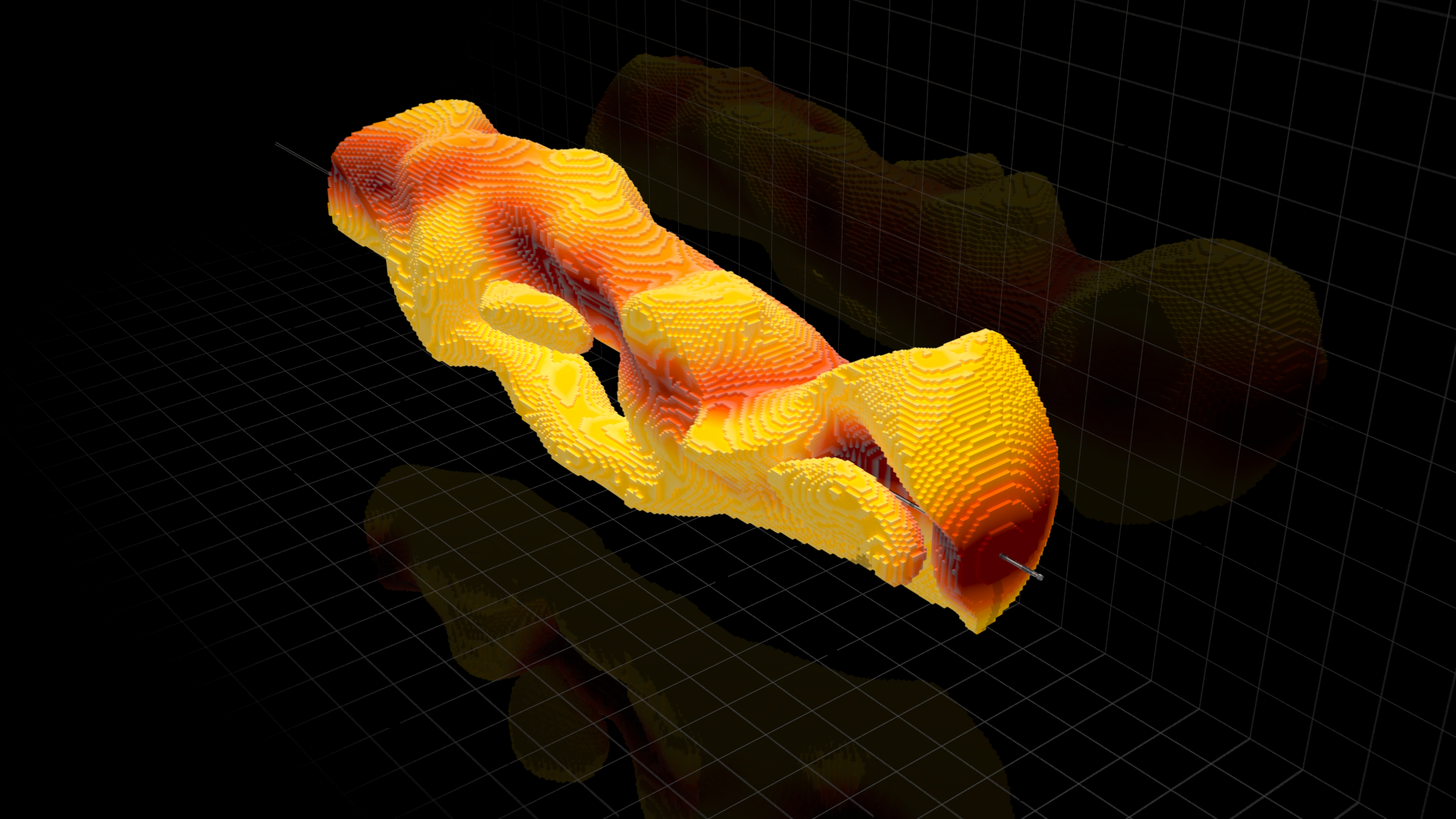
The EarthStar® ultra-deep resistivity service with 1D inversion has proven to effectively map deep into formations to improve the understanding of the well’s stratigraphic position. In this case, the technology not only identified the well path within the complex reservoir, it also mapped the adjacent formations to further understand the well’s stratigraphic positions.
The operator’s knowledge of boundary proximity was enhanced which enabled the subsurface team to precisely place the well path within the target reservoirs. While seismic and offset data informed strategic geosteering, the ultra-deep resistivity service’s inversion canvas was pivotal for most decisions. Early detection of the formation top and the upper marker beds allowed for on-the-fly adjustments to the active well plan, which ensured the well was accurately placed within the desired geological target. By combining the ultra-deep resistivity service with real-time geosteering operations, the operator was able to achieve optimal gas production.
Ultra-deep resistivity service mapping reservoir and fluid boundaries up to 225 feet from the wellbore.