Advanced sensor technologies deliver reliable formation evaluation data in real time
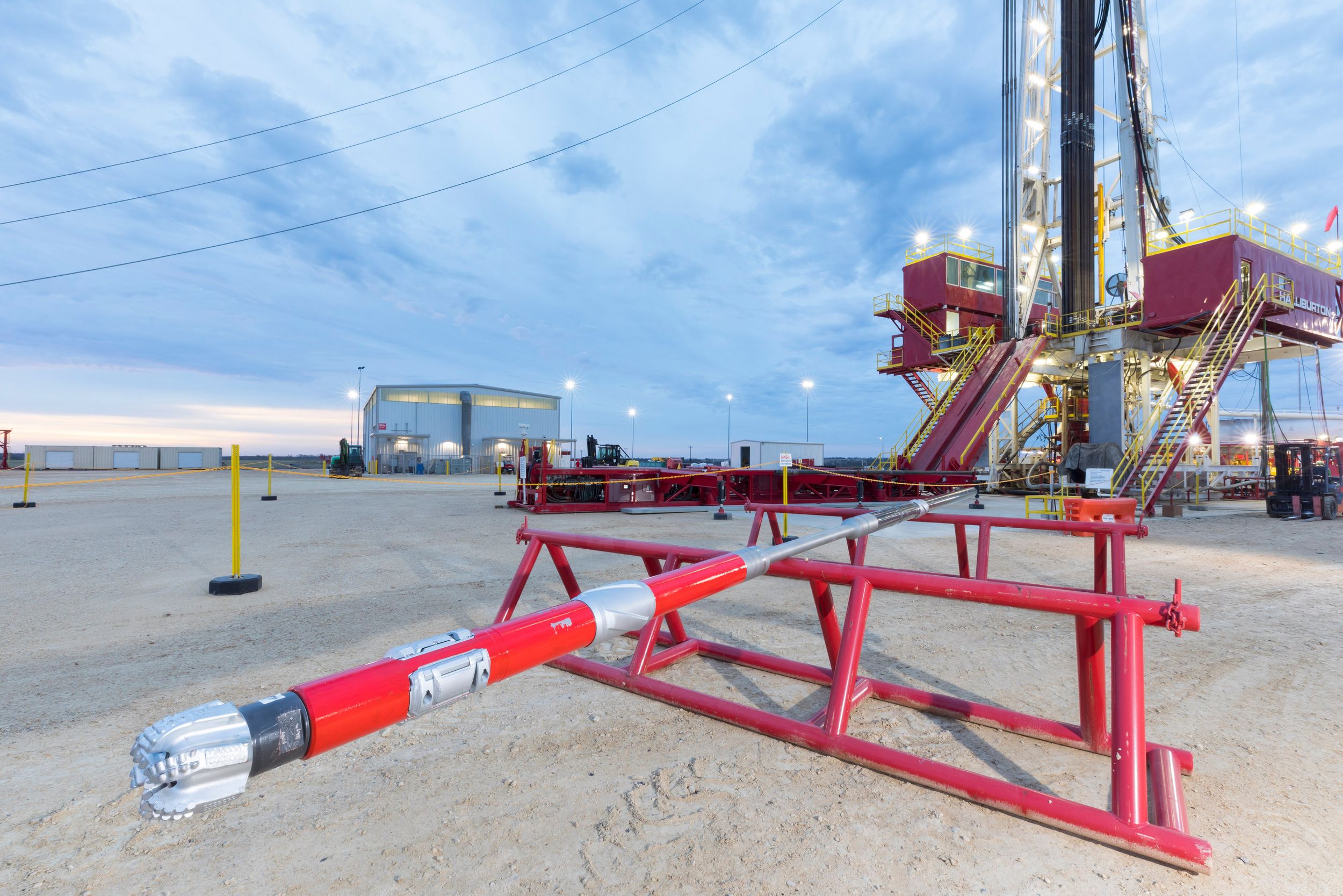
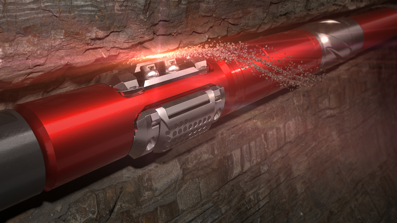
LWD tools acquire formation evaluation data to help you gain greater reservoir insight, leading to timely decision-making and accurate well placement.
Halliburton Sperry Drilling offers a wide array of LWD tools that can be engineered to provide specific reservoir data for multiple applications, including geosteering, petrophysical analysis, geomechanical analysis, reservoir fluid characterization, and reservoir mapping while drilling.
Our latest LWD innovation, advanced 3D inversion capability, provides you with unmatched visualization of the true structure of your reservoir, helping you enhance reservoir understanding.
Let us help you maximize the value of your assets through increased production and lower costs every step of the way.
Industry-leading, logging-while-drilling (LWD) service that is proven to map reservoir and fluid boundaries up to 225 feet (68 meters) from the wellbore – over twice the depth of investigation of the previous industry standard.
[{"contenttype":"Books and Catalogs","datasource":[{"title":"LWD Log Interpretation Charts","description":"This document provides an insight into the sensitivity of LWD measurements to changes in the borehole environment and the impact that this has on the evaluation of a reservoir.","path":"/content/dam/ps/public/ss/contents/Books_and_Catalogs/web/Log-Int-Charts/LWD-Log-Chart-Book-June-2018.pdf","docCreatedDate":"2018-06-26T03:00:00.000-05:00","modifiedDate":"2018-06-26T23:30:00.000-05:00","docdate":"2018-06-26T03:00:00.000-05:00","languageSet":["English"],"accessType":"P","dataSearch":"brandgroups:Sperry_Drilling_Services,|locations:Global,|prodgroups:Formation_Evaluation:Vibration_Monitoring-Formation_Evaluation,LWD:Resistivity_Logging-LWD,LWD:Neutron_Logging-LWD,Drilling,LWD:Gamma_Logging-LWD,LWD,"}]},{"contenttype":"Case Studies","datasource":[{"title":"Mexico: Operator Saves Time USD 7.5 Million in Deepwater Rig Time by Acquiring Crucial Formation Evaluation Data in Real Time","description":"An operator on a deepwater well had recently issued an internal mandate seeking opportunities to reduce the authorizations for expenditure (AFEs) associated with drilling its oil and gas exploration and development projects.","path":"/content/dam/ps/public/ss/contents/Case_Histories/web/GeoTap-IDS-MRIL-WD-Mexico-FullFE.pdf","docCreatedDate":"2016-11-01T03:00:00.000-05:00","modifiedDate":"2016-11-01T23:30:00.000-05:00","docdate":"2016-11-01T03:00:00.000-05:00","docrefNum":"H012369","languageSet":["English"],"accessType":"P","dataSearch":"custchallenges:Deepwater:Reduce_Uncertainty,Reducing_Costs,Reserve-Resource_Calculation_and_Formation_Evaluation,Drilling_Challenges:Deepwater_Drilling,Deepwater,Reduce_Nonproductive_Time,|brandgroups:Sperry_Drilling_Services,|locations:North_America,North_America:Mexico,|prodgroups:LWD:Rock_Mechanics-LWD,LWD,LWD:Nuclear_Magnetic_Resonance-LWD,LWD:Resistivity_Logging-LWD,LWD:Neutron_Logging-LWD,LWD:Density_Logging-LWD,LWD:Testing_and_Sampling-LWD,Drilling,LWD:Gamma_Logging-LWD,"},{"title":"U.K. Offshore: Operator Saves Significant Rig Time by Gathering Complete Formation Evaluation Data in Real Time","description":"In an offshore U.K. well, an operator needed to obtain a complete formation evaluation (FE) data set to measure reservoir and overburden characteristics in a deviated well.","path":"/content/dam/ps/public/ss/contents/Case_Histories/web/MLWD-Penta-Combo-UKOffshore-RT-FE-Data.pdf","docCreatedDate":"2016-11-15T02:00:00.000-06:00","modifiedDate":"2016-11-15T22:30:00.000-06:00","docdate":"2016-11-15T02:00:00.000-06:00","docrefNum":"H012370","languageSet":["English"],"accessType":"P","dataSearch":"custchallenges:Reducing_Costs,Deepwater:Reduce_Uncertainty,Reduce_Nonproductive_Time,|brandgroups:Sperry_Drilling_Services,|locations:Europe,Europe:Western_Europe:United_Kingdom_Western_Europe,Europe:Western_Europe,|prodgroups:LWD:Rock_Mechanics-LWD,Directional_Drilling,MWD,LWD,Directional_Drilling:Rotary_Steerables,LWD:Resistivity_Logging-LWD,LWD:Neutron_Logging-LWD,MWD:Wellbore_Pressure_Monitoring-MWD,LWD:Density_Logging-LWD,LWD:Testing_and_Sampling-LWD,Drilling,LWD:Gamma_Logging-LWD,"},{"title":"Oman: Operator Proves Cost Savings With LWD High-Resolution Imaging Service","description":"Borehole imaging is one of the most rapidly advancing technologies in wireline logging and logging while drilling (LWD). In an onshore horizontal well in Oman, an operator needed more details of the geology in the reservoir in order to gain a better understanding of the distribution of faults, natural fractures, borehole breakouts, and drilling-induced fractures along the well path.","path":"/content/dam/ps/public/ss/contents/Case_Histories/web/AFR-Oman-RealTimeImaging.pdf","docCreatedDate":"2017-03-21T03:00:00.000-05:00","modifiedDate":"2017-03-21T23:30:00.000-05:00","docdate":"2017-03-21T03:00:00.000-05:00","docrefNum":"H012502","languageSet":["English"],"accessType":"P","dataSearch":"custchallenges:Reservoir_Challenges:Mature_Fields,Deepwater:Reduce_Uncertainty,Reducing_Costs,Formation_Challenges:Low_Permeability_Formations,|locations:Middle_East,Middle_East:Oman_Middle_East,|prodgroups:LWD:Rock_Mechanics-LWD,LWD:Borehole_Imaging-LWD,LWD,LWD:Resistivity_Logging-LWD,LWD:Neutron_Logging-LWD,LWD:Density_Logging-LWD,LWD:Gamma_Logging-LWD,Drilling,"},{"title":"North Sea, Norway: Operator Successfully Runs 5 ¾-inch Slim-Hole Drilling Operation with Geo-Pilot® RSS System","description":"In a mature field on the Norwegian Continental Shelf of the North Sea, an operator had attempted twice to drill a new extended-reach drilling (ERD) wellbore with a 2.05 measured depth (MD) to true vertical depth (TVD) ratio that resulted in the bottomhole assembly (BHA) becoming lost in hole above the reservoir.","path":"/content/dam/ps/public/ss/contents/Case_Histories/web/GeoPilot-Norway-First575Run.pdf","docCreatedDate":"2017-03-22T03:00:00.000-05:00","modifiedDate":"2017-06-02T23:30:00.000-05:00","docdate":"2017-03-22T03:00:00.000-05:00","docrefNum":"H012515","languageSet":["English"],"accessType":"P","dataSearch":"custchallenges:Reservoir_Challenges:Mature_Fields,Drilling_Challenges:Extended_Reach_Drilling_(ERD),|brandgroups:Sperry_Drilling_Services,|locations:Oceans_Gulfs_International_Waters,Oceans_Gulfs_International_Waters:North_Sea,Europe,Europe:Northern_Europe,Europe:Northern_Europe:Norway_Northern_Europe,|prodgroups:Directional_Drilling:Rotary_Steerables,LWD:Neutron_Logging-LWD,LWD:Gamma_Logging-LWD,Geosteering,Directional_Drilling,MWD,LWD,LWD:Resistivity_Logging-LWD,MWD:Wellbore_Pressure_Monitoring-MWD,LWD:Density_Logging-LWD,LWD:Testing_and_Sampling-LWD,Drilling,Drilling:Drilling_Engineering_Solutions,"},{"title":"World's First Extreme-High-Temperature LWD Triple-Combo Run","description":"With extreme bottomhole static temperatures approaching 392°F (200°C), some of the wells in the Gulf of Thailand are among the hottest in the world \u2013 far beyond the reach of conventional measurement-while-drilling/logging-while-drilling(M/LWD) tools.","path":"/content/dam/ps/public/ss/contents/Case_Histories/web/quasar-trio-triple-combo-run-thailand.pdf","docCreatedDate":"2016-05-17T23:30:00.000-05:00","modifiedDate":"2018-02-08T22:30:00.000-06:00","docdate":"2016-05-17T23:30:00.000-05:00","docrefNum":"H012188","languageSet":["English"],"accessType":"P","dataSearch":"custchallenges:Reservoir_Challenges:High_Temperature:Ultra_Temperature_(400F),Reservoir_Challenges:High_Temperature,|brandgroups:Sperry_Drilling_Services,|locations:Asia:Southeastern_Asia:Thailand_Southeastern_Asia,Asia:Southeastern_Asia,Asia,|prodgroups:LWD:High_Pressure_High_Temperature-LWD,MWD,LWD,MWD:Wellbore_Pressure_Monitoring-MWD,LWD:Neutron_Logging-LWD,LWD:Density_Logging-LWD,LWD:Gamma_Logging-LWD,Drilling,"},{"title":"Malaysia / GOM / Norway: GeoTap®/Geo-Pilot® Malaysia/GOM/Norway Solution Profile","description":"Three case histories: 1. GeoTap Formation Tester Allows TorqueReduction While Dramatically Improving ROP2. GeoTap® Slimhole LWD Formation Tester and Geo-Pilot® Rotary SteerableSystem Get Pressure Answers In High-Risk Sidetrack3. GeoTap® Tester Increases Reservoir Section and Adds $13 Million of New Oil Production","path":"/content/dam/ps/public/ss/contents/Case_Histories/web/H05813_Malaysia_GOM_Norway_GT_GP.pdf","docCreatedDate":"2007-10-01T03:00:00.000-05:00","modifiedDate":"2012-07-19T23:30:00.000-05:00","docdate":"2007-10-01T03:00:00.000-05:00","docrefNum":"H05813","languageSet":["English"],"accessType":"P","dataSearch":"custchallenges:Formation_Challenges:Formation_Pore_Pressure,|brandgroups:Sperry_Drilling_Services,|locations:Oceans_Gulfs_International_Waters,Asia,Oceans_Gulfs_International_Waters:Gulf_of_Mexico,Europe:Northern_Europe:Norway_Northern_Europe,Asia:Southeastern_Asia,Europe,Europe:Northern_Europe,Asia:Southeastern_Asia:Malaysia_Southeastern_Asia,|prodgroups:Optimization_Services:Drilling_Optimization:Matched_System,Directional_Drilling,LWD:Borehole_Imaging-LWD,LWD,Directional_Drilling:Rotary_Steerables,LWD:Density_Logging-LWD,LWD:Testing_and_Sampling-LWD,Drilling,"},{"title":"Middle East: Middle Eastern Oil Company Saves $450,000 Field Testing the InSite AFR™ Sensor","description":"By eliminating unnecessary runs, use of the InSite AFR sensor in threehorizontal wells saved about nine days of rig time worth approximately$450,000. Also the sensor clearly revealed numerous geologic features.","path":"/content/dam/ps/public/ss/contents/Case_Histories/web/H06067.pdf","docCreatedDate":"2008-04-29T03:00:00.000-05:00","modifiedDate":"2008-09-24T23:30:00.000-05:00","docdate":"2008-04-29T03:00:00.000-05:00","docrefNum":"H06067","languageSet":["English"],"accessType":"P","dataSearch":"custchallenges:Drilling_Challenges:Precise_Well_Placement,|brandgroups:Sperry_Drilling_Services,|locations:Middle_East,|prodgroups:LWD:Resistivity_Logging-LWD,Drilling,LWD,LWD:Borehole_Imaging-LWD,"},{"title":"Texas: High-Resolution Images Identify Formation Bedding Features and Fractures in Oil-Based Mud ","description":"PixStar™ high-resolution ultrasonic imaging service enhances reservoir understanding","path":"/content/dam/ps/public/ss/contents/Case_Histories/web/pixstar-accurate-fracture-placement.pdf","docCreatedDate":"2019-11-08T10:25:00.000-06:00","modifiedDate":"2019-11-13T17:36:05.743Z","docdate":"2019-11-08T10:25:00.000-06:00","languageSet":["English"],"accessType":"P","dataSearch":"brandgroups:Sperry_Drilling_Services,|locations:North_America:United_States:Texas,|prodgroups:LWD:Rock_Mechanics-LWD,Drilling,LWD:Borehole_Imaging-LWD,"},{"title":"Middle East: Operator Identifies Fractures and Optimizes Completion Design ","description":"PixStar™ high-resolution ultrasonic imaging service enhances reservoir understanding in oil-based mud","path":"/content/dam/ps/public/ss/contents/Case_Histories/web/PixStar-Optimize-Completion-Design-Middle-East.pdf","docCreatedDate":"2019-11-08T10:19:00.000-06:00","modifiedDate":"2019-11-13T17:36:05.223Z","docdate":"2019-11-08T10:19:00.000-06:00","docrefNum":"H013412","languageSet":["English"],"accessType":"P","dataSearch":"custchallenges:Reservoir_Challenges:Mature_Fields,|brandgroups:Sperry_Drilling_Services,|locations:Middle_East,|prodgroups:LWD:Rock_Mechanics-LWD,Drilling,LWD:Borehole_Imaging-LWD,"},{"title":"Gulf of Mexico: New LWD Density Service Saves Operator USD 1 Million","description":"During a subsalt deepwater project (water depth of over 5,200 ft (1,585 m)) in the Gulf of Mexico, an operator faced significant uncertainties in the geological model below a salt section. In this area, it is often difficult to acquire good-quality seismic images due to attenuation of seismic signals by the overlying salt formations.","path":"/content/dam/ps/public/ss/contents/Case_Histories/web/ALD-GOM-LargeHoleSaltImages.pdf","docCreatedDate":"2017-01-09T02:00:00.000-06:00","modifiedDate":"2017-01-09T22:30:00.000-06:00","docdate":"2017-01-09T02:00:00.000-06:00","docrefNum":"H012341","languageSet":["English"],"accessType":"P","dataSearch":"custchallenges:Deepwater:Reduce_Uncertainty,Deepwater:Reduce_Uncertainty:Reservoir_Characterization,Salt_Challenges,Exploration_&_Seismic_Challenges,|brandgroups:Sperry_Drilling_Services,|locations:Oceans_Gulfs_International_Waters,Oceans_Gulfs_International_Waters:Gulf_of_Mexico,|prodgroups:Geosteering,LWD:Density_Logging-LWD,Drilling,LWD,"},{"title":"USA, North Dakota Bakken: Operator Achieves More Accurate Wellbore Placement Using a New Azimuthal Gamma Ray Service","description":"An operator in North Dakota\u2019s Middle Bakken shale formation sought a solution that would enable effective drilling and geosteering in a formation with little gamma ray variation, while minimizing drilling costs.","path":"/content/dam/ps/public/ss/contents/Case_Histories/web/Radian-NDBakken-StratigraphyInsight.pdf","docCreatedDate":"2017-01-26T02:00:00.000-06:00","modifiedDate":"2018-06-05T23:30:00.000-05:00","docdate":"2017-01-26T02:00:00.000-06:00","docrefNum":"H012434","languageSet":["English"],"accessType":"P","dataSearch":"custchallenges:Production_Challenges:Unconventional_Resources,Deepwater:Reduce_Uncertainty,Drilling_Challenges:Precise_Well_Placement,|brandgroups:Sperry_Drilling_Services,|locations:North_America:United_States:North_Dakota,North_America,North_America:United_States,|prodgroups:Geosteering,MWD:Wellbore_Surveying-MWD,MWD,Drilling,LWD:Gamma_Logging-LWD,LWD,"},{"title":"Middle East: Operator Validates Real-Time Magnetic Resonance Porosities in Carbonate Reservoir","description":"4-3/4-in MRIL®-WD™ LWD sensor delivers T1 data to enhance reservoir understanding of a mature field.","path":"/content/dam/ps/public/ss/contents/Case_Histories/web/mril-wd-middle-east1.pdf","docCreatedDate":"2019-05-08T13:08:00.000-05:00","modifiedDate":"2019-05-08T14:09:58.192-04:00","docdate":"2019-05-08T13:08:00.000-05:00","docrefNum":"H013021","languageSet":["English"],"accessType":"P","dataSearch":"custchallenges:Reservoir_Challenges:Mature_Fields,|brandgroups:Sperry_Drilling_Services,|locations:Middle_East,|prodgroups:LWD:Nuclear_Magnetic_Resonance-LWD,"},{"title":"Middle East: Operator Uses Real-Time Magnetic Resonance to Assess Rock Quality in Clastic Formations","description":"43\u20444-IN. MRIL®-WD™ LWD sensor delivers T1 data to enhance reservoir understanding of a mature field.","path":"/content/dam/ps/public/ss/contents/Case_Histories/web/mril-wd-middle-east3.pdf","docCreatedDate":"2019-05-08T13:15:00.000-05:00","modifiedDate":"2019-05-08T14:17:15.051-04:00","docdate":"2019-05-08T13:15:00.000-05:00","docrefNum":"H013020","languageSet":["English"],"accessType":"P","dataSearch":"brandgroups:Sperry_Drilling_Services,|locations:Middle_East,|prodgroups:LWD:Nuclear_Magnetic_Resonance-LWD,"},{"title":"Middle East: T1 Data Helps Operator Resolve Pore Size Variation in Complex Carbonate Formation","description":"43\u20444-IN. MRIL®-WD™ LWD senspr delivers T1 data for optimum well placement in a mature field.","path":"/content/dam/ps/public/ss/contents/Case_Histories/web/mril-wd-middle-east2.pdf","docCreatedDate":"2019-05-08T13:12:00.000-05:00","modifiedDate":"2019-05-08T14:13:37.901-04:00","docdate":"2019-05-08T13:12:00.000-05:00","docrefNum":"H013022","languageSet":["English"],"accessType":"P","dataSearch":"brandgroups:Sperry_Drilling_Services,|locations:Middle_East,|prodgroups:LWD:Nuclear_Magnetic_Resonance-LWD,"},{"title":"Operator Obtains Reliable Reservoir Measurements and Reduces Well Time, Saving USD 1 Million","description":"GeoTap® sensor 10K PSI drawdown capability acquires accurate and precise formation pressure data in real time.","path":"/content/dam/ps/public/ss/contents/Case_Histories/web/GeoTap-Azerbaijan.pdf","docCreatedDate":"2019-10-10T14:58:00.000-05:00","modifiedDate":"2019-10-10T16:00:29.769-04:00","docdate":"2019-10-10T14:58:00.000-05:00","languageSet":["English"],"accessType":"P","dataSearch":"custchallenges:Drilling_Challenges:Deepwater_Drilling,|brandgroups:Sperry_Drilling_Services,|locations:Asia:Southwestern_Asia:Azerbaijan_Southwestern_Asia,|prodgroups:LWD:Testing_and_Sampling-LWD,"},{"title":"Gulf of Mexico: Top of Cement Identification in Ultra-Deepwater Well Complements Wireline SBT Results","description":"XBAT™ service provides real-time cement assessments for accurate top of cement evaluations.","path":"/content/dam/ps/public/ss/contents/Case_Histories/web/XBAT-GOM-TOC-Identification.pdf","docCreatedDate":"2019-10-31T10:54:00.000-05:00","modifiedDate":"2019-11-07T16:31:51.596Z","docdate":"2019-10-31T10:54:00.000-05:00","languageSet":["English"],"accessType":"P","dataSearch":"custchallenges:Drilling_Challenges:Deepwater_Drilling,|brandgroups:Sperry_Drilling_Services,|locations:Oceans_Gulfs_International_Waters:Gulf_of_Mexico,|prodgroups:LWD:Rock_Mechanics-LWD,"},{"title":"Gulf of Mexico: Top of Cement Identification in Ultra-Deepwater Well Saves Operator USD 700,000","description":"XBAT™ service provides accurate top of cement evaluation during cementing of liner.","path":"/content/dam/ps/public/ss/contents/Case_Histories/web/XBAT-GOM-TOC-Evaluation-Cementing-Liner.pdf","docCreatedDate":"2019-10-31T11:00:00.000-05:00","modifiedDate":"2019-11-07T16:31:51.656Z","docdate":"2019-10-31T11:00:00.000-05:00","languageSet":["English"],"accessType":"P","dataSearch":"custchallenges:Drilling_Challenges:Deepwater_Drilling,|brandgroups:Sperry_Drilling_Services,|locations:Oceans_Gulfs_International_Waters:Gulf_of_Mexico,|prodgroups:LWD:Rock_Mechanics-LWD,"},{"title":"Gulf of Mexico: Top of Cement Identification in Deepwater Well Supports Cement Lift Pressure Calculations","description":"XBAT™ service accurately determines top of cement by recording and anaylzing raw waveform data.","path":"/content/dam/ps/public/ss/contents/Case_Histories/web/XBAT-GOM-TOC-Data-Anaylsis.pdf","docCreatedDate":"2019-10-31T10:45:00.000-05:00","modifiedDate":"2019-11-07T16:31:51.722Z","docdate":"2019-10-31T10:45:00.000-05:00","languageSet":["English"],"accessType":"P","dataSearch":"custchallenges:Drilling_Challenges:Deepwater_Drilling,|brandgroups:Sperry_Drilling_Services,|locations:Oceans_Gulfs_International_Waters:Gulf_of_Mexico,|prodgroups:LWD:Rock_Mechanics-LWD,"},{"title":"Kuwait: Ultrasonic Images Identify Breakout and Bed Boundaries","description":"PixStar™ high-resolution ultrasonic imaging LWD service provide images that aid welbore stability understanding. ","path":"/content/dam/ps/public/ss/contents/Case_Histories/web/KOC-PixStar-Service.pdf","docCreatedDate":"2020-04-01T15:06:00.000-05:00","modifiedDate":"2020-04-01T20:09:17.968Z","docdate":"2020-04-01T15:06:00.000-05:00","languageSet":["English"],"accessType":"P","dataSearch":"custchallenges:Reservoir_Challenges:Mature_Fields,|brandgroups:Sperry_Drilling_Services,|locations:Middle_East:Kuwait_Middle_East,|prodgroups:LWD:Rock_Mechanics-LWD,"},{"title":"Texas: High-Resolution Images Identify Formation Bedding and Fractures in High-Angle OBM Well","description":"PixStar™ high-resolution ultrasonic imaging service snhances reservoir understanding in near-horizontal wellbore.","path":"/content/dam/ps/public/ss/contents/Case_Histories/web/PixStar-High-Angle-OBM-Well.pdf","docCreatedDate":"2019-12-11T16:22:00.000-06:00","modifiedDate":"2019-12-11T22:22:58.856Z","docdate":"2019-12-11T16:22:00.000-06:00","languageSet":["English"],"accessType":"P","dataSearch":"brandgroups:Sperry_Drilling_Services,|locations:North_America:United_States:Texas,|prodgroups:LWD:Rock_Mechanics-LWD,"},{"title":"Texas: High-Resolution Images Enable Real-Time Borehole Size and Shape Assessment in OBM","description":"PixStar™ high-resolution ultrasonic imaging service provides real-time data to improve wellbore stability.","path":"/content/dam/ps/public/ss/contents/Case_Histories/web/PixStar-Wellbore-Stability.pdf","docCreatedDate":"2019-12-11T16:29:00.000-06:00","modifiedDate":"2019-12-11T22:30:41.290Z","docdate":"2019-12-11T16:29:00.000-06:00","languageSet":["English"],"accessType":"P","dataSearch":"brandgroups:Sperry_Drilling_Services,|locations:North_America:United_States:Texas,|prodgroups:LWD:Rock_Mechanics-LWD,"},{"title":"Operator Significantly Enhances Reservoir Insight from 3D Inversion","description":"EarthStar™ ultra-deep resistivity service combined with unique, industry-leading 3D inversion sheds new light on mature reservoir.","path":"/content/dam/ps/public/ss/contents/Case_Histories/web/EarthStar-3D-1.pdf","docCreatedDate":"2019-06-19T13:11:00.000-05:00","modifiedDate":"2019-06-19T14:13:34.057-04:00","docdate":"2019-06-19T13:11:00.000-05:00","docrefNum":"H013295","languageSet":["English"],"accessType":"P","dataSearch":"brandgroups:Sperry_Drilling_Services,|locations:Europe:Northern_Europe:Norway_Northern_Europe,|prodgroups:LWD:Resistivity_Logging-LWD,Geosteering,"},{"title":"North Sea: Operator Avoids Drilling Hazards and Maximizes Reservoir Exposure","description":"EarthStar™ ultra-deep resistivity service delivers additional producible reserves.","path":"/content/dam/ps/public/ss/contents/Case_Histories/web/EarthStar-Geomapping-NorthSea.pdf","docCreatedDate":"2019-07-26T15:43:00.000-05:00","modifiedDate":"2019-07-26T16:44:29.497-04:00","docdate":"2019-07-26T15:43:00.000-05:00","languageSet":["English"],"accessType":"P","dataSearch":"brandgroups:Sperry_Drilling_Services,|locations:Oceans_Gulfs_International_Waters:North_Sea,|prodgroups:Drilling,LWD:Resistivity_Logging-LWD,"},{"title":"Operator Identifies Bypassed Pay and Increases Pay Zone by 50% in Water-flooded Reservoir","description":"Earthstar™ Ultra-Deep Resistivity Service Maximizes Asset Value in Mature Carbonate Field","path":"/content/dam/ps/public/ss/contents/Case_Histories/web/earthStar-geosteering.pdf","docCreatedDate":"2018-12-05T13:01:00.000-06:00","modifiedDate":"2018-12-05T13:02:51.050-06:00","docdate":"2018-12-05T13:01:00.000-06:00","docrefNum":"H012961","languageSet":["English"],"accessType":"P","dataSearch":"locations:Oceans_Gulfs_International_Waters:North_Sea,|prodgroups:LWD:Resistivity_Logging-LWD,Formation_Evaluation:Resistivity_Logging,Geosteering,"},{"title":"Norway: North Sea Operator Drills Longest Shoe-to-Shoe Run in Slim Reservoir Section","description":"BHA configuration with EarthStar® service and Machete™ cutters enables long, vibration-free run with a single bit.","path":"/content/dam/ps/public/ss/contents/Case_Histories/web/EarthStar-Machete-Norway.pdf","docCreatedDate":"2020-12-03T11:22:00.000-06:00","modifiedDate":"2020-12-03T17:24:06.705Z","docdate":"2020-12-03T11:22:00.000-06:00","languageSet":["English"],"accessType":"P","dataSearch":"custchallenges:Reservoir_Challenges:Mature_Fields,|brandgroups:Sperry_Drilling_Services,|locations:Europe:Northern_Europe:Norway_Northern_Europe,|prodgroups:LWD:Resistivity_Logging-LWD,"},{"title":"Southeast Asia: Operator Achieves 99.5 Percent Run Efficiency in Complex Carbonate Reservoir","description":"EarthStar® servcie geomaps multiple oil saturation layers and fluid contacts, and helps execute directional plan within pay zone.","path":"/content/dam/ps/public/ss/contents/Case_Histories/web/EarthStar-Southeast-Asia.pdf","docCreatedDate":"2020-01-13T20:12:00.000-06:00","modifiedDate":"2020-01-14T02:15:12.647Z","docdate":"2020-01-13T20:12:00.000-06:00","docrefNum":"H013458","languageSet":["English"],"accessType":"P","dataSearch":"custchallenges:Reservoir_Challenges:Mature_Fields,|brandgroups:Sperry_Drilling_Services,|locations:Asia:Southeastern_Asia:Malaysia_Southeastern_Asia,|prodgroups:LWD:Resistivity_Logging-LWD,Geosteering,"},{"title":"Operator Drills Gulf of Thailand\u2019s Longest Openhole Production Section...","description":"Quasar Trio® M/LWD Triple-Combo Service reduces well time in extreme-temperature well","path":"/content/dam/ps/public/ss/contents/Case_Histories/web/quasar-trio-helps-operator-drill-longest-openhole-production-section-in-thailand.pdf","docCreatedDate":"2018-11-01T10:47:00.000-05:00","modifiedDate":"2018-11-02T10:50:40.008-05:00","docdate":"2018-11-01T10:47:00.000-05:00","docrefNum":"H012985","languageSet":["English"],"accessType":"P","dataSearch":"custchallenges:Deepwater,|brandgroups:Sperry_Drilling_Services,|locations:Asia:Southeastern_Asia:Thailand_Southeastern_Asia,|prodgroups:MWD,LWD,"},{"title":"Thailand: SOLAR® M/LWD Services Used on Thousands of High-Temperature Wells in the Gulf of Thailand","description":"SOLAR® M/LWD Services Used on Thousands of High-Temperature Wells in the Gulf of Thailand","path":"/content/dam/ps/public/ss/contents/Case_Histories/web/H06828.pdf","docCreatedDate":"2009-04-24T23:30:00.000-05:00","modifiedDate":"2009-04-24T23:30:00.000-05:00","docdate":"2009-04-24T23:30:00.000-05:00","docrefNum":"H06828","languageSet":["English"],"accessType":"P","dataSearch":"custchallenges:Reservoir_Challenges:High_Temperature,|brandgroups:Sperry_Drilling_Services,|locations:Asia:Southeastern_Asia,Asia,Asia:Southeastern_Asia:Thailand_Southeastern_Asia,Asia:Eastern_Asia,Asia:Eastern_Asia:China_Eastern_Asia,|prodgroups:MWD,Drilling,LWD,"},{"title":"South East Asia: Quasar Pulse℠ M/LWD service saves customer approximately USD 1 Million","description":"An operator wanted to reduce costs and achieve logging objectives on high-temperature wells drilled from a jack up rig in 243 feet (74 meters) of water, offshore South East Asia, where bottomhole temperatures are among the highest in the world.","path":"/content/dam/ps/public/ss/contents/Case_Histories/web/Quasar-Pulse-Asia-HT.pdf","docCreatedDate":"2015-03-18T03:00:00.000-05:00","modifiedDate":"2015-03-18T23:30:00.000-05:00","docdate":"2015-03-18T03:00:00.000-05:00","docrefNum":"H011277","languageSet":["English"],"accessType":"P","dataSearch":"custchallenges:Reservoir_Challenges:High_Temperature:Ultra_Temperature_(400F),Reservoir_Challenges:High_Temperature,|brandgroups:Sperry_Drilling_Services,|locations:Asia:Southeastern_Asia,|prodgroups:Drilling,MWD,LWD,"},{"title":"North Sea: Successful Dual Drilling Operations Saves Aker BP USD 1.2 Million with Zero HSE Issues","description":"Three simultaneous dual drilling operations ","path":"/content/dam/ps/public/ss/contents/Case_Histories/web/AkerBP-Dual-Drilling-Norway.pdf","docCreatedDate":"2019-09-04T16:22:00.000-05:00","modifiedDate":"2019-09-04T17:24:27.805-04:00","docdate":"2019-09-04T16:22:00.000-05:00","languageSet":["English"],"accessType":"P","dataSearch":"custchallenges:Deepwater,|brandgroups:Sperry_Drilling_Services,|locations:Oceans_Gulfs_International_Waters:North_Sea,|prodgroups:LWD,"},{"title":"TOTAL S.A. Drills to Record Depths in HP/HT Well and Saves USD 5 Million","description":"Engineered MWD/LWD solution delivers reliable measurements in extreme temperature environment","path":"/content/dam/ps/public/ss/contents/Case_Histories/web/QuasarTripTOTAL.pdf","docCreatedDate":"2018-05-15T23:30:00.000-05:00","modifiedDate":"2018-03-19T23:30:00.000-05:00","docdate":"2018-05-15T23:30:00.000-05:00","docrefNum":"H012826","languageSet":["English"],"accessType":"P","dataSearch":"custchallenges:Reservoir_Challenges:High_Pressure,Reservoir_Challenges:High_Temperature,|brandgroups:Sperry_Drilling_Services,|locations:Europe:Northern_Europe:Norway_Northern_Europe,|prodgroups:MWD,LWD,"},{"title":"Operator Maximizes Asset Value in Extreme-High-Temperature Wells","description":"Quasar Trio® M/LWD Triple-Combo service reduces well time in 24-slot platform operation.","path":"/content/dam/ps/public/ss/contents/Case_Histories/web/Quasar-Trio-Thailand.pdf","docCreatedDate":"2018-08-13T23:30:00.000-05:00","modifiedDate":"2018-08-13T23:30:00.000-05:00","docdate":"2018-08-13T23:30:00.000-05:00","docrefNum":"H012952","languageSet":["English"],"accessType":"P","dataSearch":"custchallenges:Reservoir_Challenges:Mature_Fields,Reservoir_Challenges:High_Temperature:High_Temperature_(300F),|brandgroups:Sperry_Drilling_Services,|locations:Asia:Southeastern_Asia:Thailand_Southeastern_Asia,|prodgroups:MWD,LWD,"},{"title":"Canada: Operator Optimizes Oil Recovery, Drills to Produce in Cyclic Steam Application","description":"Accurate geosteering helps to precisely position wellbore.","path":"/content/dam/ps/public/ss/contents/Case_Histories/web/Survey-Management-Geosteering-Canada.pdf","docCreatedDate":"2020-05-29T12:18:00.000-05:00","modifiedDate":"2020-06-03T17:20:44.664Z","docdate":"2020-05-29T12:18:00.000-05:00","languageSet":["English"],"accessType":"P","dataSearch":"custchallenges:Fluids_Challenges:Heavy_Oil,|brandgroups:Sperry_Drilling_Services,|locations:North_America:Canada,|prodgroups:Geosteering,LWD,Optimization_Services:Drilling_Optimization:Directional_Survey_Management,"},{"title":"Petroboscan Obtains Real-Time Formation Pressure Data and Extends Production in a Mature Field","description":"Sperry Drilling collaborated with the operator and providedreservoir insight and LWD expertise on reliable formationpressure measurement capabilities using its GeoTap® LWD formation tester service.","path":"/content/dam/ps/public/ss/contents/Case_Histories/web/GeoTap-Venezuela.pdf","docCreatedDate":"2018-05-15T23:30:00.000-05:00","modifiedDate":"2018-02-27T22:30:00.000-06:00","docdate":"2018-05-15T23:30:00.000-05:00","docrefNum":"H012694","languageSet":["English"],"accessType":"P","dataSearch":"custchallenges:Reservoir_Challenges:Mature_Fields,Production_Challenges:Unconventional_Resources,|brandgroups:Sperry_Drilling_Services,|locations:South_America:Venezuela_Northern_South_America,|prodgroups:LWD,"},{"title":"Oman: Operator Drills 4,245 Feet in Shoe-to-Shoe Run, Hitting Sweet Spot a Week Ahead of Plan","description":"Unique engineered drilling solution involving 4-3/4 in. EarthStar® service and iCruise® intelligent RSS maximizes asset value.","path":"/content/dam/ps/public/ss/contents/Case_Histories/web/iCruise-RSS-EarthStar-Service-Oman.pdf","docCreatedDate":"2020-07-24T16:48:00.000-05:00","modifiedDate":"2020-07-24T21:50:29.030Z","docdate":"2020-07-24T16:48:00.000-05:00","languageSet":["English"],"accessType":"P","dataSearch":"custchallenges:Production_Challenges:Unconventional_Resources,|brandgroups:Sperry_Drilling_Services,|locations:Middle_East:Oman_Middle_East,|prodgroups:Directional_Drilling:Rotary_Steerables,Formation_Evaluation:Resistivity_Logging,LWD,"}]},{"contenttype":"Data Sheets","datasource":[{"title":"Geo-Span® Downlink Service","description":"Communicate with downhole tools without impacting drilling","path":"/content/dam/ps/public/ss/contents/Data_Sheets/web/H06444.pdf","docCreatedDate":"2011-12-20T22:30:00.000-06:00","modifiedDate":"2011-12-20T22:30:00.000-06:00","docdate":"2011-12-20T22:30:00.000-06:00","docrefNum":"H06444","languageSet":["English"],"accessType":"P","dataSearch":"brandgroups:Sperry_Drilling_Services,|locations:Global,|prodgroups:MWD,Directional_Drilling,LWD:Nuclear_Magnetic_Resonance-LWD,LWD,Directional_Drilling:Rotary_Steerables,LWD:Resistivity_Logging-LWD,MWD:Wellbore_Pressure_Monitoring-MWD,Drilling,Drilling:Telemetry,"},{"title":"PixStar™ High-Resolution Ultrasonic Imaging Service ","description":"Provides greater wellbore coverage to enhance reservoir understanding","path":"/content/dam/ps/public/ss/contents/Data_Sheets/web/pixstar-high-resolution-ultrasonic-imaging-service.pdf","docCreatedDate":"2019-11-08T09:58:00.000-06:00","modifiedDate":"2019-11-13T17:36:05.788Z","docdate":"2019-11-08T09:58:00.000-06:00","docrefNum":"H013411","languageSet":["English"],"accessType":"P","dataSearch":"locations:Global,|prodgroups:LWD:Rock_Mechanics-LWD,LWD:Borehole_Imaging-LWD,"},{"title":"ABG™ At-Bit Gamma Sensor","description":"The ABG™ at-bit gamma sensor is an option on the Geo-Pilot® rotary steerable system (RSS). The combined gamma and inclination package is located close to the bit, providing an early indication of formation changes during drilling.","path":"/content/dam/ps/public/ss/contents/Data_Sheets/web/At-Bit-Gamma-Sensor-DataSheet.pdf","docCreatedDate":"2019-05-30T10:30:00.000-05:00","modifiedDate":"2019-05-30T11:36:16.651-04:00","docdate":"2019-05-30T10:30:00.000-05:00","docrefNum":"H013087","languageSet":["English"],"accessType":"P","dataSearch":"brandgroups:Sperry_Drilling_Services,|locations:Global,|prodgroups:LWD:Gamma_Logging-LWD,LWD,Geosteering,"},{"title":"XBAT™ Plus Azimuthal Sonic and Ultrasonic LWD Service","description":" The XBAT™ Plus azimuthal sonic and ultrasonic service addresses a wide range of applications, enabling increased understanding of the drilling environment and reservoir properties.","path":"/content/dam/ps/public/ss/contents/Data_Sheets/web/Azimuthal-Sonic-and-Ultrasonic-Datasheet.pdf","docCreatedDate":"2019-05-31T15:53:00.000-05:00","modifiedDate":"2019-05-31T16:56:06.709-04:00","docdate":"2019-05-31T15:53:00.000-05:00","docrefNum":"H013097","languageSet":["English"],"accessType":"P","dataSearch":"brandgroups:Sperry_Drilling_Services,|locations:Global,|prodgroups:LWD:Rock_Mechanics-LWD,LWD,"},{"title":"EarthStar™ Ultra-Deep Resistivity Service - (Russian)","description":"The EarthStar™ ultra-deep resistivity service illuminates and maps reservoir and fluid boundaries more than 200 feet (61 meters) from the wellbore. In deepwater and mature fields, this technology helps operators to maximize asset values and plans for future field developments by mapping pockets of hydrocarbons, allowing for real-time steering decisions, and eliminating costly pilot holes and sidetracks.","path":"/content/dam/ps/public/ss/contents/Data_Sheets/web/H012879-EarthStar-Russian.pdf","docCreatedDate":"2018-10-16T09:17:53.439-05:00","modifiedDate":"2018-10-16T09:17:53.439-05:00","docdate":"2018-10-16T09:17:53.439-05:00","docrefNum":"H012879","languageSet":["Russian"],"accessType":"P","dataSearch":"locations:Global,|prodgroups:LWD:Resistivity_Logging-LWD,Formation_Evaluation:Resistivity_Logging,Drilling,LWD,"},{"title":"Quasar Pulse® M/LWD Service ","description":"The Quasar Pulse® measurement/logging-while-drilling (M/LWD) service from Halliburton Sperry Drilling provides directional, gamma ray, and pressure-while-drilling (PWD) measurements and telemetry to help place the wellbore accurately and reduce well time.","path":"/content/dam/ps/public/ss/contents/Data_Sheets/web/Quasar-Pulse-Datasheet1.pdf","docCreatedDate":"2019-07-15T10:38:00.000-05:00","modifiedDate":"2019-07-15T11:41:49.212-04:00","docdate":"2019-07-15T10:38:00.000-05:00","docrefNum":"H013326","languageSet":["English"],"accessType":"P","dataSearch":"brandgroups:Sperry_Drilling_Services,|locations:Global,|prodgroups:LWD:High_Pressure_High_Temperature-LWD,"},{"title":"MRIL®-WD™ Magnetic Resonance Imaging Logging-While-Drilling Sensor","description":"The nuclear magnetic resonance measurements provided by the range of MRIL®-WD™ sensors enable early identification of critical petrophysical parameters to deliver comprehensive formation evaluation by differentiating between moveable and bound fluids.","path":"/content/dam/ps/public/ss/contents/Data_Sheets/web/MRIL-WD-Datasheet.pdf","docCreatedDate":"2019-04-30T09:28:00.000-05:00","modifiedDate":"2019-06-03T10:29:55.116-04:00","docdate":"2019-04-30T09:28:00.000-05:00","docrefNum":"H012912","languageSet":["English"],"accessType":"P","dataSearch":"brandgroups:Sperry_Drilling_Services,|locations:Global,|prodgroups:LWD:Nuclear_Magnetic_Resonance-LWD,"},{"title":"GeoTap® IDS Fluid Identification and Sampling Sensor","description":"The GeoTap® IDS fluid identification and sampling sensor from Halliburton Sperry Drilling enables reservoir fluid samples to be recovered with logging-while-drilling (LWD) technology.","path":"/content/dam/ps/public/ss/contents/Data_Sheets/web/GeoTap-Identification-and-Sampling-Sensor-Datasheet.pdf","docCreatedDate":"2019-05-30T14:38:00.000-05:00","modifiedDate":"2019-05-30T15:41:39.309-04:00","docdate":"2019-05-30T14:38:00.000-05:00","docrefNum":"H013251","languageSet":["English"],"accessType":"P","dataSearch":"brandgroups:Sperry_Drilling_Services,|locations:Global,|prodgroups:LWD:Testing_and_Sampling-LWD,"},{"title":"GeoTap® Formation Pressure Tester Service","description":"The GeoTap® formation pressure tester service from Halliburton Sperry Drilling provides real-time formation pressure measurements.","path":"/content/dam/ps/public/ss/contents/Data_Sheets/web/Geo-Tap-Formation-Datasheet.pdf","docCreatedDate":"2019-07-12T15:47:00.000-05:00","modifiedDate":"2019-07-12T16:49:59.514-04:00","docdate":"2019-07-12T15:47:00.000-05:00","docrefNum":"H013325","languageSet":["English"],"accessType":"P","dataSearch":"brandgroups:Sperry_Drilling_Services,|locations:Global,|prodgroups:LWD:Testing_and_Sampling-LWD,"},{"title":"Radian® Azimuthal Gamma-Ray and Inclination Service","description":"The Radian service utilizes four highly sensitive gamma-ray detectors arranged evenly around the circumference of the tool, allowing it to generate real-time azimuthal images, whether rotating or not, and providing more details of the reservoir structure. ","path":"/content/dam/ps/public/ss/contents/Data_Sheets/web/Radian-Gamma-Ray-Datasheet.pdf","docCreatedDate":"2019-06-21T16:17:00.000-05:00","modifiedDate":"2019-06-21T17:21:13.822-04:00","docdate":"2019-06-21T16:17:00.000-05:00","docrefNum":"H013216","languageSet":["English"],"accessType":"P","dataSearch":"brandgroups:Sperry_Drilling_Services,|locations:Global,|prodgroups:LWD:Gamma_Logging-LWD,Geosteering,"},{"title":" DGR™ Dual Gamma Ray Service ","description":"The DGR™ dual gamma ray service from Halliburton Sperry Drilling provides accurate logging-while-drilling (LWD) natural gamma ray logs with proven accuracy and reliability.","path":"/content/dam/ps/public/ss/contents/Data_Sheets/web/Dual-Gamma-Ray-Service-Datasheet.pdf","docCreatedDate":"2019-05-30T11:30:00.000-05:00","modifiedDate":"2019-05-30T12:33:11.009-04:00","docdate":"2019-05-30T11:30:00.000-05:00","docrefNum":"H013195","languageSet":["English"],"accessType":"P","dataSearch":"brandgroups:Sperry_Drilling_Services,|locations:Global,|prodgroups:LWD:Gamma_Logging-LWD,"},{"title":"EWR®-PHASE 4™ Sensors","description":"The EWR®-PHASE 4™ service from Halliburton Sperry Drilling utilizes a high-frequency logging-while-drilling (LWD) induction resistivity sensor. This tool comprises four radiofrequency transmitters and a pair of receivers.","path":"/content/dam/ps/public/ss/contents/Data_Sheets/web/Electromagnetic-Wave-Resitivity-Phase-4-Sensors-Datasheet.pdf","docCreatedDate":"2019-05-30T14:09:00.000-05:00","modifiedDate":"2019-05-30T15:14:18.636-04:00","docdate":"2019-05-30T14:09:00.000-05:00","languageSet":["English"],"accessType":"P","dataSearch":"brandgroups:Sperry_Drilling_Services,|locations:Global,|prodgroups:MWD,LWD:Resistivity_Logging-LWD,"},{"title":"EarthStar™ Ultra-Deep Resistivity Service","description":"The EarthStar™ ultra-deep resistivity service is proven to illuminate and map reservoir and fluid boundaries up to 225 feet (68m) from the wellbore. It also offers the industry\u2019s only 3D inversion capability, providing unparalleled visualization of the true reservoir structure.","path":"/content/dam/ps/public/ss/contents/Data_Sheets/web/EarthStar-Datasheet.pdf","docCreatedDate":"2019-06-14T11:34:00.000-05:00","modifiedDate":"2019-07-29T14:28:48.080-04:00","docdate":"2019-06-14T11:34:00.000-05:00","docrefNum":"H013109","languageSet":["English"],"accessType":"P","dataSearch":"brandgroups:Sperry_Drilling_Services,|locations:Global,|prodgroups:LWD:Resistivity_Logging-LWD,Geosteering,"},{"title":" AFR™ Azimuthal Focused Resistivity Sensor","description":"The AFR™ Azimuthal Focused Resistivity Sensor from Halliburton Sperry Drilling delivers high-resolution logging-while-drilling (LWD) borehole images for improved reserves estimates and enhanced understanding of the reservoir structure.","path":"/content/dam/ps/public/ss/contents/Data_Sheets/web/Azimuthal-Focused-Resistivity-Sensor-Datasheet.pdf","docCreatedDate":"2019-05-30T11:01:00.000-05:00","modifiedDate":"2019-05-30T12:06:52.034-04:00","docdate":"2019-05-30T11:01:00.000-05:00","docrefNum":"H013193","languageSet":["English"],"accessType":"P","dataSearch":"brandgroups:Sperry_Drilling_Services,|locations:Global,|prodgroups:LWD:Resistivity_Logging-LWD,Geosteering,"},{"title":"ADR™ Azimuthal Deep Resistivity Service","description":"The ADR™ azimuthal deep resistivity service from Halliburton Sperry Drilling provides a solution for optimized wellbore placement, while maximizing production and extending field life. ","path":"/content/dam/ps/public/ss/contents/Data_Sheets/web/Azimuthal-Deep-Resistivity-Datasheet.pdf","docCreatedDate":"2019-06-26T15:36:00.000-05:00","modifiedDate":"2019-06-26T16:44:53.800-04:00","docdate":"2019-06-26T15:36:00.000-05:00","docrefNum":"H0131192","languageSet":["English"],"accessType":"P","dataSearch":"brandgroups:Sperry_Drilling_Services,|locations:Global,|prodgroups:LWD:Resistivity_Logging-LWD,Geosteering,"},{"title":"Quasar Trio® M/LWD Triple-Combo Service","description":"The Quasar Trio® M/LWD triple-combo service comprises optional resistivity, azimuthal density, and neutron porosity sensors, which can be added to the required Quasar Pulse™ service collar to provide a complete formation-evaluation service at temperatures up to 200°C (392°F and pressures up to 172 MPa (25,000 psi).","path":"/content/dam/ps/public/ss/contents/Data_Sheets/web/quasar-trio.pdf","docCreatedDate":"2018-03-16T23:30:00.000-05:00","modifiedDate":"2018-04-25T23:30:00.000-05:00","docdate":"2018-03-16T23:30:00.000-05:00","docrefNum":"H011520","languageSet":["English"],"accessType":"P","dataSearch":"custchallenges:Reservoir_Challenges:High_Pressure,Reservoir_Challenges:High_Temperature,|brandgroups:Sperry_Drilling_Services,|locations:Global,|prodgroups:MWD,LWD,"}]},{"contenttype":"External News Articles","datasource":[{"title":"SPWLA Petrophysics Journal: New 4.75 in. Ultrasonic LWD Technology Provides High-Resolution Caliper and Imaging in Oil-based and Water-based Muds","description":"This article describes an LWD ultrasonic imaging tool capable of generating high-resolution images with an overview of testing and field trial results.","path":"/content/dam/ps/public/ss/contents/Papers_and_Articles/web/SPWLA-Petrophysics-Journal-Ultrasonic-LWD-Provides-High-Resolution-Caliper-Imaging .pdf","docCreatedDate":"2020-01-10T11:04:00.000-06:00","modifiedDate":"2020-01-10T17:09:09.427Z","docdate":"2020-01-10T11:04:00.000-06:00","languageSet":["English"],"accessType":"P","dataSearch":"custchallenges:Reservoir_Challenges:Mature_Fields,|brandgroups:Sperry_Drilling_Services,|locations:Global,|prodgroups:LWD:Rock_Mechanics-LWD,"},{"title":"Offshore Magazine: New Ultra-Deep Resistivity Service Identifies Bypassed Oil in Mature North Sea Field","description":"This article descrribes how the EarthStar™ service helped an operator increase the overall productive length of the well by approximately 50%.","path":"/content/dam/ps/public/ss/contents/Papers_and_Articles/web/Offshore-Magazine-EarthStar0519.pdf","docCreatedDate":"2019-06-13T09:10:00.000-05:00","modifiedDate":"2019-06-13T10:12:11.914-04:00","docdate":"2019-06-13T09:10:00.000-05:00","languageSet":["English"],"accessType":"P","dataSearch":"brandgroups:Sperry_Drilling_Services,|locations:Global,|prodgroups:LWD:Resistivity_Logging-LWD,Geosteering,"},{"title":"World Oil: Applying Ultra-deep LWD Resistivity Technology Successfully in a SAGD Operations","description":"This article discusses how a SAGD operator used the EarthStar™ service to successfully place the well accurately, and map the top and base of the reservoir.","path":"/content/dam/ps/public/ss/contents/Papers_and_Articles/web/World-Oil-EarthStar-SAGD-Operation.pdf","docCreatedDate":"2019-06-27T15:52:00.000-05:00","modifiedDate":"2019-06-27T16:52:59.409-04:00","docdate":"2019-06-27T15:52:00.000-05:00","languageSet":["English"],"accessType":"P","dataSearch":"brandgroups:Sperry_Drilling_Services,|locations:Global,|prodgroups:LWD:Resistivity_Logging-LWD,"},{"title":"Harts E&P: Clearer Downhole Picture Emerges","description":"This article descrives how the EarthStar ultra-deep resistivity service provides operators with reservoir insight by illuminating and mapping ultra-deep reservoir and fluid boundaries in the wellbore.","path":"/content/dam/ps/public/ss/contents/Papers_and_Articles/web/HartsEP-EarthStar-Sept2018.pdf","docCreatedDate":"2019-06-13T13:30:00.000-05:00","modifiedDate":"2019-06-13T14:31:53.946-04:00","docdate":"2019-06-13T13:30:00.000-05:00","languageSet":["English"],"accessType":"P","dataSearch":"brandgroups:Sperry_Drilling_Services,|locations:Global,|prodgroups:LWD:Resistivity_Logging-LWD,Geosteering,"}]},{"contenttype":"Flyer","datasource":[{"title":"Aberdeen Regional Repair and Maintenance Center","description":"Aberdeen Regional Repair and Maintenance Center","path":"/content/dam/ps/public/ss/contents/flyer/Repair-Maintanance-Center-Aberdeen.pdf","docCreatedDate":"2020-03-20T16:19:00.000-05:00","modifiedDate":"2020-03-20T21:25:31.293Z","docdate":"2020-03-20T16:19:00.000-05:00","languageSet":["English"],"accessType":"P","dataSearch":"brandgroups:Sperry_Drilling_Services,|locations:Europe:Western_Europe:United_Kingdom_Western_Europe,|prodgroups:Directional_Drilling,MWD,LWD,Surface_Data_Logging,"}]},{"contenttype":"Multimedia","datasource":[{"title":"Geo-Span Downlinking System Animation","description":"Animation","path":"/content/dam/ps/public/ss/contents/Multimedia/web/07-GeoSpan.wmv","docCreatedDate":"2012-03-23T23:30:00.000-05:00","modifiedDate":"2012-03-23T23:30:00.000-05:00","docdate":"2012-03-23T23:30:00.000-05:00","languageSet":["English"],"accessType":"P","dataSearch":"brandgroups:Sperry_Drilling_Services,|locations:Global,|prodgroups:LWD:Testing_and_Sampling-LWD,Drilling,Directional_Drilling,LWD,Drilling:Telemetry,"},{"title":"EarthStar™ Ultra-Deep Resistivity Service 3D Inversion Demonstration","description":"With 3D inversions from the EarthStar™ ultra-deep resistivity service, know the location, size, and shape of your reservoir in three dimensions to help you place wells accurately the first time, every time.","path":"/content/dam/ps/public/ss/contents/Multimedia/web/earthstar-3D-inversions-demonstration.mp4","docCreatedDate":"2019-07-31T09:05:42.470-04:00","modifiedDate":"2019-07-31T09:05:42.470-04:00","docdate":"2019-07-31T09:05:42.470-04:00","languageSet":["English"],"accessType":"P","dataSearch":"brandgroups:Sperry_Drilling_Services,|locations:Global,|prodgroups:Drilling,LWD:Resistivity_Logging-LWD,Geosteering,"},{"title":"EarthStar™ Ultra-Deep Resistivity Service Video","description":"This video highlights the benefits of the EarthStar™ Ultra-Deep Resistivity Service.","path":"/content/dam/ps/public/ss/contents/Multimedia/web/EarthStarFINAL1080.mp4","docCreatedDate":"2019-06-17T10:18:00.000-05:00","modifiedDate":"2019-06-17T11:20:43.914-04:00","docdate":"2019-06-17T10:18:00.000-05:00","languageSet":["English"],"accessType":"P","dataSearch":"brandgroups:Sperry_Drilling_Services,|locations:Global,|prodgroups:LWD:Resistivity_Logging-LWD,Geosteering,"},{"title":"HP/HT: 6. Total","description":"Halliburton continues to push the limits of HP/HT technologies and processes for increasing efficiency, recovery, safety and reliability","path":"/content/dam/ps/public/ss/contents/Multimedia/web/HPHT_6_Total.wmv","docCreatedDate":"2013-12-20T08:00:00.000Z","modifiedDate":"2013-12-20T22:30:00.000-06:00","publishDate":"2018-10-02T11:06:37.683-05:00","docdate":"2013-12-20T08:00:00.000Z","docrefNum":"","languageSet":["English"],"accessType":"P","dataSearch":"custchallenges:Reservoir_Challenges:High_Temperature,Reservoir_Challenges:High_Pressure,|brandgroups:Sperry_Drilling_Services,|locations:Global,|prodgroups:LWD,MWD,Drilling,"},{"title":"HP/HT: 3. Definition","description":"UltraHT-230 redefines the standard, reliably taking operators to the next level","path":"/content/dam/ps/public/ss/contents/Multimedia/web/HPHT_3_Definitions.wmv","docCreatedDate":"2013-12-20T08:00:00.000Z","modifiedDate":"2013-12-20T22:30:00.000-06:00","publishDate":"2018-10-02T11:06:37.683-05:00","docdate":"2013-12-20T08:00:00.000Z","docrefNum":"","languageSet":["English"],"accessType":"P","dataSearch":"custchallenges:Reservoir_Challenges:High_Temperature,Reservoir_Challenges:High_Pressure,|brandgroups:Sperry_Drilling_Services,|locations:Global,|prodgroups:LWD,MWD,Drilling,"},{"title":"HP/HT: 1. Overview","description":"Ultra High Temperature - the next fontier for oil and gas exploration","path":"/content/dam/ps/public/ss/contents/Multimedia/web/HPHT_1_Overview.wmv","docCreatedDate":"2013-12-20T08:00:00.000Z","modifiedDate":"2013-12-20T22:30:00.000-06:00","publishDate":"2018-10-02T11:06:37.683-05:00","docdate":"2013-12-20T08:00:00.000Z","docrefNum":"","languageSet":["English"],"accessType":"P","dataSearch":"custchallenges:Reservoir_Challenges:High_Pressure,Reservoir_Challenges:High_Temperature,|brandgroups:Sperry_Drilling_Services,|locations:Global,|prodgroups:Drilling,MWD,LWD,"},{"title":"HP/HT: 2. Rethinking","description":"UltraHT-230 M/LWD sensors","path":"/content/dam/ps/public/ss/contents/Multimedia/web/HPHT_2_Rethinking.wmv","docCreatedDate":"2013-12-20T08:00:00.000Z","modifiedDate":"2013-12-20T22:30:00.000-06:00","publishDate":"2018-10-02T11:06:37.683-05:00","docdate":"2013-12-20T08:00:00.000Z","docrefNum":"","languageSet":["English"],"accessType":"P","dataSearch":"custchallenges:Reservoir_Challenges:High_Pressure,Reservoir_Challenges:High_Temperature,|brandgroups:Sperry_Drilling_Services,|locations:Global,|prodgroups:Drilling,MWD,LWD,"},{"title":"Quasar Trio® M/LWD Triple-Combo Service - Thailand R&M Facility Video","description":"Learn the benefits of this service and take a quick tour of the R&M facility. (No audio.)","path":"/content/dam/ps/public/ss/contents/Multimedia/web/QuasarTrioV1.mp4","docCreatedDate":"2018-03-20T08:00:00.000Z","modifiedDate":"2018-03-20T23:30:00.000-05:00","publishDate":"2018-10-02T11:06:47.239-05:00","docdate":"2018-03-20T08:00:00.000Z","docrefNum":"","languageSet":["English"],"accessType":"P","dataSearch":"custchallenges:Reservoir_Challenges:High_Temperature,Reservoir_Challenges:High_Pressure,|brandgroups:Sperry_Drilling_Services,|locations:Global,|prodgroups:LWD,MWD,"},{"title":"HP/HT: 5. Depth","description":"UltraHT-230 sensors help make drilling less perilous, more productive and more cost effective than ever before","path":"/content/dam/ps/public/ss/contents/Multimedia/web/HPHT_5_Depth.wmv","docCreatedDate":"2013-12-20T08:00:00.000Z","modifiedDate":"2013-12-20T22:30:00.000-06:00","publishDate":"2018-10-02T11:06:37.683-05:00","docdate":"2013-12-20T08:00:00.000Z","docrefNum":"","languageSet":["English"],"accessType":"P","dataSearch":"custchallenges:Reservoir_Challenges:High_Temperature,Reservoir_Challenges:High_Pressure,|brandgroups:Sperry_Drilling_Services,|locations:Global,|prodgroups:LWD,MWD,Drilling,"},{"title":"HP/HT: 4. Testing","description":"UltraHT-230 sensors tested for conditions well beyond anything available today","path":"/content/dam/ps/public/ss/contents/Multimedia/web/HPHT_4_Testing.wmv","docCreatedDate":"2013-12-20T08:00:00.000Z","modifiedDate":"2013-12-20T22:30:00.000-06:00","publishDate":"2018-10-02T11:06:47.239-05:00","docdate":"2013-12-20T08:00:00.000Z","docrefNum":"","languageSet":["English"],"accessType":"P","dataSearch":"custchallenges:Reservoir_Challenges:High_Temperature,Reservoir_Challenges:High_Pressure,|brandgroups:Sperry_Drilling_Services,|locations:Global,|prodgroups:Drilling,LWD,MWD,"}]},{"contenttype":"Technical Papers","datasource":[{"title":"Oilfield Technology: M/LWD Q&A","description":"2017 Oilfield Technology M/LWD Q&A article discusses the applications and benefits of the Radian™ Service and 9 1/2-inch ALD™ Service","path":"/content/dam/ps/public/ss/contents/Papers_and_Articles/web/Oilfield-Technlogy-2017MLWD-QA.pdf","docCreatedDate":"2017-06-01T03:00:00.000-05:00","modifiedDate":"2017-07-18T23:30:00.000-05:00","docdate":"2017-06-01T03:00:00.000-05:00","languageSet":["English"],"accessType":"P","dataSearch":"custchallenges:Salt_Challenges,Deepwater:Reduce_Uncertainty,Drilling_Challenges:Precise_Well_Placement,Formation_Challenges:Shale,|brandgroups:Sperry_Drilling_Services,|locations:Global,|prodgroups:Geosteering,MWD,LWD:Borehole_Imaging-LWD,LWD,MWD:Wellbore_Surveying-MWD,LWD:Density_Logging-LWD,LWD:Gamma_Logging-LWD,Drilling,"}]},{"contenttype":"Webinars","datasource":[{"title":"EarthStar® 3D Inversion Capability Webinar","description":"Learn how this technology can provide you an unmatched and unique visualization of the true structure of your reservoir, helping you gain greater insight.","path":"/content/dam/ps/public/ss/contents/webinars/earthstar-3d-inversion-webinar.mp4","docCreatedDate":"2020-09-23T11:56:00.000-05:00","modifiedDate":"2020-09-23T16:58:49.455Z","docdate":"2020-09-23T11:56:00.000-05:00","languageSet":["English"],"accessType":"P","dataSearch":"brandgroups:Sperry_Drilling_Services,|locations:Global,|prodgroups:LWD:Resistivity_Logging-LWD,LWD,"}]},{"contenttype":"centerColList","datasource":[{"title":"Mexico: Operator Saves Time USD 7.5 Million in Deepwater Rig Time by Acquiring Crucial Formation Evaluation Data in Real Time","description":"An operator on a deepwater well had recently issued an internal mandate seeking opportunities to reduce the authorizations for expenditure (AFEs) associated with drilling its oil and gas exploration and development projects.","path":"/content/dam/ps/public/ss/contents/Case_Histories/web/GeoTap-IDS-MRIL-WD-Mexico-FullFE.pdf","docCreatedDate":"2016-11-01T03:00:00.000-05:00","modifiedDate":"2016-11-01T23:30:00.000-05:00","docdate":"2016-11-01T03:00:00.000-05:00","docrefNum":"H012369","languageSet":["English"],"accessType":"P","dataSearch":"custchallenges:Deepwater:Reduce_Uncertainty,Reducing_Costs,Reserve-Resource_Calculation_and_Formation_Evaluation,Drilling_Challenges:Deepwater_Drilling,Deepwater,Reduce_Nonproductive_Time,|brandgroups:Sperry_Drilling_Services,|locations:North_America,North_America:Mexico,|prodgroups:LWD:Rock_Mechanics-LWD,LWD,LWD:Nuclear_Magnetic_Resonance-LWD,LWD:Resistivity_Logging-LWD,LWD:Neutron_Logging-LWD,LWD:Density_Logging-LWD,LWD:Testing_and_Sampling-LWD,Drilling,LWD:Gamma_Logging-LWD,"},{"title":"U.K. Offshore: Operator Saves Significant Rig Time by Gathering Complete Formation Evaluation Data in Real Time","description":"In an offshore U.K. well, an operator needed to obtain a complete formation evaluation (FE) data set to measure reservoir and overburden characteristics in a deviated well.","path":"/content/dam/ps/public/ss/contents/Case_Histories/web/MLWD-Penta-Combo-UKOffshore-RT-FE-Data.pdf","docCreatedDate":"2016-11-15T02:00:00.000-06:00","modifiedDate":"2016-11-15T22:30:00.000-06:00","docdate":"2016-11-15T02:00:00.000-06:00","docrefNum":"H012370","languageSet":["English"],"accessType":"P","dataSearch":"custchallenges:Reducing_Costs,Deepwater:Reduce_Uncertainty,Reduce_Nonproductive_Time,|brandgroups:Sperry_Drilling_Services,|locations:Europe,Europe:Western_Europe:United_Kingdom_Western_Europe,Europe:Western_Europe,|prodgroups:LWD:Rock_Mechanics-LWD,Directional_Drilling,MWD,LWD,Directional_Drilling:Rotary_Steerables,LWD:Resistivity_Logging-LWD,LWD:Neutron_Logging-LWD,MWD:Wellbore_Pressure_Monitoring-MWD,LWD:Density_Logging-LWD,LWD:Testing_and_Sampling-LWD,Drilling,LWD:Gamma_Logging-LWD,"},{"title":"Oman: Operator Proves Cost Savings With LWD High-Resolution Imaging Service","description":"Borehole imaging is one of the most rapidly advancing technologies in wireline logging and logging while drilling (LWD). In an onshore horizontal well in Oman, an operator needed more details of the geology in the reservoir in order to gain a better understanding of the distribution of faults, natural fractures, borehole breakouts, and drilling-induced fractures along the well path.","path":"/content/dam/ps/public/ss/contents/Case_Histories/web/AFR-Oman-RealTimeImaging.pdf","docCreatedDate":"2017-03-21T03:00:00.000-05:00","modifiedDate":"2017-03-21T23:30:00.000-05:00","docdate":"2017-03-21T03:00:00.000-05:00","docrefNum":"H012502","languageSet":["English"],"accessType":"P","dataSearch":"custchallenges:Reservoir_Challenges:Mature_Fields,Deepwater:Reduce_Uncertainty,Reducing_Costs,Formation_Challenges:Low_Permeability_Formations,|locations:Middle_East,Middle_East:Oman_Middle_East,|prodgroups:LWD:Rock_Mechanics-LWD,LWD:Borehole_Imaging-LWD,LWD,LWD:Resistivity_Logging-LWD,LWD:Neutron_Logging-LWD,LWD:Density_Logging-LWD,LWD:Gamma_Logging-LWD,Drilling,"},{"title":"North Sea, Norway: Operator Successfully Runs 5 ¾-inch Slim-Hole Drilling Operation with Geo-Pilot® RSS System","description":"In a mature field on the Norwegian Continental Shelf of the North Sea, an operator had attempted twice to drill a new extended-reach drilling (ERD) wellbore with a 2.05 measured depth (MD) to true vertical depth (TVD) ratio that resulted in the bottomhole assembly (BHA) becoming lost in hole above the reservoir.","path":"/content/dam/ps/public/ss/contents/Case_Histories/web/GeoPilot-Norway-First575Run.pdf","docCreatedDate":"2017-03-22T03:00:00.000-05:00","modifiedDate":"2017-06-02T23:30:00.000-05:00","docdate":"2017-03-22T03:00:00.000-05:00","docrefNum":"H012515","languageSet":["English"],"accessType":"P","dataSearch":"custchallenges:Reservoir_Challenges:Mature_Fields,Drilling_Challenges:Extended_Reach_Drilling_(ERD),|brandgroups:Sperry_Drilling_Services,|locations:Oceans_Gulfs_International_Waters,Oceans_Gulfs_International_Waters:North_Sea,Europe,Europe:Northern_Europe,Europe:Northern_Europe:Norway_Northern_Europe,|prodgroups:Directional_Drilling:Rotary_Steerables,LWD:Neutron_Logging-LWD,LWD:Gamma_Logging-LWD,Geosteering,Directional_Drilling,MWD,LWD,LWD:Resistivity_Logging-LWD,MWD:Wellbore_Pressure_Monitoring-MWD,LWD:Density_Logging-LWD,LWD:Testing_and_Sampling-LWD,Drilling,Drilling:Drilling_Engineering_Solutions,"},{"title":"World's First Extreme-High-Temperature LWD Triple-Combo Run","description":"With extreme bottomhole static temperatures approaching 392°F (200°C), some of the wells in the Gulf of Thailand are among the hottest in the world \u2013 far beyond the reach of conventional measurement-while-drilling/logging-while-drilling(M/LWD) tools.","path":"/content/dam/ps/public/ss/contents/Case_Histories/web/quasar-trio-triple-combo-run-thailand.pdf","docCreatedDate":"2016-05-17T23:30:00.000-05:00","modifiedDate":"2018-02-08T22:30:00.000-06:00","docdate":"2016-05-17T23:30:00.000-05:00","docrefNum":"H012188","languageSet":["English"],"accessType":"P","dataSearch":"custchallenges:Reservoir_Challenges:High_Temperature:Ultra_Temperature_(400F),Reservoir_Challenges:High_Temperature,|brandgroups:Sperry_Drilling_Services,|locations:Asia:Southeastern_Asia:Thailand_Southeastern_Asia,Asia:Southeastern_Asia,Asia,|prodgroups:LWD:High_Pressure_High_Temperature-LWD,MWD,LWD,MWD:Wellbore_Pressure_Monitoring-MWD,LWD:Neutron_Logging-LWD,LWD:Density_Logging-LWD,LWD:Gamma_Logging-LWD,Drilling,"},{"title":"Malaysia / GOM / Norway: GeoTap®/Geo-Pilot® Malaysia/GOM/Norway Solution Profile","description":"Three case histories: 1. GeoTap Formation Tester Allows TorqueReduction While Dramatically Improving ROP2. GeoTap® Slimhole LWD Formation Tester and Geo-Pilot® Rotary SteerableSystem Get Pressure Answers In High-Risk Sidetrack3. GeoTap® Tester Increases Reservoir Section and Adds $13 Million of New Oil Production","path":"/content/dam/ps/public/ss/contents/Case_Histories/web/H05813_Malaysia_GOM_Norway_GT_GP.pdf","docCreatedDate":"2007-10-01T03:00:00.000-05:00","modifiedDate":"2012-07-19T23:30:00.000-05:00","docdate":"2007-10-01T03:00:00.000-05:00","docrefNum":"H05813","languageSet":["English"],"accessType":"P","dataSearch":"custchallenges:Formation_Challenges:Formation_Pore_Pressure,|brandgroups:Sperry_Drilling_Services,|locations:Oceans_Gulfs_International_Waters,Asia,Oceans_Gulfs_International_Waters:Gulf_of_Mexico,Europe:Northern_Europe:Norway_Northern_Europe,Asia:Southeastern_Asia,Europe,Europe:Northern_Europe,Asia:Southeastern_Asia:Malaysia_Southeastern_Asia,|prodgroups:Optimization_Services:Drilling_Optimization:Matched_System,Directional_Drilling,LWD:Borehole_Imaging-LWD,LWD,Directional_Drilling:Rotary_Steerables,LWD:Density_Logging-LWD,LWD:Testing_and_Sampling-LWD,Drilling,"},{"title":"Middle East: Middle Eastern Oil Company Saves $450,000 Field Testing the InSite AFR™ Sensor","description":"By eliminating unnecessary runs, use of the InSite AFR sensor in threehorizontal wells saved about nine days of rig time worth approximately$450,000. Also the sensor clearly revealed numerous geologic features.","path":"/content/dam/ps/public/ss/contents/Case_Histories/web/H06067.pdf","docCreatedDate":"2008-04-29T03:00:00.000-05:00","modifiedDate":"2008-09-24T23:30:00.000-05:00","docdate":"2008-04-29T03:00:00.000-05:00","docrefNum":"H06067","languageSet":["English"],"accessType":"P","dataSearch":"custchallenges:Drilling_Challenges:Precise_Well_Placement,|brandgroups:Sperry_Drilling_Services,|locations:Middle_East,|prodgroups:LWD:Resistivity_Logging-LWD,Drilling,LWD,LWD:Borehole_Imaging-LWD,"},{"title":"Texas: High-Resolution Images Identify Formation Bedding Features and Fractures in Oil-Based Mud ","description":"PixStar™ high-resolution ultrasonic imaging service enhances reservoir understanding","path":"/content/dam/ps/public/ss/contents/Case_Histories/web/pixstar-accurate-fracture-placement.pdf","docCreatedDate":"2019-11-08T10:25:00.000-06:00","modifiedDate":"2019-11-13T17:36:05.743Z","docdate":"2019-11-08T10:25:00.000-06:00","languageSet":["English"],"accessType":"P","dataSearch":"brandgroups:Sperry_Drilling_Services,|locations:North_America:United_States:Texas,|prodgroups:LWD:Rock_Mechanics-LWD,Drilling,LWD:Borehole_Imaging-LWD,"},{"title":"Middle East: Operator Identifies Fractures and Optimizes Completion Design ","description":"PixStar™ high-resolution ultrasonic imaging service enhances reservoir understanding in oil-based mud","path":"/content/dam/ps/public/ss/contents/Case_Histories/web/PixStar-Optimize-Completion-Design-Middle-East.pdf","docCreatedDate":"2019-11-08T10:19:00.000-06:00","modifiedDate":"2019-11-13T17:36:05.223Z","docdate":"2019-11-08T10:19:00.000-06:00","docrefNum":"H013412","languageSet":["English"],"accessType":"P","dataSearch":"custchallenges:Reservoir_Challenges:Mature_Fields,|brandgroups:Sperry_Drilling_Services,|locations:Middle_East,|prodgroups:LWD:Rock_Mechanics-LWD,Drilling,LWD:Borehole_Imaging-LWD,"},{"title":"Gulf of Mexico: New LWD Density Service Saves Operator USD 1 Million","description":"During a subsalt deepwater project (water depth of over 5,200 ft (1,585 m)) in the Gulf of Mexico, an operator faced significant uncertainties in the geological model below a salt section. In this area, it is often difficult to acquire good-quality seismic images due to attenuation of seismic signals by the overlying salt formations.","path":"/content/dam/ps/public/ss/contents/Case_Histories/web/ALD-GOM-LargeHoleSaltImages.pdf","docCreatedDate":"2017-01-09T02:00:00.000-06:00","modifiedDate":"2017-01-09T22:30:00.000-06:00","docdate":"2017-01-09T02:00:00.000-06:00","docrefNum":"H012341","languageSet":["English"],"accessType":"P","dataSearch":"custchallenges:Deepwater:Reduce_Uncertainty,Deepwater:Reduce_Uncertainty:Reservoir_Characterization,Salt_Challenges,Exploration_&_Seismic_Challenges,|brandgroups:Sperry_Drilling_Services,|locations:Oceans_Gulfs_International_Waters,Oceans_Gulfs_International_Waters:Gulf_of_Mexico,|prodgroups:Geosteering,LWD:Density_Logging-LWD,Drilling,LWD,"},{"title":"USA, North Dakota Bakken: Operator Achieves More Accurate Wellbore Placement Using a New Azimuthal Gamma Ray Service","description":"An operator in North Dakota\u2019s Middle Bakken shale formation sought a solution that would enable effective drilling and geosteering in a formation with little gamma ray variation, while minimizing drilling costs.","path":"/content/dam/ps/public/ss/contents/Case_Histories/web/Radian-NDBakken-StratigraphyInsight.pdf","docCreatedDate":"2017-01-26T02:00:00.000-06:00","modifiedDate":"2018-06-05T23:30:00.000-05:00","docdate":"2017-01-26T02:00:00.000-06:00","docrefNum":"H012434","languageSet":["English"],"accessType":"P","dataSearch":"custchallenges:Production_Challenges:Unconventional_Resources,Deepwater:Reduce_Uncertainty,Drilling_Challenges:Precise_Well_Placement,|brandgroups:Sperry_Drilling_Services,|locations:North_America:United_States:North_Dakota,North_America,North_America:United_States,|prodgroups:Geosteering,MWD:Wellbore_Surveying-MWD,MWD,Drilling,LWD:Gamma_Logging-LWD,LWD,"},{"title":"Middle East: Operator Validates Real-Time Magnetic Resonance Porosities in Carbonate Reservoir","description":"4-3/4-in MRIL®-WD™ LWD sensor delivers T1 data to enhance reservoir understanding of a mature field.","path":"/content/dam/ps/public/ss/contents/Case_Histories/web/mril-wd-middle-east1.pdf","docCreatedDate":"2019-05-08T13:08:00.000-05:00","modifiedDate":"2019-05-08T14:09:58.192-04:00","docdate":"2019-05-08T13:08:00.000-05:00","docrefNum":"H013021","languageSet":["English"],"accessType":"P","dataSearch":"custchallenges:Reservoir_Challenges:Mature_Fields,|brandgroups:Sperry_Drilling_Services,|locations:Middle_East,|prodgroups:LWD:Nuclear_Magnetic_Resonance-LWD,"},{"title":"Middle East: Operator Uses Real-Time Magnetic Resonance to Assess Rock Quality in Clastic Formations","description":"43\u20444-IN. MRIL®-WD™ LWD sensor delivers T1 data to enhance reservoir understanding of a mature field.","path":"/content/dam/ps/public/ss/contents/Case_Histories/web/mril-wd-middle-east3.pdf","docCreatedDate":"2019-05-08T13:15:00.000-05:00","modifiedDate":"2019-05-08T14:17:15.051-04:00","docdate":"2019-05-08T13:15:00.000-05:00","docrefNum":"H013020","languageSet":["English"],"accessType":"P","dataSearch":"brandgroups:Sperry_Drilling_Services,|locations:Middle_East,|prodgroups:LWD:Nuclear_Magnetic_Resonance-LWD,"},{"title":"Middle East: T1 Data Helps Operator Resolve Pore Size Variation in Complex Carbonate Formation","description":"43\u20444-IN. MRIL®-WD™ LWD senspr delivers T1 data for optimum well placement in a mature field.","path":"/content/dam/ps/public/ss/contents/Case_Histories/web/mril-wd-middle-east2.pdf","docCreatedDate":"2019-05-08T13:12:00.000-05:00","modifiedDate":"2019-05-08T14:13:37.901-04:00","docdate":"2019-05-08T13:12:00.000-05:00","docrefNum":"H013022","languageSet":["English"],"accessType":"P","dataSearch":"brandgroups:Sperry_Drilling_Services,|locations:Middle_East,|prodgroups:LWD:Nuclear_Magnetic_Resonance-LWD,"},{"title":"Operator Obtains Reliable Reservoir Measurements and Reduces Well Time, Saving USD 1 Million","description":"GeoTap® sensor 10K PSI drawdown capability acquires accurate and precise formation pressure data in real time.","path":"/content/dam/ps/public/ss/contents/Case_Histories/web/GeoTap-Azerbaijan.pdf","docCreatedDate":"2019-10-10T14:58:00.000-05:00","modifiedDate":"2019-10-10T16:00:29.769-04:00","docdate":"2019-10-10T14:58:00.000-05:00","languageSet":["English"],"accessType":"P","dataSearch":"custchallenges:Drilling_Challenges:Deepwater_Drilling,|brandgroups:Sperry_Drilling_Services,|locations:Asia:Southwestern_Asia:Azerbaijan_Southwestern_Asia,|prodgroups:LWD:Testing_and_Sampling-LWD,"},{"title":"Texas: High-Resolution Images Identify Formation Bedding and Fractures in High-Angle OBM Well","description":"PixStar™ high-resolution ultrasonic imaging service snhances reservoir understanding in near-horizontal wellbore.","path":"/content/dam/ps/public/ss/contents/Case_Histories/web/PixStar-High-Angle-OBM-Well.pdf","docCreatedDate":"2019-12-11T16:22:00.000-06:00","modifiedDate":"2019-12-11T22:22:58.856Z","docdate":"2019-12-11T16:22:00.000-06:00","languageSet":["English"],"accessType":"P","dataSearch":"brandgroups:Sperry_Drilling_Services,|locations:North_America:United_States:Texas,|prodgroups:LWD:Rock_Mechanics-LWD,"},{"title":"Texas: High-Resolution Images Enable Real-Time Borehole Size and Shape Assessment in OBM","description":"PixStar™ high-resolution ultrasonic imaging service provides real-time data to improve wellbore stability.","path":"/content/dam/ps/public/ss/contents/Case_Histories/web/PixStar-Wellbore-Stability.pdf","docCreatedDate":"2019-12-11T16:29:00.000-06:00","modifiedDate":"2019-12-11T22:30:41.290Z","docdate":"2019-12-11T16:29:00.000-06:00","languageSet":["English"],"accessType":"P","dataSearch":"brandgroups:Sperry_Drilling_Services,|locations:North_America:United_States:Texas,|prodgroups:LWD:Rock_Mechanics-LWD,"},{"title":"Gulf of Mexico: Top of Cement Identification in Ultra-Deepwater Well Complements Wireline SBT Results","description":"XBAT™ service provides real-time cement assessments for accurate top of cement evaluations.","path":"/content/dam/ps/public/ss/contents/Case_Histories/web/XBAT-GOM-TOC-Identification.pdf","docCreatedDate":"2019-10-31T10:54:00.000-05:00","modifiedDate":"2019-11-07T16:31:51.596Z","docdate":"2019-10-31T10:54:00.000-05:00","languageSet":["English"],"accessType":"P","dataSearch":"custchallenges:Drilling_Challenges:Deepwater_Drilling,|brandgroups:Sperry_Drilling_Services,|locations:Oceans_Gulfs_International_Waters:Gulf_of_Mexico,|prodgroups:LWD:Rock_Mechanics-LWD,"},{"title":"Gulf of Mexico: Top of Cement Identification in Ultra-Deepwater Well Saves Operator USD 700,000","description":"XBAT™ service provides accurate top of cement evaluation during cementing of liner.","path":"/content/dam/ps/public/ss/contents/Case_Histories/web/XBAT-GOM-TOC-Evaluation-Cementing-Liner.pdf","docCreatedDate":"2019-10-31T11:00:00.000-05:00","modifiedDate":"2019-11-07T16:31:51.656Z","docdate":"2019-10-31T11:00:00.000-05:00","languageSet":["English"],"accessType":"P","dataSearch":"custchallenges:Drilling_Challenges:Deepwater_Drilling,|brandgroups:Sperry_Drilling_Services,|locations:Oceans_Gulfs_International_Waters:Gulf_of_Mexico,|prodgroups:LWD:Rock_Mechanics-LWD,"},{"title":"Gulf of Mexico: Top of Cement Identification in Deepwater Well Supports Cement Lift Pressure Calculations","description":"XBAT™ service accurately determines top of cement by recording and anaylzing raw waveform data.","path":"/content/dam/ps/public/ss/contents/Case_Histories/web/XBAT-GOM-TOC-Data-Anaylsis.pdf","docCreatedDate":"2019-10-31T10:45:00.000-05:00","modifiedDate":"2019-11-07T16:31:51.722Z","docdate":"2019-10-31T10:45:00.000-05:00","languageSet":["English"],"accessType":"P","dataSearch":"custchallenges:Drilling_Challenges:Deepwater_Drilling,|brandgroups:Sperry_Drilling_Services,|locations:Oceans_Gulfs_International_Waters:Gulf_of_Mexico,|prodgroups:LWD:Rock_Mechanics-LWD,"},{"title":"Kuwait: Ultrasonic Images Identify Breakout and Bed Boundaries","description":"PixStar™ high-resolution ultrasonic imaging LWD service provide images that aid welbore stability understanding. ","path":"/content/dam/ps/public/ss/contents/Case_Histories/web/KOC-PixStar-Service.pdf","docCreatedDate":"2020-04-01T15:06:00.000-05:00","modifiedDate":"2020-04-01T20:09:17.968Z","docdate":"2020-04-01T15:06:00.000-05:00","languageSet":["English"],"accessType":"P","dataSearch":"custchallenges:Reservoir_Challenges:Mature_Fields,|brandgroups:Sperry_Drilling_Services,|locations:Middle_East:Kuwait_Middle_East,|prodgroups:LWD:Rock_Mechanics-LWD,"},{"title":"Operator Significantly Enhances Reservoir Insight from 3D Inversion","description":"EarthStar™ ultra-deep resistivity service combined with unique, industry-leading 3D inversion sheds new light on mature reservoir.","path":"/content/dam/ps/public/ss/contents/Case_Histories/web/EarthStar-3D-1.pdf","docCreatedDate":"2019-06-19T13:11:00.000-05:00","modifiedDate":"2019-06-19T14:13:34.057-04:00","docdate":"2019-06-19T13:11:00.000-05:00","docrefNum":"H013295","languageSet":["English"],"accessType":"P","dataSearch":"brandgroups:Sperry_Drilling_Services,|locations:Europe:Northern_Europe:Norway_Northern_Europe,|prodgroups:LWD:Resistivity_Logging-LWD,Geosteering,"},{"title":"North Sea: Operator Avoids Drilling Hazards and Maximizes Reservoir Exposure","description":"EarthStar™ ultra-deep resistivity service delivers additional producible reserves.","path":"/content/dam/ps/public/ss/contents/Case_Histories/web/EarthStar-Geomapping-NorthSea.pdf","docCreatedDate":"2019-07-26T15:43:00.000-05:00","modifiedDate":"2019-07-26T16:44:29.497-04:00","docdate":"2019-07-26T15:43:00.000-05:00","languageSet":["English"],"accessType":"P","dataSearch":"brandgroups:Sperry_Drilling_Services,|locations:Oceans_Gulfs_International_Waters:North_Sea,|prodgroups:Drilling,LWD:Resistivity_Logging-LWD,"},{"title":"Operator Identifies Bypassed Pay and Increases Pay Zone by 50% in Water-flooded Reservoir","description":"Earthstar™ Ultra-Deep Resistivity Service Maximizes Asset Value in Mature Carbonate Field","path":"/content/dam/ps/public/ss/contents/Case_Histories/web/earthStar-geosteering.pdf","docCreatedDate":"2018-12-05T13:01:00.000-06:00","modifiedDate":"2018-12-05T13:02:51.050-06:00","docdate":"2018-12-05T13:01:00.000-06:00","docrefNum":"H012961","languageSet":["English"],"accessType":"P","dataSearch":"locations:Oceans_Gulfs_International_Waters:North_Sea,|prodgroups:LWD:Resistivity_Logging-LWD,Formation_Evaluation:Resistivity_Logging,Geosteering,"},{"title":"Norway: North Sea Operator Drills Longest Shoe-to-Shoe Run in Slim Reservoir Section","description":"BHA configuration with EarthStar® service and Machete™ cutters enables long, vibration-free run with a single bit.","path":"/content/dam/ps/public/ss/contents/Case_Histories/web/EarthStar-Machete-Norway.pdf","docCreatedDate":"2020-12-03T11:22:00.000-06:00","modifiedDate":"2020-12-03T17:24:06.705Z","docdate":"2020-12-03T11:22:00.000-06:00","languageSet":["English"],"accessType":"P","dataSearch":"custchallenges:Reservoir_Challenges:Mature_Fields,|brandgroups:Sperry_Drilling_Services,|locations:Europe:Northern_Europe:Norway_Northern_Europe,|prodgroups:LWD:Resistivity_Logging-LWD,"},{"title":"Southeast Asia: Operator Achieves 99.5 Percent Run Efficiency in Complex Carbonate Reservoir","description":"EarthStar® servcie geomaps multiple oil saturation layers and fluid contacts, and helps execute directional plan within pay zone.","path":"/content/dam/ps/public/ss/contents/Case_Histories/web/EarthStar-Southeast-Asia.pdf","docCreatedDate":"2020-01-13T20:12:00.000-06:00","modifiedDate":"2020-01-14T02:15:12.647Z","docdate":"2020-01-13T20:12:00.000-06:00","docrefNum":"H013458","languageSet":["English"],"accessType":"P","dataSearch":"custchallenges:Reservoir_Challenges:Mature_Fields,|brandgroups:Sperry_Drilling_Services,|locations:Asia:Southeastern_Asia:Malaysia_Southeastern_Asia,|prodgroups:LWD:Resistivity_Logging-LWD,Geosteering,"},{"title":"Operator Drills Gulf of Thailand\u2019s Longest Openhole Production Section...","description":"Quasar Trio® M/LWD Triple-Combo Service reduces well time in extreme-temperature well","path":"/content/dam/ps/public/ss/contents/Case_Histories/web/quasar-trio-helps-operator-drill-longest-openhole-production-section-in-thailand.pdf","docCreatedDate":"2018-11-01T10:47:00.000-05:00","modifiedDate":"2018-11-02T10:50:40.008-05:00","docdate":"2018-11-01T10:47:00.000-05:00","docrefNum":"H012985","languageSet":["English"],"accessType":"P","dataSearch":"custchallenges:Deepwater,|brandgroups:Sperry_Drilling_Services,|locations:Asia:Southeastern_Asia:Thailand_Southeastern_Asia,|prodgroups:MWD,LWD,"},{"title":"Thailand: SOLAR® M/LWD Services Used on Thousands of High-Temperature Wells in the Gulf of Thailand","description":"SOLAR® M/LWD Services Used on Thousands of High-Temperature Wells in the Gulf of Thailand","path":"/content/dam/ps/public/ss/contents/Case_Histories/web/H06828.pdf","docCreatedDate":"2009-04-24T23:30:00.000-05:00","modifiedDate":"2009-04-24T23:30:00.000-05:00","docdate":"2009-04-24T23:30:00.000-05:00","docrefNum":"H06828","languageSet":["English"],"accessType":"P","dataSearch":"custchallenges:Reservoir_Challenges:High_Temperature,|brandgroups:Sperry_Drilling_Services,|locations:Asia:Southeastern_Asia,Asia,Asia:Southeastern_Asia:Thailand_Southeastern_Asia,Asia:Eastern_Asia,Asia:Eastern_Asia:China_Eastern_Asia,|prodgroups:MWD,Drilling,LWD,"},{"title":"South East Asia: Quasar Pulse℠ M/LWD service saves customer approximately USD 1 Million","description":"An operator wanted to reduce costs and achieve logging objectives on high-temperature wells drilled from a jack up rig in 243 feet (74 meters) of water, offshore South East Asia, where bottomhole temperatures are among the highest in the world.","path":"/content/dam/ps/public/ss/contents/Case_Histories/web/Quasar-Pulse-Asia-HT.pdf","docCreatedDate":"2015-03-18T03:00:00.000-05:00","modifiedDate":"2015-03-18T23:30:00.000-05:00","docdate":"2015-03-18T03:00:00.000-05:00","docrefNum":"H011277","languageSet":["English"],"accessType":"P","dataSearch":"custchallenges:Reservoir_Challenges:High_Temperature:Ultra_Temperature_(400F),Reservoir_Challenges:High_Temperature,|brandgroups:Sperry_Drilling_Services,|locations:Asia:Southeastern_Asia,|prodgroups:Drilling,MWD,LWD,"},{"title":"North Sea: Successful Dual Drilling Operations Saves Aker BP USD 1.2 Million with Zero HSE Issues","description":"Three simultaneous dual drilling operations ","path":"/content/dam/ps/public/ss/contents/Case_Histories/web/AkerBP-Dual-Drilling-Norway.pdf","docCreatedDate":"2019-09-04T16:22:00.000-05:00","modifiedDate":"2019-09-04T17:24:27.805-04:00","docdate":"2019-09-04T16:22:00.000-05:00","languageSet":["English"],"accessType":"P","dataSearch":"custchallenges:Deepwater,|brandgroups:Sperry_Drilling_Services,|locations:Oceans_Gulfs_International_Waters:North_Sea,|prodgroups:LWD,"},{"title":"TOTAL S.A. Drills to Record Depths in HP/HT Well and Saves USD 5 Million","description":"Engineered MWD/LWD solution delivers reliable measurements in extreme temperature environment","path":"/content/dam/ps/public/ss/contents/Case_Histories/web/QuasarTripTOTAL.pdf","docCreatedDate":"2018-05-15T23:30:00.000-05:00","modifiedDate":"2018-03-19T23:30:00.000-05:00","docdate":"2018-05-15T23:30:00.000-05:00","docrefNum":"H012826","languageSet":["English"],"accessType":"P","dataSearch":"custchallenges:Reservoir_Challenges:High_Pressure,Reservoir_Challenges:High_Temperature,|brandgroups:Sperry_Drilling_Services,|locations:Europe:Northern_Europe:Norway_Northern_Europe,|prodgroups:MWD,LWD,"},{"title":"Operator Maximizes Asset Value in Extreme-High-Temperature Wells","description":"Quasar Trio® M/LWD Triple-Combo service reduces well time in 24-slot platform operation.","path":"/content/dam/ps/public/ss/contents/Case_Histories/web/Quasar-Trio-Thailand.pdf","docCreatedDate":"2018-08-13T23:30:00.000-05:00","modifiedDate":"2018-08-13T23:30:00.000-05:00","docdate":"2018-08-13T23:30:00.000-05:00","docrefNum":"H012952","languageSet":["English"],"accessType":"P","dataSearch":"custchallenges:Reservoir_Challenges:Mature_Fields,Reservoir_Challenges:High_Temperature:High_Temperature_(300F),|brandgroups:Sperry_Drilling_Services,|locations:Asia:Southeastern_Asia:Thailand_Southeastern_Asia,|prodgroups:MWD,LWD,"},{"title":"Canada: Operator Optimizes Oil Recovery, Drills to Produce in Cyclic Steam Application","description":"Accurate geosteering helps to precisely position wellbore.","path":"/content/dam/ps/public/ss/contents/Case_Histories/web/Survey-Management-Geosteering-Canada.pdf","docCreatedDate":"2020-05-29T12:18:00.000-05:00","modifiedDate":"2020-06-03T17:20:44.664Z","docdate":"2020-05-29T12:18:00.000-05:00","languageSet":["English"],"accessType":"P","dataSearch":"custchallenges:Fluids_Challenges:Heavy_Oil,|brandgroups:Sperry_Drilling_Services,|locations:North_America:Canada,|prodgroups:Geosteering,LWD,Optimization_Services:Drilling_Optimization:Directional_Survey_Management,"},{"title":"Petroboscan Obtains Real-Time Formation Pressure Data and Extends Production in a Mature Field","description":"Sperry Drilling collaborated with the operator and providedreservoir insight and LWD expertise on reliable formationpressure measurement capabilities using its GeoTap® LWD formation tester service.","path":"/content/dam/ps/public/ss/contents/Case_Histories/web/GeoTap-Venezuela.pdf","docCreatedDate":"2018-05-15T23:30:00.000-05:00","modifiedDate":"2018-02-27T22:30:00.000-06:00","docdate":"2018-05-15T23:30:00.000-05:00","docrefNum":"H012694","languageSet":["English"],"accessType":"P","dataSearch":"custchallenges:Reservoir_Challenges:Mature_Fields,Production_Challenges:Unconventional_Resources,|brandgroups:Sperry_Drilling_Services,|locations:South_America:Venezuela_Northern_South_America,|prodgroups:LWD,"},{"title":"Oman: Operator Drills 4,245 Feet in Shoe-to-Shoe Run, Hitting Sweet Spot a Week Ahead of Plan","description":"Unique engineered drilling solution involving 4-3/4 in. EarthStar® service and iCruise® intelligent RSS maximizes asset value.","path":"/content/dam/ps/public/ss/contents/Case_Histories/web/iCruise-RSS-EarthStar-Service-Oman.pdf","docCreatedDate":"2020-07-24T16:48:00.000-05:00","modifiedDate":"2020-07-24T21:50:29.030Z","docdate":"2020-07-24T16:48:00.000-05:00","languageSet":["English"],"accessType":"P","dataSearch":"custchallenges:Production_Challenges:Unconventional_Resources,|brandgroups:Sperry_Drilling_Services,|locations:Middle_East:Oman_Middle_East,|prodgroups:Directional_Drilling:Rotary_Steerables,Formation_Evaluation:Resistivity_Logging,LWD,"}]}]