Subsurface interpretation and characterization workflows
talk to an expertSolve complex subsurface imaging, interpretation, and characterization challenges in a multi-user environment to help define uncertainty and reduce well planning cycles.
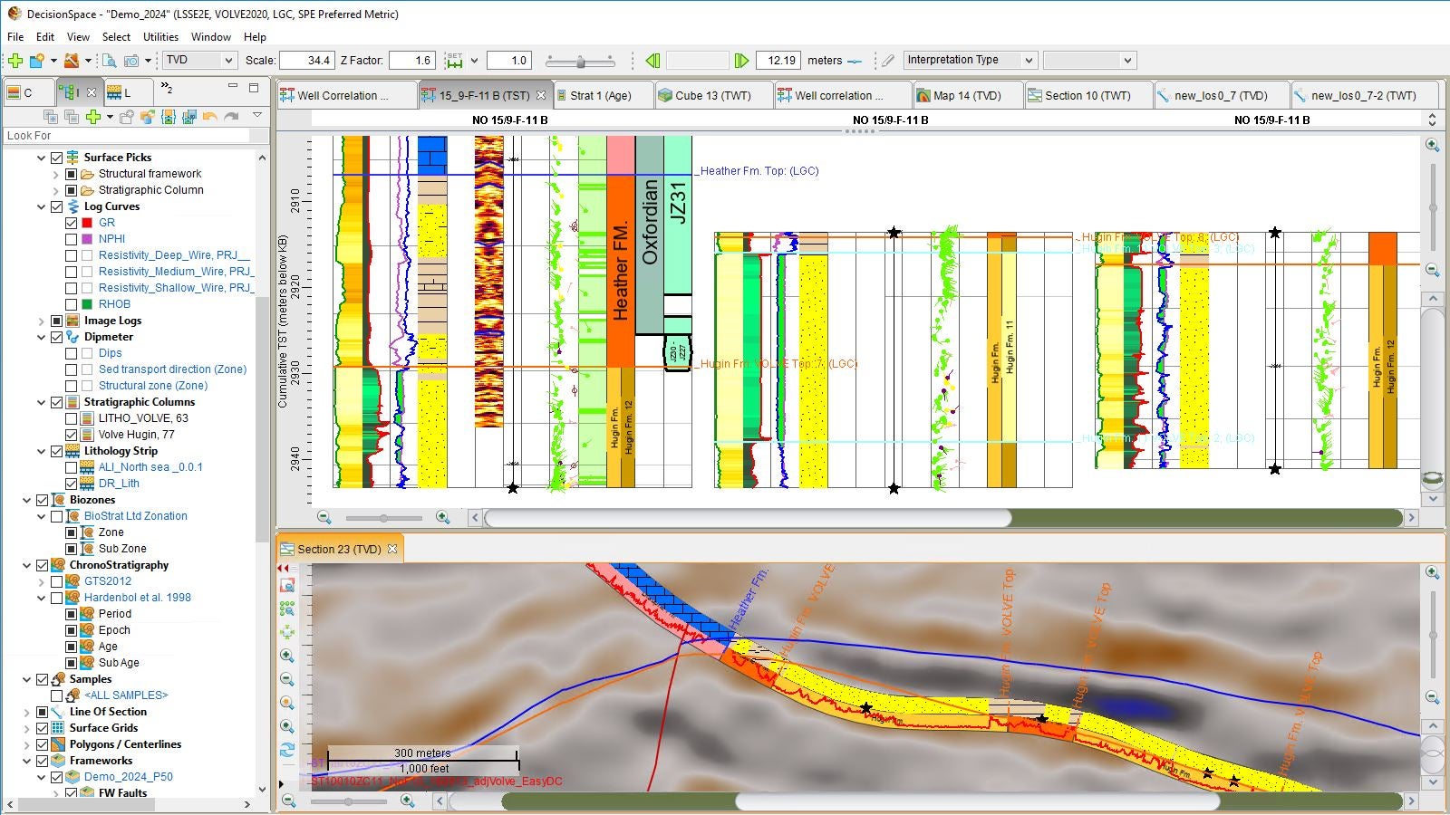
Visualize and use stratigraphy to validate and improve interpretations using:
Interpret and display multi-discipline data types in each view to aid interpretation and enhance understanding of the subsurface: Key features include:
Webinar
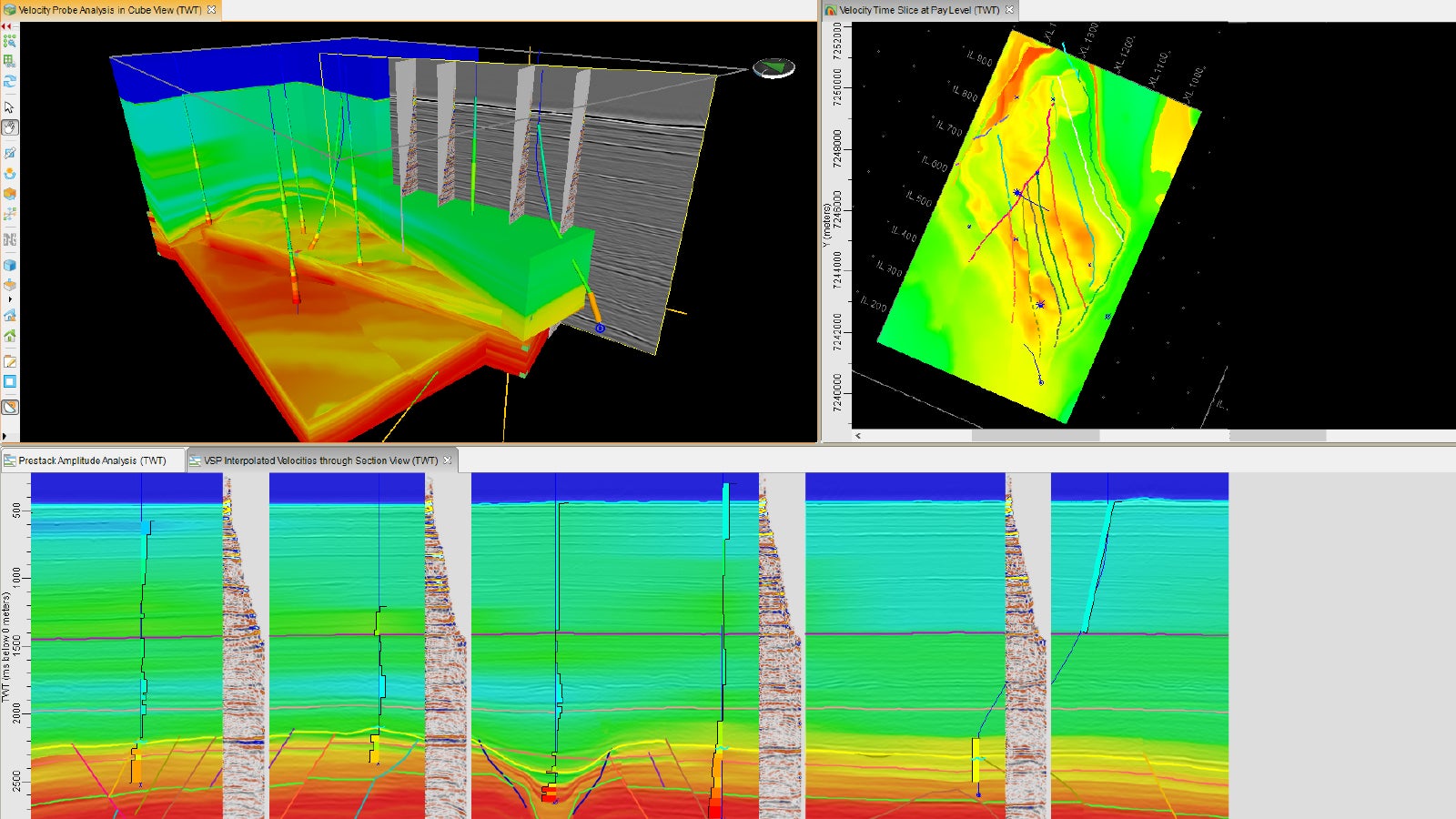
In this webinar we will take a look at the latest velocity modeling developments in the newest release of DecisionSpace® 365 Geosciences Suite.
Watch WebinarWebinar
In this webinar we showcase how DecisionSpace® 365 Geosciences Suite’s Seismic Interpretation software offers a unique and powerful multi-z horizon interpretation solution that enables geoscientists to accomplish prospect generation and drilling sweet-spot identification in complex geological settings with greater efficiency and a higher level of confidence
Watch webinar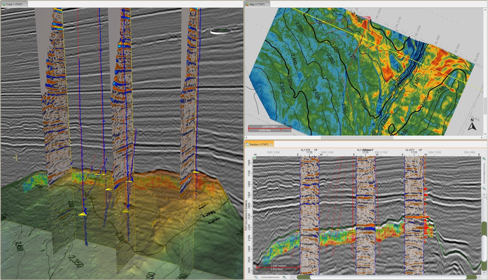
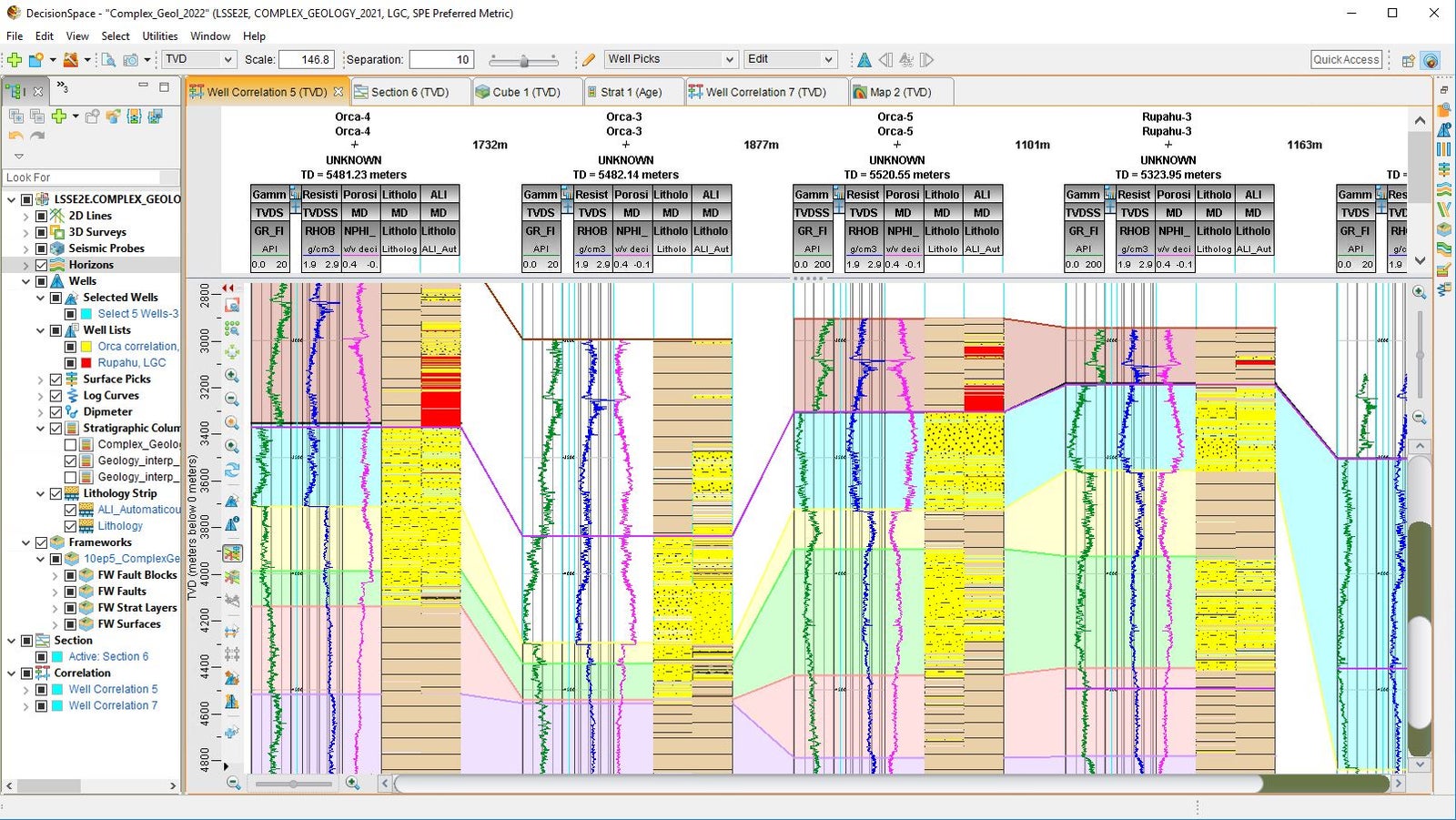
Provides core seismic interpretation workflows for mapping complex subsurface geology, including multi-z structures such as thrust-faults and salt-intrusions. Key features include:
Data can be viewed in 1D, 2D, 3D, histogram, crossplot, and spreadsheet formats. Raw, edited, and interpreted data, as well as existing velocity model information is integrated to create geologically sound velocity models for even the most structurally complex geologic regions. The velocity modelling workflow includes industry leading QC and uncertainty analysis tools which incorporate: