
Successful Geotap® IDS fluid identification and sampling service run in high-directional difficulty index (DDI) and long step-out trajectories
Download PDFUnconventionals

Fluid identification and sampling in complex trajectories

Malaysia

An international oil and gas company in Malaysia developed a strategic plan to drill two oil producer wells to encourage future oil exploitation endeavors within the acreage. This reservoir has been producing for some time, and uncertainties existed regarding fluid contact and total hydrocarbon in-place. Therefore, pressure gradients and fluid identification pump-outs were necessary at various reservoir intervals.
The in-field development plan involved a well trajectory with a high DDI and a long step-out to tap into the distal targets from the platform surface location.
Because of the high inclination angle and the relatively long step-out of the tangent section, acquiring wireline pressure test points and sampling would have been challenging using costly options, such as pipe-conveyed methods or deploying a tractor.
Thus, a quad-combo LWD package combining GeoTap IDS fluid identification and sampling service and a Geo-Pilot RSS BHA was proposed to help achieve the operator’s formation evaluation requirements and tap into a relatively shallow drilling target to obtain positive identification of the reservoir fluid type.
Pre-job planning was key to understanding the operator’s challenges. Collaboration with the operator involved multiple teams working with a global solutions engineering staff for directional drilling and logging feasibility, BHA engineering, simulations, risk assessment, offset analysis, and formation sampling while drilling (FSWD) on-paper sessions.
Five pressure gradients were acquired in two runs, identifying water, oil, and gas. A pump-out station was also performed where water was successfully confirmed in real time. The positive identification of the fluid type using the GeoTap IDS service enhanced the operator’s reservoir understanding and as a result, the customer no longer needed to take samples.
pressure test points in two runs
pressure gradient zones acquired
hours pump-out time
Delivered a high-DDI well trajectory to target TD with a long complex quad-combo FSWD RSS BHA, performed 36 pressure pre-test points in two runs, acquiring five pressure gradient zones with water, oil, and gas. Additionally, a 2.5-hour pump-out for fluid identification was performed.
The positive identification of the fluid type using GeoTap IDS service in this multiple sand target reservoir enhanced the operator’s understanding of the reservoir and allowed real-time decisions to be made regarding current operations and subsequent drilling plans.
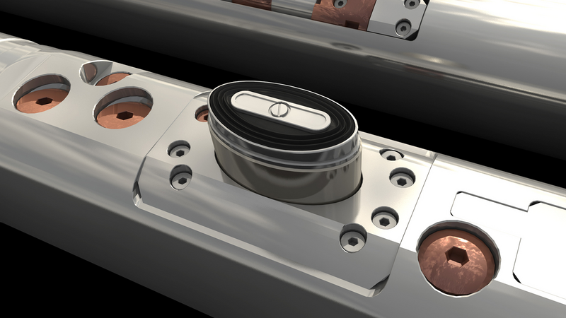
Fluid identification and sampling solution.

Direct formation pressure measurements on-demand.
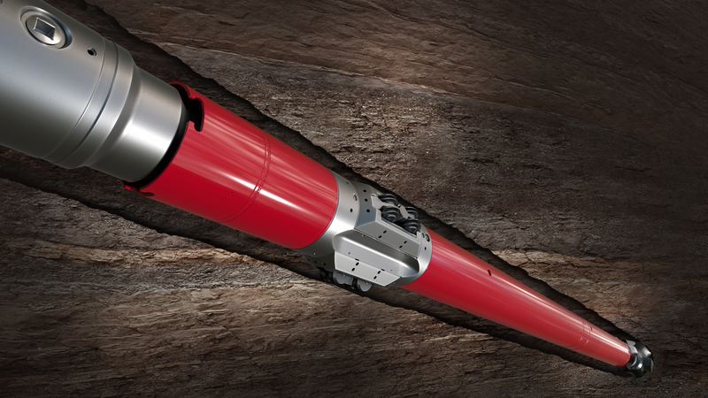
The Halliburton Geo-Pilot® rotary steerable systems (RSS) is designed to deliver unprecedented speed and precise steering.