A tailored core-log integrated program reduced uncertainty in unconventional resource characterization and empowered data-led decisions to help reduce risk
Download PDFUnconventional

Heterogeneous reservoir architecture challenged confident landing zone placement
Middle East

A local operator in the Middle East collaborated with Halliburton to assess a highly heterogeneous unconventional play within the Shilaif Formation. Historically, operators underexplored the formation due to its tight matrix and low permeability. The formation extends across a broad area and varies in thickness from 100 to 400 ft, which highlights its significant resource potential.
However, limited well and core data, coupled with the complexity introduced by its depositional, structural, and post-depositional history, posed challenges for accurate petrophysical interpretation. To address this, Halliburton implemented an integrated workflow that combined digital and physical core analysis to optimize landing zone selection and reduce uncertainty in development planning.
The operator faced two major obstacles in evaluating the Shilaif Formation. First, the reservoir’s heterogeneity and limited historical data of this play made it difficult to characterize the formation with confidence. Second, insufficient core and well data hindered the operator’s ability to identify optimal landing zones and assess source rock quality. These challenges increased the risk of suboptimal well placement and inefficient resource recovery.
Halliburton implemented a four-stage formation evaluation workflow that combined digital rock analysis with conventional core and log data.
The process began with core characterization that used dual-energy CT scanning and spectral gamma ray analysis. The team conducted petrophysical and geochemical testing in the laboratory to assess mineralogy, porosity, and organic content.
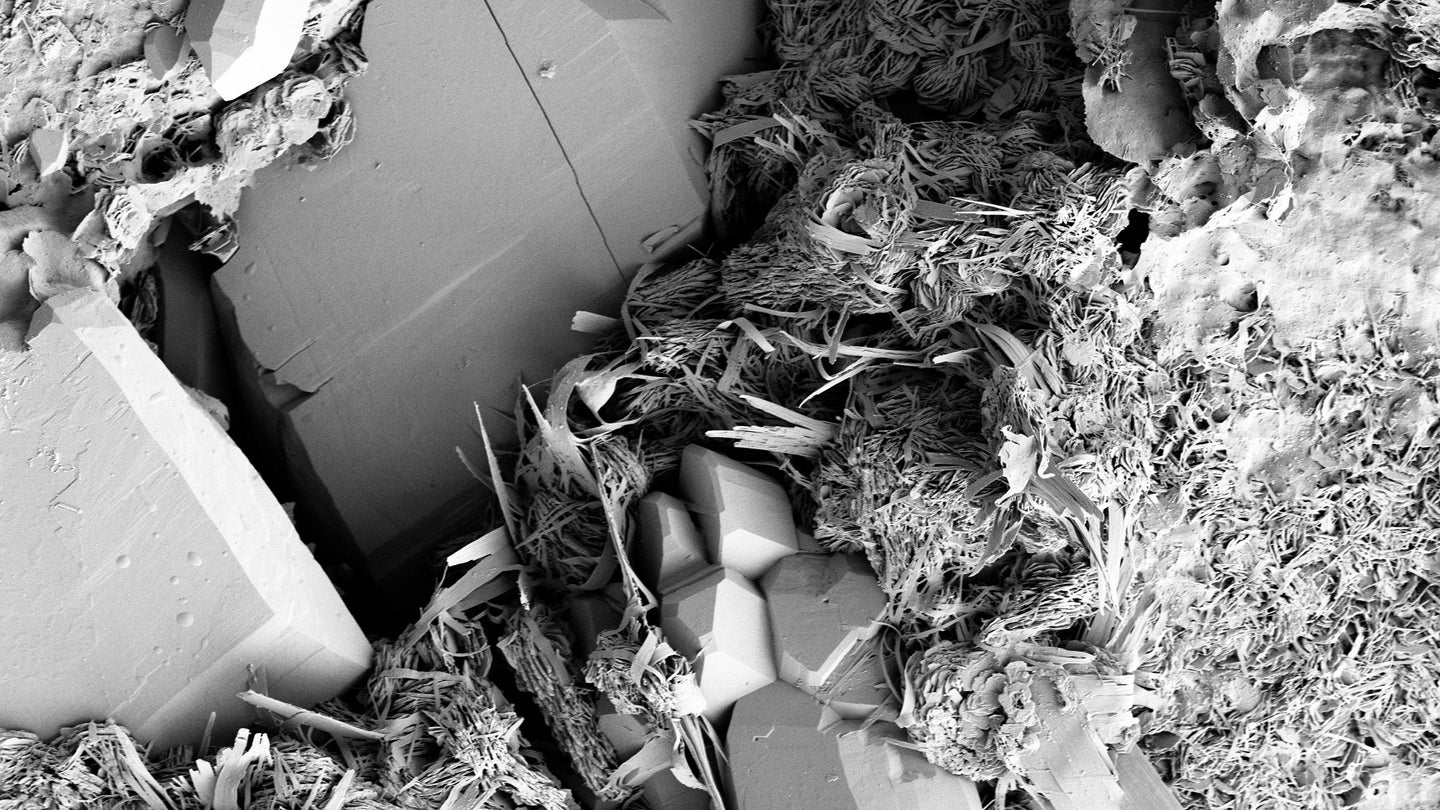
They used high-resolution 2D SEM imaging and digital segmentation to characterize pore structures and their relationship to organic matter, an important indicator of source rock potential.
Finally, the team integrated results from both digital and physical analyses with wireline log data to understand findings and evaluate the formation at a reservoir scale. This comprehensive approach allowed for rapid, cost-effective zonal evaluation and source rock quality ranking.
Imaging & digital segmentation used to define structure
Intervals identified and ranked with formation
Viable zone identified for development
Cost-effective zonal isolation
The integrated analysis identified and ranked three distinct intervals within the formation. The team identified a primary landing zone at intermediate depth, which offered favorable organic porosity, richness, and mineralogy. Higher clay content affected the secondary interval, although it showed potential. The team deemed the third zone to have poor hydrocarbon potential. Because of the combination of digital and conventional core analysis with wireline data, the operator identified the most viable zone for development.
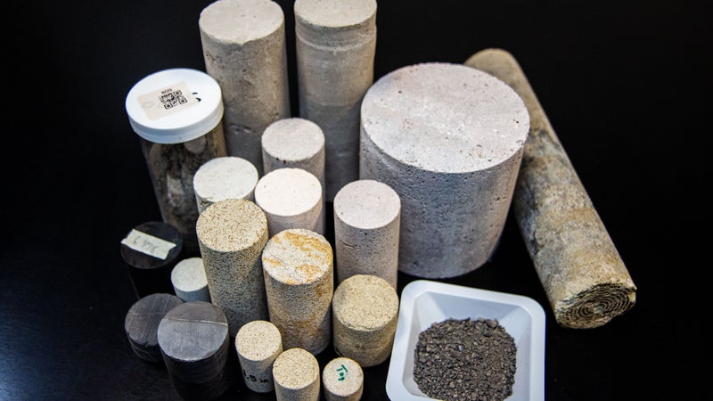
Integrated rock analysis provides the link between downhole measurements and physical properties of the reservoir, including those that control fluid flow.